|
MY WALKING WORLD
David Preston
2016 Walk Summary |
|
|
|
Last updated
03/11/2018 |
|
|
|
Walk No |
Date |
Area |
Walk |
Weather |
Miles |
|
16001 |
03/01/16 |
Cheshire |
Macclesfield Forest and Forest
Chapel with
Broken Cross Walkers |
Rain |
6 |
|
16002 |
04/01/16 |
Cheshire |
Shutlingslow from Trentabank Visitor Centre |
Clear night |
3 |
|
16003 |
10/01/16 |
Cheshire |
Lyme Park with Macclesfield Ramblers |
Sunny periods |
5 |
|
16004 |
16/01/16 |
Lake District |
Blencathra and Halls Fell Ridge with the
MaccPackers |
Sunny periods then cloudy |
5 |
|
16005 |
17/01/16 |
Staffordshire |
Rushton Spencer and Rudyard with Broken Cross
Walkers |
Sunny periods |
7 |
|
16006 |
18/01/16 |
Cheshire |
Nessit Hill and Macc Forest |
Clear night |
3 |
|
16007 |
20/01/16 |
Cheshire |
 Kettleshulme to Macclesfield with East Cheshire Ramblers
 |
Sunny periods |
10 |
|
16008 |
24/01/16 |
Cheshire |
Bollington and Rainow with Macclesfield
Ramblers |
Overcast |
7 |
|
16009 |
25/01/16 |
Cheshire |
Nessit Hill and Macclesfield Forest |
Clear moonlight night |
3 |
|
16010 |
31/01/16 |
Cheshire |
Alderley Edge and Nether Alderley with Broken
Cross Walkers |
Rain |
7 |
|
16011 |
01/02/16 |
Cheshire |
Evening walk around Macclesfield Forest |
Clear night |
2 |
|
16012 |
05/02/16 |
Lake District |
Ascent of Rough Crag from Haweswater |
Very windy,showers |
5 |
|
16013 |
06/02/16 |
Lake District |
Stonethwaite,Dock Tarn and Watendlath with
Northern Walkers |
Rain |
10 |
|
16014 |
07/02/16 |
Lake District |
Sale How from Underscar |
Very windy |
9 |
|
16015 |
09/02/16 |
Cheshire |
Evening walk around Macclesfield Forest |
Clear night |
3 |
|
16016 |
12/02/16 |
Lake District |
Iron Crag from Ennerdale Bridge |
Sunny periods |
9 |
|
16017 |
13/02/16 |
Lake District |
Muncaster Fell from Ravenglass |
Sunny periods |
7 |
|
16018 |
14/02/16 |
Lake District |
Lingmell from Wasdale |
Sunny periods |
5 |
|
16019 |
15/02/16 |
Cheshire |
Evening walk to Shutlingsloe |
Clear starry night |
3 |
|
16020 |
21/02/16 |
Cheshire |
Peover from Seven Sisters Lane with
Macclesfield Ramblers |
Sunny periods |
7 |
|
16021 |
22/02/16 |
Cheshire |
Evening walk around Macclesfield Forest |
Clear night |
2 |
|
16022 |
23/02/16 |
Cheshire |
Evening walk around Macclesfield Forest |
Clear night |
2 |
|
16023 |
24/02/16 |
Staffordshire |
Mow Cop from Biddulph Grange |
Sunny periods |
7 |
|
16024 |
27/02/16 |
Lake District |
Four Lake District Peaks from Dungeon Ghyll with
the Maccpackers |
Sunny periods |
7 |
|
16025 |
28/02/16 |
Cheshire |
Bramall Hall from Poynton with Macclesfield
Ramblers |
Sunny periods |
8 |
|
16026 |
29/02/16 |
Cheshire |
Evening walk around Macclesfield Forest |
Clear night |
2 |
|
16027 |
05/03/16 |
Staffordshire |
Danebridge, Hanging Stone and Dane Valley Way |
Sunny periods, windy |
4 |
|
16028 |
06/03/16 |
Cheshire |
Bollington from Macclesfield with Macclesfield
Ramblers |
Overcast & sunny periods |
8 |
|
16029 |
07/03/10 |
Cheshire |
Shutlingsloe from Trentabank, evening walk |
Clear night |
3 |
|
16030 |
10/03/16 |
Cheshire |
Evening walk Forest Chapel and Macclesfield Forest |
Clear night |
4 |
|
16031 |
11/03/16 |
Cheshire |
Ridgegate Reservoir and Macclesfield Forest |
Sunny periods |
2 |
|
16032 |
13/03/16 |
Cheshire |
Prestbury and Bollington with Broken Cross
Walkers |
Sunny periods |
7 |
|
16033 |
14/03/16 |
Cheshire |
Evening walk around Macclesfield Forest |
Clear night |
3 |
|
16034 |
16/03/16 |
Cheshire |
Evening walk around Macclesfield Forest |
Clear night |
2 |
|
16035 |
19/03/16 |
Lake District |
Catbells, Maiden Moor and High Spy from Little Town |
Sunny periods |
9 |
|
16036 |
20/03/16 |
Peak District |
Hartington and Pilsbury Castle with Macclesfield
Ramblers |
Sunny |
6 |
|
16037 |
21/03/16 |
Cheshire |
Macclesfield Forest evening walk |
Clear night |
2
|
|
16038 |
23/03/16 |
Cheshire |
Macclesfield Forest evening walk |
Clear night |
2 |
|
16039 |
25/03/16 |
Peak District |
Circuit of Chatsworth from Calton Lees |
Sunny periods |
6 |
|
16040 |
27/03/16 |
Cheshire |
Gawsworth, Bosley Locks and North Rode |
Sunny periods and showers |
8 |
|
16041 |
30/03/16 |
Cheshire |
Circuit of Ridgegate |
Sunny periods |
2 |
|
16042 |
31/03/16 |
Cheshire |
Evening walk up Shutlingsloe from Trentabank |
Clear night |
3 |
|
16043 |
03/04/16 |
Peak District |
Pym Chair and Shining Tor with Macclesfield
Ramblers |
Sunny periods |
7 |
|
16044 |
04/04/16 |
Cheshire |
Evening walk up Shutlingsloe from Trentabank |
Clear night |
3 |
|
16045 |
06/04/16 |
Wales |
Circuit of the Great Orme from Llandudno |
Sunny periods, windy |
6 |
|
16046 |
07/04/16 |
Cheshire |
Evening walk around Macclesfield Forest |
Clear night |
2
|
|
16047 |
10/04/16 |
Peak District |
Millers Dale and Monsal Head with Broken Cross
Walkers |
Sunny periods |
7 |
|
16048 |
11/04/17 |
Cheshire |
Evening walk Shutlingsloe from Trentabank |
Clear night |
3 |
|
16049 |
12/04/16 |
Cheshire |
Evening walk around Macclesfield Forest |
Clear evening |
2 |
|
16050 |
13/04/16 |
Cheshire |
Circuit of Ridgegate Reservoir |
Clear evening |
2 |
|
16051 |
15/04/16 |
Peak District |
Backpacking Burbage to Shining Tor |
Rain, sleet |
6 |
|
16052 |
16/04/16 |
Peak District |
Backpacking Shining Tor to Macclesfield
 |
Sunny periods |
8 |
|
16053 |
17/04/16 |
Cheshire |
Bollington, Rainow and Lamaload with
Macclesfield Ramblers |
Sunny periods |
6 |
|
16054 |
18/04/16 |
Cheshire |
Evening walk Shutlingsloe from Trentabank |
Clear evening |
3 |
|
16055 |
20/04/16 |
Peak District |
Ashford in the Water and Bakewell |
Sunny periods |
6 |
|
16056 |
24/04/16 |
Cheshire |
Styal Mill and Lindow with Broken Cross Walkers |
Sunny periods |
7 |
|
16057 |
25/04/16 |
Cheshire |
Evening walk around Macclesfield Forest |
Clear evening |
2 |
|
16058 |
01/05/16 |
Cairngorms |
Backpacking Glenmore to Fords of Avon Refuge with
MaccPackers |
Sunny periods then rain |
10 |
|
16059 |
02/05/16 |
Cairngorms |
Backpacking Fords of Avon to Derry Lodge with
MaccPackers |
Rain then sunny periods |
10 |
|
16060 |
03/05/16 |
Cairngorms |
Backpacking Derry Lodge to Braemar with
MaccPackers |
Sunny periods |
8 |
|
16061 |
04/05/16 |
Cairngorms |
Backpacking Braemar to Corrour Bothy with
MaccPackers |
Sunny periods then rain |
16 |
|
16062 |
05/05/16 |
Cairngorms
|
Backpacking Corrour Bothy to Glenmore with
MaccPackers |
Sunny periods, very windy |
13 |
|
16063 |
08/05/16 |
Staffordshire |
Ruchton Spencer and Danebridge with Broken
Cross Walkers |
Sunny periods |
7 |
|
16064 |
09/05/16 |
Cheshire |
Evening walk around Macclesfield Forest |
Clear evening |
2 |
|
16065 |
12/05/16 |
Cheshire |
Evening walk Shutlingsloe from Trentabank |
Clear evening |
3 |
|
16066 |
14/05/16 |
Cheshire |
Gawsworth Circular walk |
Sunny periods |
7 |
|
16067 |
15/05/16 |
Cheshire |
Bramall Hall circular walk with Macclesfield
Ramblers |
Sunny periods |
7 |
|
16068 |
16/05/16 |
Cheshire |
Croker Hill from Lowerhouse |
Sunny evening |
4 |
|
16069 |
22/05/16 |
Cheshire |
Goostrey and Twemlow with Broken Cross
Walkers |
Sunny periods |
7 |
|
16070 |
23/05/16 |
Cheshire |
Shutlingsloe from Trentabank evening walk |
Clear night |
3 |
|
16071 |
25/05/16 |
Peak District |
Axe Edge Moor and Cheeks Hill |
Overcast |
3 |
|
16072 |
28/05/16 |
Cheshire |
Macclesfield Forest and Shutlinsloe from Trentabank |
Clear evening |
3 |
|
16073 |
29/05/16 |
Staffordshire |
Danebridge and Turners Pool with Macclesfield
Ramblers |
Sunny periods |
7 |
|
16074 |
31/05/16 |
Cheshire |
Macclesfield Forest circular |
Clear evening |
3 |
|
16075 |
05/06/16 |
Peak District |
Whaley Bridge and Chapel Milton with Broken
Cross Walkers |
Sunny |
8 |
|
16076 |
06/06/16 |
Cheshire |
Macclesfield Forest and Hanging Gate |
Sunny and clear evening |
5 |
|
16077 |
08/06/16 |
Cheshire |
Macclesfield Forest and Nessit Hill |
Clear evening |
2 |
|
16078 |
12/06/16 |
Italy |
Sorrento Marina Grande and Priora |
Sunny |
3 |
|
16079 |
13/06/16 |
Italy |
Sant Agata to Sorrento Marina Grande |
Sunny |
3 |
|
16080 |
14/06/16 |
Italy |
Sorrento Marina Grande to Tasso Square and return |
Sunny |
2 |
|
16081 |
15/06/16 |
Italy |
Sant Agata to Crapola |
Sunny |
3 |
|
16082 |
16/06/16 |
Italy |
Sorrento Marina Grande to Regina Giovanna |
Sunny |
4 |
|
16083 |
21/06/16 |
Cheshire |
Nessit Hill and Macclesfield Forest |
Clear evening |
2 |
|
16084 |
22/06/16 |
Cheshire |
Teggs Nose from Langley |
Clear evening |
3 |
|
16085 |
25/06/16 |
Cheshire |
Pickmere and Great Budworth |
Sunny periods |
8 |
|
16086 |
26/06/16 |
Peak District |
Youlgreave and Lathkill Dale with
Macclesfield Ramblers |
Sunny periods |
8 |
|
16087 |
28/06/16 |
Cheshire |
Nessit Hill and Macclesfield Forest |
Overcast |
2 |
|
16088 |
03/07/16 |
Cheshire |
Pickmere and Great Budworth with Broken Cross
Walkers |
Sunny periods |
7 |
|
16089 |
04/07/16 |
Cheshire |
Nessit Hill and Macclesfield Forest |
Clear evening |
2 |
|
16090 |
08/07/16 |
Lake District |
Coombe Door Top from Stonethwaite with
MaccPackers |
Sunny periods |
6 |
|
16091 |
09/07/16 |
Lake District |
Seathwaite and Esk Hause from Stonethwaite with
MaccPackers |
Rain |
10 |
|
16092 |
11/07/16 |
Cheshire |
Nessit Hill and Macclesfield Forest |
Clear evening |
2 |
|
16093 |
14/07/16 |
Cheshire |
Nessit Hill and Macclesfield Forest
evening walk |
Clear evening, |
2 |
|
16094 |
17/07/16 |
Cheshire |
Macclesfield Forest & Piggford
Moor with Broken Cross Walkers |
Sunny |
7 |
|
16095 |
18/07/16 |
Cheshire |
Nessit Hill and Macclesfield Forest |
Sunny evening, warm 25c |
2 |
|
16096 |
24/07/16 |
Lake District |
Rosthwaite to Grange via Castle Crag |
Sunshine and showers |
3 |
|
16097 |
25/07/16 |
Cheshire |
Macclesfield Forest and Nessit Hill |
Clear night |
2 |
|
16098 |
29/07/16 |
Peak District |
Mam Tor, Lose Hill and Castleton |
Sunshine and showers |
8 |
|
16099 |
31/07/16 |
Staffordshire |
Rushton Spencer and Bosley Cloud with
Broken Cross Walkers |
Sunny periods |
7 |
|
16100 |
03/08/16 |
Cheshire |
Nessit Hill and Macclesfield Forest |
Clear night |
2 |
|
16101 |
07/08/16 |
Staffordshire |
Timbersbrook and Biddulph Valley Way with
Macclesfield Ramblers |
Sunny periods |
7 |
|
16102 |
12/08/16 |
Perthshire |
The Cateran Trail - Blairgowrie to Easter
Dalnabreck |
Overcast, showers |
12 |
|
16103 |
13/08/16 |
Perthshire |
The Cateran Trail - Easter Dalnabreck to Outdoor
Centre, Glenshee Lodge |
Sunny periods |
16 |
|
16104 |
14/08/16 |
Perthshire |
The Cateran Trail - Glenshee Outdoor Centre to
Kirton of Glenisla |
Sunny periods |
12 |
|
16105 |
15/08/16 |
Perthshire |
The Cateran Trail - Kirton of Glenisla to Alyth |
Sunny periods |
12 |
|
16106 |
16/08/16 |
Perthshire |
The Cateran Trail - Alyth to Blairgowrie |
Sunny |
18 |
|
16107 |
21/08/16 |
High Peak |
New Mills and Hayfield with Macclesfield
Ramblers |
Overcast |
7 |
|
16108 |
22/08/16 |
Cheshire |
Nessit Hill and Macclesfield Forest |
Clear evening |
2 |
|
16109 |
24/08/16 |
Cheshire |
Piggford Moor and Macclesfield Forest |
Sunny evening |
3 |
|
16110 |
28/08/16 |
Cheshire |
Langley and Higher Pethills with Broken Cross
Walkers |
Misty then sunny periods |
7 |
|
16111 |
30/08/16 |
Cheshire |
Nessit Hill and Macclesfield Forest |
Clear evening |
2 |
|
16112 |
31/08/16 |
High Peak |
Whaley Bridge and Taxal |
Sunny periods |
7 |
|
16113 |
06/09/16 |
Cheshire |
Nessit hill and Macclesfield Forest |
Clear evening |
2 |
|
16114 |
07/09/16 |
Cheshire |
Nessit Hill and Macclesfield Forest |
Clear evening |
2 |
|
16115 |
11/09/16 |
High Peak |
Whaley Bridge and Taxal with Broken Cross Walkers |
Sunny |
7
|
|
16116 |
12/09/16 |
Cheshire |
Nessit Hill and Macclesfield Forest |
Clear evening |
2 |
|
16117 |
13/09/16 |
Peak District |
Edale to Fairbrook Naze backpacking, wild camp at
fairbrook Naze |
Sunny, stormy evening |
8 |
|
16118 |
14/09/16 |
Peak District |
Fairbrook Naze to Edale backpacking |
Sunny |
10 |
|
16119 |
18/09/16 |
Staffordshire |
Biddulph Grange and Gritstone Trail with
Macclesfield Ramblers |
Sunny |
8
|
|
16120 |
19/09/16 |
Cheshire |
Nessit Hill and Macclesfield Forest |
Clear evening |
2
|
|
16121 |
24/09/16 |
Shropshire |
Bridges to Church Stretton with
Macclesfield Ramblers |
Sunny periods, windy |
6 |
|
16122 |
25/09/16 |
Shropshire |
Church Stretton to Acton Stuart circular with
Macclesfield Ramblers |
Sunny periods |
9 |
|
16123 |
26/09/16 |
Shropshire |
Church Stretton - circuit of Helmerth Hill -
Macclesfield Ramblers |
Showers |
5 |
|
16124 |
26/09/16 |
Cheshire |
Nessit Hill and Macclesfield Forest |
Clear evening |
2 |
|
16125 |
28/09/16 |
Cheshire |
Higher Hurdsfield, Teggs Nose & Langley with
Broken Cross Walkers |
Sunny periods |
8 |
|
16126 |
28/09/16 |
Cheshire |
Macclesfield Forest and Nessit Hill |
Clear evening |
2 |
|
16127 |
03/10/16 |
Spain |
Benidorm to Cross on Sierra Helada |
Sunny |
3 |
|
16128 |
06/10/16 |
Spain |
Benidorm to Cross on Sierra Helada |
Sunny |
3 |
|
16129 |
07/10/16 |
Spain |
Altea to Albir |
Sunny |
5 |
|
16130 |
12/10/16 |
Staffordshire |
Circuit of Rudyard Lake with
Broken Cross Walkers |
Sunny periods |
7 |
|
16131 |
13/10/16 |
Cheshire |
Nessit Hill and Macclesfield Forest |
Clear evening |
2 |
|
16132 |
16/10/16 |
Cheshire |
Prestbury and Bollington with Macclesfield
Ramblers |
Sunny periods |
8 |
|
16133 |
16/10/16 |
Cheshire |
Nessit Hill and Macclesfield Forest - evening walk |
Clear evening |
2 |
|
16134 |
18/10/16 |
Staffordshire |
Backpacking - Day 1 - Leek to the Roaches |
Rain, windy |
9 |
|
16135 |
19/10/16 |
Staffordshire |
Backpacking - Day 2 Roaches to Cat and Fiddle |
Sunny periods |
7 |
|
16136 |
23/10/16 |
Cheshire |
Nelson Pit and Lyme Park with Broken Cross
Walkers |
Sunny periods |
7 |
|
16137 |
24/10/16 |
Cheshire |
Nessit Hill and Macclesfield Forest - evening walk |
Clear evening |
2 |
|
16138 |
30/10/16 |
Staffordshire |
Circuit of Tittesworth Reservoir with
Macclesfield Ramblers |
Overcast |
7 |
|
16139 |
31/10/16 |
Cheshire |
Nessit Hill and Macclesfield Forest |
Clear evening |
2 |
|
16140 |
04/11/16 |
Lake District |
Harrop Pike from Swindale with the
MaccPackers |
Showery |
10 |
|
16141 |
05/11/16 |
Lake District |
Clough Head and Great Dodd with the
MaccPackers |
Windy |
14 |
|
16142 |
06/11/16 |
Lake District |
Scales Tarn from Scales with the MaccPackers |
Snow and sleet |
4 |
|
16143 |
07/11/16 |
Cheshire |
Nessit Hill and Macclesfield Forest evening walk |
Clear evening |
2 |
|
16144 |
08/11/16 |
Cheshire |
Plumley and Holford Hall |
Overcast |
7 |
|
16145 |
12/11/16 |
Cheshire |
Alderley Edge and the Wizard |
Overcast, damp |
7 |
|
16146 |
13/11/16 |
High Peak |
Whaley Bridge circular with Macclesfield
Ramblers |
Sunny periods |
7 |
|
16147 |
14/11/16 |
Cheshire |
Macclesfield Forest and Nessit Hill evening walk |
Clear night
|
2 |
|
16148 |
16/11/16 |
Cheshire |
Macclesfield Forest and Nessit Hill evening walk |
Clear night |
2 |
|
16149 |
20/11/16 |
Cheshire |
Alderley Edge and the Wizard with Broken
Cross Walkers |
Drizzle then dry |
7 |
|
16150 |
21/11/16 |
Cheshire |
Nessit Hill and Macclesfield Forest evening walk |
Clear night |
2 |
|
16151 |
25/11/16 |
Cheshire |
A walk in Tatton Park |
Sunny periods |
4 |
|
16152 |
27/11/16 |
Cheshire |
Tatton Park from Knutsford with Macclesfield
Ramblers |
Sunny periods |
6 |
|
16153 |
28/11/16 |
Cheshire |
Shutlingsloe from Trentabank evening walk |
Clear night |
3 |
|
16154 |
03/12/16 |
Cheshire |
Timbersbrook and Congleton |
Sunny periods |
7 |
|
16155 |
04/12/16 |
Cheshire/Staffs |
Timbersbrook and the Biddulph Valley Way with
Broken Cross Walkers |
Sunny |
7 |
|
16156 |
05/11/16 |
Cheshire |
Nessit Hill and Macclesfield Forest evening walk |
Clear night |
2 |
|
16157 |
09/12/16 |
Cheshire |
Rainow and Harrop Fold Farm |
Overcast |
4 |
|
16158 |
10/12/16 |
Lake District |
Bowfell and Angle Tarn with the MaccPackers |
Overcast, cold wind |
8 |
|
16159 |
11/12/16 |
Cheshire |
Gawsworth and North Rode with Macclesfield
Ramblers |
Sunny periods |
7 |
|
16160 |
14/12/16 |
Cheshire |
Lyme Park from West Parkgate |
Sunny periods |
3 |
|
16161 |
14/12/16 |
Cheshire |
Nessit Hill and Macclesfield Forest evening walk |
Clear night |
2 |
|
16162 |
16/11/16 |
Cheshire |
Xmas meal at Langley with the MaccPackers
and walk back to Macclesfield
|
Clear night |
5 |
|
16163 |
18/12/16 |
Cheshire |
Rainow and Kerridge with Broken Cross Walkers |
Overcast |
6 |
|
16164 |
19/12/16 |
Cheshire |
Nessit Hill and Macclesfield Forest evening walk |
Clear night |
2 |
|
16165 |
26/12/16 |
Cheshire |
A circuit of Ridgegate Reservoir |
Overcast |
2 |
|
16166 |
27/12/16 |
Peak District |
A walk around Bakewell |
Sunny periods |
3 |
|
16167 |
30/12/16 |
Lake District |
Bakestall, Skiddaw, Carl Side &
Ullock Pike with the MaccPackers |
Low cloud, windy |
9 |
|
|
|
|
|
|
|
|
|
|
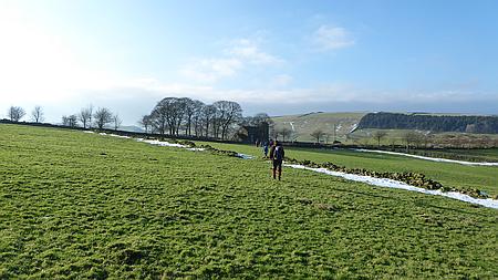
Walk
16001 - 03/01/16 - Macclesfield Forest and Forest Chapel with
Broken Cross Walkers |
| Area |
Cheshire |
Walking time |
3 hours |
Average speed |
|
| Walk |
Macclesfield
Forest & Forest Chapel. Broken Cross Walkers |
Minimum altitude |
|
Maximum altitude |
|
| Start
from |
Langley |
Altitude loss |
|
Altitude gain |
|
| Weather |
Rain |
Distance |
6 miles |
|
|
| Map |
Ordnance Survey OL24 |
Information from
Viewranger app on my Samsung S4 phone |
|
Route Bottoms
Reservoir - Clough Hough - Hacked Way - Forest Chapel -
Standing Stone - Ferriser - Trentabank Vistor Centre -
Bottoms Reservoir |
|
| Eight
of us set off from the car park on a rainy Sunday, the
first walk of the year. We followed the track past the
reservoir and up to Clough House, a right turn took us up
Hacked Way and into the forest and onto Charity Lane. A
short way down the track we came to Forest Chapel as it
was quiet and we were not in anybodys way we decided to
have an early lunch in the Church out of the rain.
Suitably refreshed and after making a donation to the
Church funds we headed along the lane to Standing Stone
and after crossing the lane we carried on past Ferriser
and down to Trentabank Visitor Centre. The lane took us
past the Reservoir and the Leathers Smithy Inn and back to
the car park. A nice walk which we all enjoyed despite the
weather.
Thanks to Christine, Kati, Doreen, Chris, Alec, Karen and
Chris R for coming on the walk despite the weather |
 |
|
Heading towards Teggs
Nose at the end of the walk |
|
|
|
 |
|
Lunch break in Forest
Chapel sheltering from the rain |
|
We
made a donation to Chapel Funds and left everywhere clean
and tidy |
| |
|
|
|
|
|
|
| |
|
| |
|
|
| |
|
|
|
|
Walk
16002 04/01/16 - Night walk Shutlingsloe from Trentabank |
| Area |
Cheshire |
Walking time |
1.5
hours |
Average speed |
|
| Walk |
Night
walk Shutlingsloe from Trentabank |
Minimum altitude |
|
Maximum altitude |
|
| Start
from |
Trentabank Visitor Centre |
Altitude loss |
|
Altitude gain |
|
| Weather |
Clear
night |
Distance |
4 miles |
|
|
| Map |
OS
OL24 |
Information from
Viewranger app on my Samsung S4 phone |
|
Route Trentabank
Visitor Centre - Macclesfield Forest - Piggford Moor -
return the same way |
|
|
Richard, Barry and myself set off from Trentabank Visitors
Car Park and followed the path up through the forest and
out onto Piggford Moor, once across the moor a short steep
climb took us up onto the summit of Shutlingsloe 506m. We
followed the same route back down to the car park. |
|
|
| |
|
|
|
|
| |
|
|
| |
|
| |
|
 |
|
Route of our walk |
| |
|
| |
|
|
| |
|
|
|
|
Walk
16003 - 10/01/16 - Lyme Park with Macclesfield Ramblers |
| Area |
Cheshire |
Walking time |
3 hours |
Average speed |
|
| Walk |
Lyme
Park with Macclesfield Ramblers |
Minimum altitude |
|
Maximum altitude |
|
| Start
from |
Nelson
Pit Visitor Centre |
Altitude loss |
|
Altitude gain |
|
| Weather |
Sunny
periods |
Distance |
5 miles |
|
|
| Map |
Explorer 268 |
Information from
Viewranger app on my Samsung S4 phone |
|
Route - Nelson Pit
Visitor Centre - Macclesfield Canal - Ryles Wood -
Parkgate - Cage Hill - Lyme Park Visitor Centre -
Windgather - Nelson Pit |
|
| Ten
of us set off from Nelson Pit Visitor Centre northwards
along the Canal and then over the bridge and up through
Ryles Wood, we entered Lyme Park and followed the track to
Parkgate and then up the path onto Cage Hill. Great views
from the hill all round. We walked down to the Visitor
Centre and stopped for lunch in the Timber Yard and
afterwards followed the track over to Windgather and back
to Nelson Pit Visitor Centre. A great walk with some
wonderful views. |
|
|
 |
|
Heading towards
Windgather |
|
|
| |
|
|
|
|
|
|
|
|
|
 |
|
Cage Hill in Lyme Park |
|
|
 |
|
Macclesfield Canal near Nelson Pit |
|
| |
|
|
| |
|
|
|
|
Walk
16004 - 16/01/16 - Blencathra and Halls Fell Ridge with the
MaccPackers |
| Area |
Lake
District |
Total time including stops |
5hrs
20mins |
Average speed |
0.96mph |
| Walk |
Blencathra
and Halls Fell Ridge with the MaccPackers |
Minimum altitude |
617ft |
Maximum altitude |
2784ft |
| Start
from |
Threlkeld |
Altitude loss |
2423ft |
Altitude gain |
2420ft |
| Weather |
Sunny
periods then overcast and light snow |
Distance |
5.11
miles |
|
|
| Map |
OS
English Lakes OL5 |
Information from
Viewranger app on my Samsung S4 phone |
|
Route Threlkeld -
Gategill - Halls Fell Ridge - Blencathra - Knowe Crags -
Threlkeld |
|
|
Richard, Alan and myself set off from Threlkeld and
followed the path along the hillside to the foot of Halls
Fell Ridge with a just a few snow patches on the fields.
Once we started up the steep path the depth of snow
increased and we donned our Micro Spikes, the views were
wonderful and as we progressed along the ridge care was
needed as the snow was more than knee deep in places. The
summit was crowded with many walkers and skiers and we
stopped for lunch on the windy top, dark clouds started to
roll in as we set off along the ridge heading for Knowe
Crag. It started to snow and we continued on along the
ridge and took the path down to the lane by the Blencathra
Centre. A steady walk along the lane brought us back to
our car in Threlkeld. A really great walk, only just over
5 miles but really exciting up on Halls Fell Ridge. |
|
|
 |
|
Poppy urging us to
hurry up. She has boundless energy |
|
|
 |
|
Nearing the top of
Halls Fell Ridge |
| |
 |
|
Walkers heading
towards Knowe Crag after leaving the summit of Blencathra |
| |
 |
|
Walkers heading up to
the summit of Blencathra |
| |
 |
|
Heading down the lane
back to Threlkeld |
| |
|
 |
|
Heading along the fell
side before we reach the base of Halls Fell Ridge |
|
|
 |
|
Looking west towards Keswick |
|
|
 |
|
Walkers on another ridge parallel with Halls Fell Ridge |
| |
 |
|
Quite a few walkers on the summit of Blencathra |
| |
 |
|
Walkers amd Skiers near Knowe Crag |
| |
| |
| |
| |
| |
| |
|
| |
|
|
| |
|
|
|
|
Walk
16005 - 17/01/16 - Rushton Spencer and Rudyard with
Broken Cross Walkers |
| Area |
Staffordshire |
Walking time |
3 hours |
Average speed |
|
| Walk |
Rushton Spencer and Rudyard with Broken Cross
Walkers |
Minimum altitude |
|
Maximum altitude |
|
| Start
from |
Rushton Spencer |
Altitude loss |
|
Altitude gain |
|
| Weather |
Sunny
periods |
Distance |
7 miles |
|
|
| Map |
Explorer 268 |
Information from
Viewranger app on my Samsung S4 phone |
|
Route - Rushton
Spencer - Church - Great Hough - Birch Trees Farm - Horton
Lodge - Rudyard - Dismantled Railway - Rushton Spencer |
|
| Ten
of us set off from Rushton Spencer and headed across the
fields and up to the beautiful Church overlooking the
valley, we then followed the lane south and took the field
path to Birch Trees Farm and onto the lane near Horton
Lodge. A muddy and tricky path through the woods brought
us down to the Lake Shore where we stopped for lunch. A
level walk back along the dismantled railway took us back
to Rushton Spencer |
|
Thanks to Christine,
Doreen, Kati, Chris J and Alec, David, Sharon, Ray and
Chris R for coming on the walk. |
| |
 |
|
Heading across the
snowy fields |
| |
 |
|
Rudyard Lake |
|
 |
|
The beautiful Church
near Rushton Spencer |
|
|
 |
|
Heading along the track away from Birch Trees Farm |
|
|
|
|
| |
|
| |
|
|
| |
|
|
|
|
Walk
16006 - 18/01/16 - Nessit Hill and Macclesfield Forest |
| Area |
Cheshire |
Walking time |
1 hour |
Average speed |
|
| Walk |
Nessit
Hill and Macclesfield Forest |
Minimum altitude |
|
Maximum altitude |
|
| Start
from |
Trentabank Visitor Centre |
Altitude loss |
|
Altitude gain |
|
| Weather |
Clear
night |
Distance |
3 miles |
|
|
| Map |
Explorer 268 |
Information from
Viewranger app on my Samsung S4 phone |
|
Route Trentabank -
Forest Paths - Nesstit Hill - Trentabank |
|
|
Richard, Barry John and myself set off from Trentabank
Visitor Centre and walked up and over Nessit Hill. Great
night time views over Macclesfield and then it was along
the forest paths and back the start. |
|
|
| |
|
|
|
|
| |
|
|
| |
|
| |
|
 |
|
Plan
of our route |
|
| |
|
|
| |
|
|
|
|
Walk
16007 - 18/01/16 - Kettleshulme to Macclesfield with
East Cheshire Ramblers |
| Area |
Cheshire |
Total time inc stops |
5¼
hours |
Average speed |
1.91
mph |
| Walk |
Kettleshulme to Macclesfield. East
Cheshire Ramblers |
Minimum altitude |
424ft |
Maximum altitude |
1312ft |
| Start
from |
Kettleshulme |
Altitude loss |
1786ft |
Altitude gain |
1407ft |
| Weather |
Sunny
periods |
Distance |
9.92miles |
|
|
| Map |
OS
OL24 and Explorer 268 |
Information from
Viewranger app on my Samsung S4 phone |
|
Route - Kettleshulme -
Dunge Farm - Jenkin Farm Ewrin Lane - Lamaload - Snipe
House - Tower Hill - Kerridge Hill - Middlewood Way -
Macclesfield |
|
|
Fourteen of us caught the 09:50am Bus from Macclesfield
and alighted at Kettleshulme. Our walk was to take us back
to Macclesfield, we passed Dunge Farm and Jenkin Chapel
and then across the fields to Ewrin Lane. We followed the
lane down to Lamaload Reservoir and then took the track
through the woods stopping in a sheltered place for lunch.
Afterwards we passed the Treatment Works and Snipe House
and then along Berristall Road to Tower Hill. We crossed
the main road followed the path down into the valley and
then a steep climb up to Kerridge Ridge. A coffee break
saw us refreshed and the we followed the path down and
across the fields past Moat Hall Farm and onto the
Middlewood Way. A level walk along the path brought us
back into Macclesfield. A great walk with the East
Cheshire Ramblers. |
|
|
 |
|
Lamaload Reservoir in
the distance |
|
|
 |
|
Difficult decisions
near Snipe House |
| |
|
| |
|
 |
|
Heading towards Jenkin Chapel |
| |
 |
|
Heading towards Lamaload |
|
|
 |
|
A
Cormorant drying his wings by a small pool not far
from Kerridge |
| |
| |
| |
|
| |
|
|
| |
|
|
|
|
Walk
16008 - 24/01/16 - Bollington and Rainow with
Macclesfield Ramblers |
| Area |
Cheshire |
Walking time |
|
Average speed |
|
| Walk |
Bollington and Rainow with Macclesfield Ramblers |
Minimum altitude |
|
Maximum altitude |
|
| Start
from |
Bollington |
Altitude loss |
|
Altitude gain |
|
| Weather |
Sunny
periods |
Distance |
7 miles |
|
|
| Map |
OL24 |
Information from
Viewranger app on my Samsung S4 phone |
|
Route Bollington -
Rainow- Common Barn Farm - Waggonshaw Brow - Blue Boar
Farm - Harrop Fold Farm - Hedge Row - Bollington |
|
| Eight
of us set off from Bollington and headed across to Rainow,
once through the village we took the track past Common Barn Farm and Waggonshaw
Brow onto Ewrin Lane. We followed the lane as far as Blue
Boar Farm and turned
right along the farm track and stopping for lunch in a
sheltered farm entrance. After lunch we followed the
paths across some rather muddy fields and through the
farmyard to the main road. We crossed the road and walked through Harrop Fold Farm and down the path
to Hedge Row. A pleasant walk along the track brought us
to the road and we followed this back into Bollington. Refreshments in
the Spinners Arms finished the day off nicely. |
|
Thanks to Christine,
Doreen, Kati, Sue, Nichola, John L and Roy for joining me
on this walk. |
| |
 |
|
Heading across the
fields towards Rainow |
| |
|
|
| |
|
 |
|
The waterfall at
Waulkmill |
|
|
 |
|
Slightly muddy track heading towards Hedge Row |
|
|
|
|
| |
|
| |
|
|
| |
|
|
|
|
Walk
16009 - 25/01/16 Nessit Hill and Macclesfield Forest |
| Area |
Cheshire |
Walking time |
1 hour |
Average speed |
|
| Walk |
Nessit
Hill and Macclesfield Forest |
Minimum altitude |
|
Maximum altitude |
|
| Start
from |
Trentabank Visitor Centre |
Altitude loss |
|
Altitude gain |
|
| Weather |
Clear
moonlit night |
Distance |
3 miles |
|
|
| Map |
Explorer 268 |
Information from
Viewranger app on my Samsung S4 phone |
|
Route Trentabank
Visitor Centre - Nessit Hill - Forest paths and trails -
Trentabank Visitor Centre |
|
|
Richard, Barry and myself set off on our usual Monday
evening walk from Trentabank up to Nessit Hill and then
along the forest trails and back to the car park. Plenty
of Mountain bikers and walkers out in the darkness on a
lovely moonlit night. |
|
|
| |
|
|
|
|
| |
|
|
| |
|
| |
|
 |
|
A
mountain biker passing by on Nessit Hill |
| |
|
| |
|
|
| |
|
|
|
|
Walk 16010 - 31/01/16 -
Alderley Edge and Nether Alderley with Broken Cross
Walkers |
| Area |
Cheshire |
Total time inc stops |
3hrs
40 mins |
Average speed |
|
| Walk |
Alderley Edge & Nether Alderley with Broken Cross
Walkers |
Minimum altitude |
274 ft |
Maximum altitude |
622ft |
| Start
from |
National Trust Car Park next to Wizard Tea Rooms |
Altitude loss |
530 ft |
Altitude gain |
533 ft |
| Weather |
Rain |
Distance |
7.03
miles |
|
|
| Map |
Explorer 268 |
Information from
Viewranger app on my Samsung S4 phone |
|
Route - Wizard car
park - Finlow Hill - Hocker Lane - Fernhill - Bollington
Lane - Heawood Hall - Nether Alderley Church - Bradford
Lane - Car park |
|
| Seven
of us set off on a rainy day from the National Trust Car
Park by the Wizard Tea Rooms, we followed the lane towards
Finlow Hill and thenacross the fields to Hocker Lane.
After passing Acton Farm we headed south along the track
and then various field paths eventually brought us to the
A34 near Monks Heath. We crossed the road and then took
Bollington Lane as far as More Farm and then a field path
took us to Heawood Hall. A lull in the rain allowed us to
eat our lunch and then it was off across the fields to
Nether Alderley Church. A beautiful building with a lot of
History. Our route took us past the 16th Century Water
Mill and then up the cobbled Bradford Lane and back
to the car park. A lovely walk and one that we will repeat
in better weather.
Thanks to Christine,
Doreen, Ros, Mike, Jo and Chris R for joining me ohn this
walk |
|
|
 |
|
The walkers bridge
over the new Alderley Edge Bypass |
|
|
| |
 |
|
Nether Alderley Church |
|
|
| |
|
|
| |
|
|
|
|
Walk
16011 - 01/02/16 Evening walk around Macclesfield Forest |
| Area |
Cheshire |
Walking time |
1 hour |
Average speed |
|
| Walk |
Evening walk around Macclesfield Forest |
Minimum altitude |
|
Maximum altitude |
|
| Start
from |
Leathers Smithy roadside parking |
Altitude loss |
|
Altitude gain |
|
| Weather |
Clear
night |
Distance |
2 miles |
|
|
| Map |
Explorer 268 |
Information from
Viewranger app on my Samsung S4 phone |
|
Route Leathers Smithy
- Ridgegate Resevoir - Macclesfield Forest - return by
same route |
|
| Four
of us set off from Leathers Smithy roadside parking and
followed the path around Trentabank Reservoir and into
Macclesfield Forest, a circular route through the forest
bought us back to the Reservoir path and back to the start
by Leathers Smithy Inn. |
|
|
| |
|
|
|
|
| |
|
|
| |
|
| |
|
 |
|
Route of our walk |
| |
|
| |
|
|
| |
|
|
|
|
Walk
16012 - 05/02/16 - Rough Crag from Haweswater |
| Area |
Lake
District |
Walking time |
3 hours |
Average speed |
1.6
mph |
| Walk |
Rough
Crag from Haweswater |
Minimum altitude |
803 ft |
Maximum altitude |
1783
ft |
| Start
from |
Haweswater |
Altitude loss |
1720 ft |
Altitude gain |
1720
ft |
| Weather |
Very
windy, showers |
Distance |
4.64
miles |
|
|
| Map |
|
Information from
Viewranger app on my Samsung S4 phone |
|
Route Haweswater - The
Rigg - Swine Crag - Rough Crag and return by same route |
|
| I
drove down the road alongside Haweswater Reservoir heading
for the car park at the south end of the reservoir but was
stopped about ¼ mile from the end by a massive landslide
across the road. The result of the terrible storms we had
recently. I parked up at the roadside and considered my
options. The original plan was to climb Harrop Pike but
the heavy showers and gale force winds made my decision
for me. I decided to head for Rough Crag another on my
list of Nuttalls, a much shorter walk bearing in mind the
stormy conditions. I walked to the end of the Lake and
took the shore path as far as the Rigg and then followed
the ridge path up onto the summit of Rough Crag, care was
needed on the ridge path due to the gale force winds but I
eventually arrived at the Cairn on the summit. After a
brief stop I followed the path down along the ridge taking
care on the slippery rocks. Once down and back on the
shore path it was an easy walk back to the car. I then
headed across to Borrowdale to stay at the Glaramara
Centre with the Northern Walkers. |
|
|
 |
|
Looking up towards the
summit of Rough Crag |
|
|
 |
|
Looking across
Haweswater, you can see where the landslip was |
| |
 |
|
Looking down on
Haweswater on the way down |
| |
|
 |
|
The landslip blocking
the road |
|
|
|
|
|
|
 |
|
Looking down on Haweswater |
|
|
|
|
|
|
 |
|
The
summit of Rough Crag |
| |
| |
| |
| |
| |
| |
|
| |
|
|
| |
|
|
|
|
Walk
16013 - 06/02/16 - Stonethwaite, Dock Tarn and Watendlath with
Northern Walkers |
| Area |
Lake
District |
Walking time |
6 hours |
Average speed |
|
| Walk |
Stonethwaite, Dock Tarn and Watendlath with Northern
Walkers |
Minimum altitude |
|
Maximum altitude |
|
| Start
from |
Glaramara Centre, Seatoller |
Altitude loss |
|
Altitude gain |
|
| Weather |
Rain
most of the day |
Distance |
10
miles |
|
|
| Map |
|
Information from
Viewranger app on my Samsung S4 phone |
|
Route Glaramara Centre
- Stonethwaite - Dock Tarn - Watendlath - High Lodore
Grange - Rosthwaite - Glaramara Centre |
|
| Nine
of us from Northern Walkers set off from the Glaramara
Centre at Seatoller and headed off in the rain across to
Stonethwaite, once through the small hamlet we climbed the
steep fell side and then across to Dock Tarn and onward to
Watendlath where we stopped for lunch. Afterwards we
followed Watendlath Beck north to Mossmire Coppice and
then down to High Lodore and onto the road. A short way
along the road we came to Grange and joined the Cumbria
Way which we followed almost to Rosthwaite. Once past the
Youth Hostel we joined the road and followed this back to
the Glaramara Centre. A great 10 mile walk that we all
enjoyed despite the weather |
|
|
 |
|
Eagle Crag in the
distance |
|
|
 |
|
Watendlath |
| |
|
 |
|
Another group of
Northern Walkers setting off in the rain |
|
|
 |
|
The
dogs happy, you should have seen the big log he had before |
|
|
 |
|
Some
of the group on the Cumbria Way heading back to Glaramara |
|
| |
|
|
| |
|
|
|
|
Walk
16014 - 07/02/16 - Sale How from Underscar |
| Area |
Lake
District |
Walking time |
4 hours |
Average speed |
|
| Walk |
Sale
How from Underscar |
Minimum altitude |
955 ft |
Maximum altitude |
2168
ft |
| Start
from |
Underscar Car Park near Keswick NY281253 |
Altitude loss |
|
Altitude gain |
2265
ft |
| Weather |
Gale
Force winds but dry |
Distance |
9 miles |
|
|
| Map |
|
Information from
Viewranger app on my Samsung S4 phone |
|
Route Underscar Car
Park - Cumbria Way - Skiddaw House - Sale How and return
by same route |
|
| After
parking at Underscar car park I set off along the Cumbria
Way in very windy conditions, at least it was not raining
but it was very wet underfoot. At Skiddaw House I paused
for a coffee and then set off up the path to the summit of
Sale How which was my objective for the day. The gale
force winds were ferocious and several walkers in a group
ahead were actually blown of their feet. You could usually
sense when there was gust building up and the best action
was to drop to your knees and brace yourself to prevent
being blown over. A brief stop on the summit for a few
photos and then I beat a hasty retreat back down to
Skiddaw House where I ate my lunch in the shelter of the
wall. An easy walk back down the Cumbria Way brought me
back to the Underscar car park. A satisfying day with
another 2000ft Nuttall summit ticked off. |
|
|
 |
|
On the way to Skiddaw
House with Great Calva in the distance |
|
|
 |
|
Skiddaw House |
| |
 |
|
Heading back to
Underscar with Derwentwater in the distance |
|
 |
|
Heading along the
Cumbria Way |
|
|
 |
|
Skiddaw House in the distance |
|
|
 |
|
|
 |
|
Looking across to Blencathra from the Summit of Sale How |
|
|
|
|
| |
| |
| |
|
| |
|
|
| |
|
|
|
|
Walk 16015 - 09/02/16- Evening walk to Shutlingsloe |
| Area |
Cheshire |
Walking time |
1 hour |
Average speed |
|
| Walk |
Evening
walk to Shutlingsloe |
Minimum altitude |
|
Maximum altitude |
|
| Start
from |
Trentabank Visitors Car Park |
Altitude loss |
|
Altitude gain |
|
| Weather |
Clear
night |
Distance |
3 miles |
|
|
| Map |
Explorer 268 |
Information from
Viewranger app on my Samsung S4 phone |
|
Route Trentabank Car
Park - Nessit Hill - Macclesfield Forest - Trentabank Car
Park |
|
|
Richard and I set off from Trentabank Visitors Car Park
and walked up to the viewpoint on Nessit Hill, after a
brief stop to admire the night time view we set of through
the forest and back to down to the Car Park. |
|
|
| |
|
|
|
|
| |
|
|
| |
|
| |
|
|
|
Plan
of our route |
|
| |
|
|
| |
|
|
|
|
Walk
16016 - 12/02/16 - Iron Crag from Ennerdale Bridge |
| Area |
Lake
District |
Walking time |
5hrs
30 mins |
Average speed |
1.7
mph |
| Walk |
Iron
Crag from Ennerdale Bridge |
Minimum altitude |
374 ft |
Maximum altitude |
2090
ft |
| Start
from |
Ennerdale Bridge |
Altitude loss |
2365
ft |
Altitude gain |
2367
ft |
| Weather |
Sunny
periods |
Distance |
9.33
miles |
|
|
| Map |
Ordnance Survey - OL4 |
Information from
Viewranger app on my Samsung S4 phone |
|
Route - Ennerdale
Bridge - Boathow Crag - Iron Crag - Ennerdale Water
- Anglers Crag - Ennerdale Bridge |
|
| After
the long drive from Macclesfield I parked at Ennerdale
Bridge and set off along the shore of Ennerdale Water, my
objective was Iron Crag which is one off the 2000ft
Nuttall Summits. A short way along the shore I took
the ascending path which climbed the hillside and passed
behind Anglers Crag and then after a short descent climbed
again to the fells above Boathow Crag. A steadily
rising path took me up to the summit of my objective Iron
Crag with some great views across towards the higher
mountains. A bitter wind encouraged me to move on quickly
and I decided to head east down Ennerdale Fell to
Silvercove Beck and then north to join the path back
alongside Ennerdale Water. Once halfway down the hillside
I regretted my decision as the steep fellside was covered
in heather and was pathless most of the way back to
Ennerdale Water. It would have been far easier to have
retraced my route of ascent. Lesson learned. Once on the
shore path it was an easy walk back to Ennerdale Bridge
and the car park. A short drive took me to my B & B at
Ravenglass, the excellent Bay Horse Hotel. Highly
recommended. |
|
|
 |
|
Looking down on
Ennerdale Water from above Anglers Crag |
|
|
 |
|
Ennerdale Water
looking along the shore to Anglers Crag |
| |
|
 |
|
Looking up Ennerdale
Water at the start of the walk |
|
|
 |
|
Heading along the ridge towards Iron Crag |
|
|
|
|
 |
|
Looking east from Iron Crag |
|
|
|
| |
|
|
| |
|
|
|
|
Walk
16017 - 13/02/16 - Muncaster Fell from Ravenglass |
| Area |
Lake
District |
Walking time |
4.15
mins |
Average speed |
1.6
mph |
| Walk |
Muncaster Fell from Ravenglass |
Minimum altitude |
7 ft |
Maximum altitude |
696 ft |
| Start
from |
Ravenglass |
Altitude loss |
1138
ft |
Altitude gain |
1138
ft |
| Weather |
Sunny
periods, cold wind |
Distance |
7.53
miles |
|
|
| Map |
Ordnance Survey - OL6 |
Information from
Viewranger app on my Samsung S4 phone |
|
Route - Ravenglass -
Muncaster Castle - Fell Lane - Muncaster Fell - Hooker
Crag and return by same route |
|
| A
nice easy day today after the exertions of the descent
from Iron Crag yesterday, I set off from Ravenglass and
after a short distance along the Cumbria Coastal Way I
stopped at the Roman Bath House at Walls Castle. A
fascinating place, I then carried on through woods and
fields and passed through the grounds on Muncaster Castle,
another place to come back to and spend a bit of time. I
called in at the Church in the Castle grounds and the took
the Fell Lane which climbed steadily up onto Muncaster
Fell, a short distance brought me to the summit of Hooker
Crag with some great views all round. After a lunch break
out of the wind I set off back to Ravenglass following the
same route but as the tide was in I had to deviate
slightly to enter Ravenglass by a different route. A
really nice leisurely day of walking, enjoying the scenery
and photographing |
 |
|
Passing through the
grounds of Muncaster Castle |
|
|
|
 |
|
Trig Point on Hooker
Crag looking east |
|
|
| |
|
I
stayed for two nights at the Bay Horse Hotel, Ravenglass.
Excellent !! |
|
The Bay
Horse Hotel, Ravenglass
|
| |
| |
| |
|
 |
|
Roman Bath House at
Ravenglass. Very impressive. |
|
|
 |
|
Looking along Fell Lane towards Hooker Crag |
|
|
 |
|
Looking across to Sellarfield from Hooker Crag |
|
|
|
| |
|
|
| |
|
|
|
|
Walk 16018 - 14/02/16 - Lingmell from Wasdale |
| Area |
Lake
District |
Walking time |
4hrs 8 mins |
Average speed |
1.1 mph |
| Walk |
Lingmell from Wasdale |
Minimum altitude |
223 ft |
Maximum altitude |
2605 ft |
| Start
from |
National Trust Car Park Wasdale |
Altitude loss |
2445 ft |
Altitude gain |
2446 ft |
| Weather |
Sunny
periods, bitter wind |
Distance |
4.45 miles |
|
|
| Map |
Ordnance Survey - OL6 |
Information from
Viewranger app on my Samsung S4 phone |
|
Route - NT
Wasdale Car Park - Goat Crag - Lingmell - Limgmell Col -
Brown Tongue - NT Car Park |
|
| This
walk took me up Lingmell, a steep climb up from the
National Trust Car Park in Wasdale, I was hoping to bag a
few more Nuttalls as I still have four more to do in this
area. They are Middleboot Knotts, Round How, Ill Crag and
Broad Crag. Once I was over Lingmell I realised that time
was short and the best course of action was to leave them
for another day when there is a bit more daylight. The
snow on the tops gave some great views over to the
Scafells. On the way down Brown Tongue I met quite a few
walkers heading up to Scafell Pike, even at 2.00pm. Not
sure what time they will complete the ascent but I like
plenty of daylight left when I am going that high in the
snow. It was still a great days walking though. |
 |
|
Looking down on
Wastwater from the slopes of Lingmell |
|
|
|
 |
|
Lingmell Summit |
|
|
 |
|
Heading towards Brown
Tongue on the way down |
|
|
| |
|
 |
|
Looking along
Wastwater as I drove to the start |
|
|
 |
|
The
summit of Lingmell is beyond the Crag in the distance |
|
|
 |
|
Looking across to Scafell as I descended from Lingmell |
| |
| |
| |
| |
| |
|
| |
|
|
| |
|
|
|
|
Walk
16019 - 15/02/16 - Evening walk to Shutlingsloe |
| Area |
Cheshire |
Walking time |
1½ hrs |
Average speed |
|
| Walk |
Evening
walk to Shutlingsloe |
Minimum altitude |
|
Maximum altitude |
|
| Start
from |
Trentabank Visitor Centre |
Altitude loss |
|
Altitude gain |
|
| Weather |
Clear
starry night |
Distance |
4 miles |
|
|
| Map |
Explorer 268 |
Information from
Viewranger app on my Samsung S4 phone |
|
Route Trentabank
Visitor Centre - Macclesfield Forest - Piggford Moor -
Shutlingsloe - return by same route |
|
| Three
of us set off from Trentabank Visitor Centre and walked up
through the forest and across Piggford Moor and up to the
summit of Shutlingsloe. A lovely star filled sky gave us
some fantastic views of Manchester, Macclesfield,
Congleton and Leek. We returned back down to Piggford Moor
and followed the outward route back to the car park. |
|
|
| |
|
|
|
|
| |
|
|
| |
|
| |
|
 |
|
Looking towards Manchester and Stockport from Shutlingsloe.
8:15pm |
| |
|
| |
|
|
| |
|
|
|
|
Walk 16020 - 21/02/16 Peover from
Seven Sisters Lane with Macclesfield Ramblers |
| Area |
Cheshire |
Walking time |
4 hours |
Average speed |
1.9
mph |
| Walk |
Peover
from A50 near Radbrook Hall with Macclesfield
Ramblers |
Minimum altitude |
|
Maximum altitude |
|
| Start
from |
Seven
Sisters Lane |
Altitude loss |
244 ft |
Altitude gain |
244 ft |
| Weather |
Sunny
periods |
Distance |
7.63
miles |
|
|
| Map |
Explorer 268 |
Information from
Viewranger app on my Samsung S4 phone |
|
Route -
Radbrooke Hall - Sandy Lane - Freegreen Lane -
Peover Hall - Lower Moss Radbrooke Hall |
|
| Ten
of us set off from the lay-by on the A50 and after passing
Radbooke Hall followed the Sandy Lane down to Freegreen
Lane and then along Long Lane to Peover Hall where we
stopped in the Churchyard for lunch. Afterwards using
field paths and tracks we headed for Lower Moss and back
to the start near Radbrook Hall on the A50. A very
interesting walk through some lovely countryside. |
|
|
| |
|
|
 |
|
Plenty of Snowdrops
out |
|
|
 |
|
St Lawrences Church.
Over Peover |
| |
|
 |
|
Peover Hall |
|
|
 |
|
Macclesfield Ramblers with the 'Big Owl' |
|
|
|
|
| |
|
| |
|
|
| |
|
|
|
|
Walk 16021 - 22/02/16 Evening walk
around Macclesfield Forest |
| Area |
Cheshire |
Walking time |
1 hour |
Average speed |
|
| Walk |
Evening walk around Macclesfield Forest |
Minimum altitude |
|
Maximum altitude |
|
| Start
from |
Leathers Smithy roadside parking |
Altitude loss |
|
Altitude gain |
|
| Weather |
Clear
night |
Distance |
2 miles |
|
|
| Map |
Explorer 268 |
Information from
Viewranger app on my Samsung S4 phone |
|
Route- Leathers
Smithy - Ridgegate Reservoir - Macclesfield Forest -
Leathers Smithy |
|
| Five
of us set off from Leathers Smithy at Langley and walked
around Ridgegate Reservoir and through Macclesfield Forest
and back to the start at Leathers Smithy. |
|
|
| |
|
|
|
|
| |
|
|
| |
|
| |
|
|
|
Route of our walk |
| |
|
| |
|
|
| |
|
|
|
|
Walk 16022 - 23/02/16 Evening walk
around Macclesfield Forest |
| Area |
Cheshire |
Walking time |
1 hour |
Average speed |
|
| Walk |
Evening walk around Macclesfield Forest |
Minimum altitude |
|
Maximum altitude |
|
| Start
from |
Leathers Smithy roadside parking |
Altitude loss |
|
Altitude gain |
|
| Weather |
Clear
night |
Distance |
2 miles |
|
|
| Map |
Explorer 268 |
Information from
Viewranger app on my Samsung S4 phone |
|
Route- Leathers
Smithy - Ridgegate Reservoir - Macclesfield Forest -
Leathers Smithy |
|
| Three
of us set off from Leathers Smithy at Langley and walked
around Ridgegate Reservoir and through Macclesfield Forest
and back to the start at Leathers Smithy. This was the
same walk as the previous night, just different stars. |
|
|
 |
|
Just a walk in the
woods |
|
|
| |
|
|
| |
|
| |
|
 |
|
Bench with a view, The lights of Leathers Smithy across
the reservoir |
| |
|
|
|
|
|
|
| |
|
| |
|
|
| |
|
|
|
|
Walk 16023 - 24/02/16 - Mow Cop from
Biddulph Grange |
| Area |
Staffordshire |
Total time |
3 hrs
30 mins |
Average speed |
|
| Walk |
Mow
Cop from Biddulph Grange |
Minimum altitude |
436 ft |
Maximum altitude |
1053
ft |
| Start
from |
Biddulph Grange Car Park |
Altitude loss |
887 ft |
Altitude gain |
889ft |
| Weather |
Sunny
periods, windy |
Distance |
7.55
miles |
|
|
| Map |
Explorer 268 |
Information from
Viewranger app on my Samsung S4 phone |
|
Route Biddulph Grange
- Staffordshire Moorland Walks - Higher Whitemoor Farm -
Congleton Edge - Mow Cop - Woodside Farm - Biddulph Grange |
|
| After
parking at Biddulph Grange I followed the Staffordshire
Moorland Walk up past Higher Whitemoor Farm to Congleton
Edge and then along the Ridge to Mow Cop where I stopped
for lunch with some great views over the Cheshire Plain.
Afterwards I headed down the lane past Tower Hill Farm and
Woodside Farm and onto the Biddulph Valley Way which I
followed back to Marsh Green and then back to the car park
near Biddulph Grange. |
|
|
 |
|
Looking over the
Cheshire Plain, Jodrell Bank telescope in the distance |
|
|
| |
| |
| |
|
All
about Mow Cop Castle on Wikipedia |
| |
|
|
| |
|
 |
|
Pool near Poolfold on
the Staffordshire Moorlands Walks |
|
|
 |
|
Mow
Cop Castle |
|
| |
|
|
| |
|
|
|
|
Walk 16024 - 27/02/16 - Four
Lakeland Peaks from Dungeon Ghyll with the MaccPackers |
| Area |
Lake
District |
Total time |
6¼
hours |
Average speed |
|
| Walk |
Four
Lakeland Peaks from Dungeon Ghyll with the
MaccPackers |
Minimum altitude |
|
Maximum altitude |
2379
ft |
| Start
from |
Dungeon Ghyll, Langdale Valley |
Altitude loss |
|
Altitude gain |
|
| Weather |
Sunny
periods |
Distance |
7.50
miles |
|
|
| Map |
Ordnance Survey English Lakes OL6 |
Information from
Viewranger app on my Samsung S4 phone |
|
Route - Dungeon Ghyll
- Stickle Ghyll - Stickle Tarn - Blea Rigg - Codale Head -
Sergeant Man - Thunacar Knott - Dungeon Ghyll |
|
| Five
of us set off early from Macclesfield and headed for the
Lake District, we parked at Dungeon Ghyll and set off
up the track at the side of Stickle Ghyll to Stickle Tarn
with Pavey Ark towering above the water. After a brief
stop we headed east along a rather indistinct path
and then north to the summit of Blea Rigg, the first
objective of the day. The path north west then took us
across to Codale Head which was summit No 2 and then a
short distance to Sergeant Man our 3rd summit. Heading
south we passed over Thunacar Knott our final summit and
then took the path down past Langdale Pikes and back to
the car park at Dungeon Ghyll. A really great walk in a
fantastic walking area. |
|
|
 |
|
Looking across
Stickle Tarn towards Pavey Ark |
|
|
 |
|
Looking down on
walkers approaching Sergeant Man |
| |
 |
|
Looking down into
Dungeon Ghyll from the path on Thorn Crag |
| |
| |
| |
| |
| |
| |
|
 |
|
Heading up Stickle
Ghyll |
|
|
 |
|
On
the Summit of Blea Rigg |
|
|
 |
|
Heading down from Thorn Crag with Windermere in the
distance |
| |
 |
|
Kevin looking down into the Langdale Valley |
|
| |
|
|
| |
|
|
|
|
Walk 16025 - 28/02/16 Bramall Hall from
Poynton with Broken Cross Walkers |
| Area |
Cheshire |
Total
time inc stops |
4 hrs
15mins |
Average speed |
1.9
mph |
| Walk |
Bramall
Hall from Poynton with Broken Cross Walkers |
Minimum Altitude |
219 ft |
Maximum altitude |
315 ft |
| Start
from |
Poynton |
Altitude loss |
412 ft |
Altitude gain |
411 ft |
| Weather |
Sunny
periods |
Distance |
8.10
miles |
|
|
| Map |
Explorer 268 |
Information from
Viewranger app on my Samsung S4 phone |
|
Route - Poynton Park -
Lower Park Road - Birch Hall - Dairyground - Carr Wood
Park - Bramall Hall - Happy Valley - Millhill Bridge -
Poynton Park |
|
| Ten
of us set off from Poynton Park along Lower Park Road and
then using field paths and tracks headed across to
Bramhall, tricky navigation through a housing estate
eventually brought us to the pleasant Carr Wood Park. At
the end of the wood we crossed the road into the grounds
of Bramall Hall, a beautiful Tudor Manor House where we
stopped for lunch. Afterwards we followed Lady Brook away
from the Hall and crossed the road into Happy Valley
Nature Reserve, a missed turning on the river bank saw us
retracing our steps for a short way and then an
interesting river crossing over some large stepping
stones. Once past Millhill Bridge we encountered a blocked
path due to construction work, a reconnaissance team was
despatched and a solution was devised to avoid the advised
lengthy diversion. Once back on track we eventually
arrived back at our start point at Poynton Pool.
Thanks to Chris, Doreen, Janet D, Wendy, Chris J, Alec,
Jo, Ruth and Ray for joining me on this interesting walk
with a few challenges thrown in. |
|
|
 |
|
Bramall Hall |
|
|
 |
|
Jo crossing Lady Brook
using the stepping stones |
| |
|
|
| |
|
|
| |
|
|
|
|
Walk 16026 - 29/02/16
Evening walk around Macclesfield Forest |
| Area |
Cheshire |
Walking time |
1 hour |
Average speed |
|
| Walk |
Evening
walk around Macclesfield Forest |
Minimum altitude |
|
Maximum altitude |
|
| Start
from |
Trentabank Visitor Centre |
Altitude loss |
|
Altitude gain |
|
| Weather |
Clear
night |
Distance |
2 miles |
|
|
| Map |
Explorer 268 |
Information from
Viewranger app on my Samsung S4 phone |
|
Route Trentabank
Visitor Centre - Macclesfield Forest - Trentabank Visitor
Centre |
|
| Four
of us set off from the Vistor Centre and followed our
usual nightime route around Macclesfield Forest. It was a
clear night with a few mountain bikers and walkers out in
the forest illuminated by headtorches. |
|
|
| |
|
|
|
|
| |
|
|
| |
|
| |
|
 |
|
Route of our walk |
| |
|
| |
|
|
| |
|
|
|
|
Walk
16027 05/03/16 Danebridge, Hanging Stone and Dane Valley Way |
| Area |
Staffordshire |
Walking time |
2
hours |
Average speed |
|
| Walk |
Danebridge,
Hanging Stone and Dane Valley Way |
Minimum altitude |
579 ft |
Maximum altitude |
1066
ft |
| Start
from |
Danebridge |
Altitude loss |
783 ft |
Altitude gain |
794 ft |
| Weather |
Sunny
periods, windy, icy |
Distance |
4.19
miles |
|
|
| Map |
OS
White Peak OL24 |
Information from
Viewranger app on my Samsung S4 phone |
|
Route Danebridge -
Hanging Stone - Park House - Snipe - Gig Hall - Dane
Valley Way - Danebridge |
|
| After
parking at Danebridge I set off up through the forest and
headed across the sodden fields to Hanging Stone, great
views from the top of the Stone. I descended
and followed the track back to the lane passing Park House
and Snipe on the way. Once back on the lane I followed it
south and then took the track west past the deserted farm
called Hannel and down to Gig Hall on the banks of the
River Dane. I crossed the Dane and followed the Dane
Valley Way back to the start at Dane Bridge. |
|
|
 |
|
Looking across to the
Radio Tower on Croker Hill |
|
|
| |
|
|
| |
|
 |
|
Heading up to Hanging Rock |
|
|
 |
|
Looking across to Shutlingsloe |
|
|
|
|
| |
|
| |
|
|
| |
|
|
|
|
Walk
16028- 06/03/16 Bollington from Macclesfield with
Macclesfield Ramblers |
| Area |
Cheshire |
Walking time |
3½ hours |
Average speed |
1.9 mph |
| Walk |
Bollington from Macclesfield with Macclesfield
Ramblers |
Minimum altitude |
|
Maximum altitude |
|
| Start
from |
Macclesfield Railway Station |
Altitude loss |
705 ft |
Altitude gain |
705 ft |
| Weather |
Overcast then sunny periods |
Distance |
7.83 miles |
|
|
| Map |
Explorer 268 |
Information from
Viewranger app on my Samsung S4 phone |
|
Route Macclesfield
- Canal - Endon Hall - Kerridge - Bollington - Middlewood
Way - Macclesfield |
|
The weather
overnight had been wet with some snow flurries and the
prospect of the boggy fields and paths around Danebridge
together with the overcast sky did not seem a good idea
with the current weather outlook.
After a short discussion among the six of us, we agreed
to walk from the Station to Bollington using paths and
tracks that we hoped would be a little drier
than the planned walk to Turners Pool.
We walked up to
the Canal on Buxton Road and set off along the towpath
as the blue skies and sunshine arrived giving us some
great views across the fields to the snow covered
Kerridge Ridge. What a change in a hour but that's
British weather for you.
After a short
distance we left the towpath and crossed some very wet
and boggy fields to Endon Hall and then along through
Kerridge and down into Bollington where we stopped for
lunch on the Recreation Ground. Afterwards we climbed
up onto the Middlewood Way and followed this back into
Macclesfield.
A walk of
almost 8 miles, wet and boggy walk in places with
unexpected blue skies and sunny periods, many thanks
to everyone for coming along.
|
 |
|
Heading across the
fields with Kerridge Ridge in the background |
|
|
|
|
| |
|
|
| |
|
 |
|
Heading north along
the Macclesfield Canal |
|
|
 |
|
Passing a pool on the way to Endon Hall |
|
|
|
|
| |
|
| |
|
|
| |
|
|
|
|
Walk 16029 - 07/03/16 Shutlingsloe
from Trentabank |
| Area |
Cheshire |
Walking time |
1½ hrs |
Average speed |
2.1
mph |
| Walk |
Shutlingsloe from Trentabank |
Minimum altitude |
870 ft |
Maximum altitude |
1550
ft |
| Start
from |
Trentabank |
Altitude loss |
742 ft |
Altitude gain |
739 ft |
| Weather |
Clear
night |
Distance |
3.36
miles |
|
|
| Map |
Explorer 268 |
Information from
Viewranger app on my Samsung S4 phone |
|
Route Trentabank -
Macclesfield Forest - Piggford Moor - return by same route |
|
| Three
of us set off from Trentabank car park and walked up
through the forest and across Piggford Moor and up to the
summit of Shutlingsloe (506m). It was a cold icy night
with frozen snow and ice on the ground. We donned our
Microspikes while coming through the forest as the
pathways were icy and slippery. The views from
Shutlingsloe summit were amazing with the lights of
Manchester, Stockport and Warrington to be seen on the
horizon and Macclesfield and Congleton below. The stars
were very bright but unfortunately there was no display of
the Northern Lights although they had been seen the
previous night further north. We returned back to the car
using the same route that we had used on the ascent. |
|
|
| |
|
|
|
|
| |
|
|
| |
|
| |
|
 |
|
Looking across to Manchester and Stockport |
| |
|
| |
|
|
| |
|
|
|
|
Walk 16030 - 10/03/16 Evening walk
around Macclesfield Forest |
| Area |
Cheshire |
Walking time |
1½
hours |
Average speed |
|
| Walk |
Evening walk around Macclesfield Forest |
Minimum altitude |
|
Maximum altitude |
|
| Start
from |
Leathers Smithy, Langley |
Altitude loss |
|
Altitude gain |
|
| Weather |
Clear
night |
Distance |
4
miles |
|
|
| Map |
Explorer 268 |
Information from
Viewranger app on my Samsung S4 phone |
|
Route - Leathers
Smithy - Forest Chapel - Standing Stone - Trentabank -
Leathers Smithy |
|
| Four
of us set off from Leathers Smithy and headed up the steep
lane to Forest Chapel,we then followed the lane across to
Standing Stone and then back down the steep lane past
Trentabank Reservoir and Ridgegate Reservoir to the start
near Leathers Smithy. |
|
|
| |
|
|
|
|
| |
|
|
| |
|
| |
|
 |
|
Leathers Smithy all lit up and welcoming |
| |
|
| |
|
|
| |
|
|
|
|
Walk 16031 - 11/03/16 Short afternoon
walk around Macclesfield Forest |
| Area |
Cheshire |
Walking time |
1 hour |
Average speed |
|
| Walk |
Short
afternoon walk around Macclesfield Forest |
Minimum altitude |
|
Maximum altitude |
|
| Start
from |
Leathers Smithy, Langley |
Altitude loss |
|
Altitude gain |
|
| Weather |
Sunny |
Distance |
2
miles |
|
|
| Map |
Explorer 268 |
Information from
Viewranger app on my Samsung S4 phone |
|
Route - Leathers
Smithy - Ridgegate Reservoir - Macclesfield Forest -
Leathers Smithy |
|
| It
was such a lovely afternoon I just fancied a quiet walk
around Macclesfield in the sunshine. I set off from
Leathers Smithy around Ridgegate Reservoir and up through
Macclesfield Forest and back down to the start at Leathers
Smithy. A lovely peaceful walk in the sunshine. |
|
|
| |
|
|
|
|
| |
|
|
| |
|
| |
|
 |
|
Teggs Nose and Leathers Smithy across Ridgegate Reservoir |
| |
|
| |
|
|
| |
|
|
|
|
Walk 16032 - 13/03/16
Prestbury and Tytherington with Broken Cross Walkers |
| Area |
Cheshire |
Walking time |
3½
hours |
Average speed |
1.6
mph |
| Walk |
Prestbury and Tytherington with Broken Cross Walkers |
Minimum altitude |
347 ft |
Maximum altitude |
562 ft |
| Start
from |
Springfield Car Park Prestbury. Post Code SK10 4DW |
Altitude loss |
506 ft |
Altitude gain |
511 ft |
| Weather |
Sunny
periods |
Distance |
7.25
miles |
|
|
| Map |
Explorer 268 |
Information from
Viewranger app on my Samsung S4 phone |
|
Route Prestbury -
Tytherington Golf Club - Kerridge - Canal towpath -
Clarence Mill - Whiteley Green - Butley Town - Preston |
|
| Eight
of us set off from Prestbury out of the Village and across
Tytherington Golf Course, once over the A523 we crossed
the Middlewood Way and the Macclesfield Canal and headed
across the fields towards Kerridge and then back onto the
Canal Towpath which we followed past Bollington to
Clarence Mill where we stopped for lunch in the sunshine.
Afterwards we followed the Canal a short way and
then using field paths and lanes we passed Whiteley Green
and then across the fields to Butley Town. Once across the
A523 we crossed the fields and arrived back in Prestbury.
A nice walk in pleasant weather |
|
Thanks to Carol,
Doreen, Ruth, Ray, Janet D, Wendy and Chris R for joining
me on this walk. |
| |
 |
|
Clarence Mill |
| |
|
|
| |
|
| |
|
 |
|
Macclesfield Canal |
| |
 |
|
Heading along the track towards the Middlewood Way |
|
|
| |
|
| |
|
|
| |
|
|
|
|
Walk 16033 - 14/03/16 Evening
walk around Macclesfield Forest |
| Area |
Cheshire |
Walking time |
|
Average speed |
|
| Walk |
Evening walk around Macclesfield Forest |
Minimum altitude |
|
Maximum altitude |
|
| Start
from |
Leathers Smithy Inn, Langley |
Altitude loss |
|
Altitude gain |
|
| Weather |
Clear
night |
Distance |
3
miles |
|
|
| Map |
Explorer 268 |
Information from
Viewranger app on my Samsung S4 phone |
|
Route - Leathers
Smithy - Ridgegate Reservoir - Macclesfield Forest -
Leathers Smithy |
|
| Four
of us set off from Leathers Smithy around Ridgegate
Reservoir and up through Macclesfield Forest and back down
to the start at Leathers Smithy |
|
|
| |
|
|
|
|
| |
|
|
| |
|
| |
|
|
|
Route of our walk |
| |
|
| |
|
|
| |
|
|
|
|
Walk
16034 - 16/03/16 Macclesfield Forest evening walk |
| Area |
Cheshire |
Walking time |
1 hour |
Average speed |
|
| Walk |
Macclesfield
Forest evening walk |
Minimum altitude |
|
Maximum altitude |
|
| Start
from |
Trentabank |
Altitude loss |
|
Altitude gain |
|
| Weather |
Clear
night |
Distance |
2
miles |
|
|
| Map |
Explorer 268 |
Information from
Viewranger app on my Samsung S4 phone |
|
Route Trentabank
Visitor Centre Forest paths Nessit Hill - Forest paths -
Trentabank Visitor Centre |
|
|
Richard and I set off from Trentabank Visitor Centre and
followed the paths up through the forest and onto Nessit
Hill. After a brief stop to admire the view over the
lights of Macclesfield we descended back to to the
start at the car park at the Visitor Centre |
|
|
| |
|
|
|
|
| |
|
|
| |
|
| |
|
 |
|
Mountain Bikers heading through the forest |
| |
|
| |
|
|
| |
|
|
|
|
Walk
16035 - 19/03/16 Catbells, Maiden Moor and High Spy with the
MaccPackers |
| Area |
Lake
District |
Walking time |
|
Average speed |
|
| Walk |
Catbells, Maiden Moor and High Spy with the
MaccPackers |
Minimum altitude |
|
Maximum altitude |
|
| Start
from |
Little
Town |
Altitude loss |
|
Altitude gain |
|
| Weather |
Sunny |
Distance |
9
miles |
|
|
| Map |
OS The
English Lakes OL4 |
Information from
Viewranger app on my Samsung S4 phone |
|
Route |
|
Another great walk in the Lakes with the MaccPackers, four
of us set off early from Macclesfield and after parking in
Little Town in the Newlands Valley we set off along the
hillside heading for the summit of Catbells, the weather
was overcast but we had great views over the surrounding
peaks.
Once over Catbells we followed the ridge up onto the
summit of Maiden Moor where we stopped for lunch, a brief
spot of blue in the grey sky above soon developed into a
glorious sunny day
as we headed along the ridge path to the summit of High
Spy and then down to Dale Head Tarn.
We then followed the rocky path down alongside Newlands
Beck and a steady walk along the excellent track
eventually brought us back to Little Town. A quick stop at
the Swinside Inn for refreshments and then it was back
down the M6 and back to Macclesfield. Thanks to Richard,
Alan and Kevin for a great day out. |
|
|
 |
|
Heading along the
ridge towards Catbells |
|
|
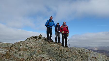 |
|
Richard, Alan and
Kevin |
| |
 |
|
Looking at the
interesting climbing routes on Miners Crag |
| |
| |
| |
| |
| |
| |
| |
|
 |
|
Route planning |
|
|
 |
|
Looking back towards Keswick and Derwentwater |
|
|
 |
|
A
bit more route planning |
|
|
 |
|
Heading down from Dale Head Tarn |
|
|
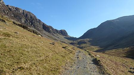 |
|
Looking back towards High Spy and Dale Head |
|
|
|
|
| |
|
| |
|
|
| |
|
|
|
|
|
|
|
|
Walk 16036 - 20/03/16 Hartington and Pilsbury Castle with
Macclesfield Ramblers |
| Area |
Peak
District |
Walking time |
|
Average speed |
|
| Walk |
Hartington
and Pilsbury Castle with Macclesfield Ramblers |
Minimum altitude |
|
Maximum altitude |
|
| Start
from |
Hartington |
Altitude loss |
|
Altitude gain |
|
| Weather |
Sunny |
Distance |
|
|
|
| Map |
Ordnance Survey Peak District OL24 |
Information from
Viewranger app on my Samsung S4 phone |
|
Route Hartington
- Madge Dale - Pilsbury Castle Hills - Pilsbury - Parks
Barn - Bank Top Farm - Hartington |
|
Last
Sundays walk on 20/03/16 from Hartington was a superb walk
in a great area , ten of us led by Roy set off on a
beautiful sunny day up the lane towards Moat Hall and then
a rising track took us up the hillside to gain a wonderful
high level path.
We followed the contour of the hillside which gave us
great views across the valley and the surrounding
countryside. Our lunch break was taken at Pilsbury Castle,
an ancient iron age fortification later used by the
Normans who built
a substantial motte and bailey castle on the site, sadly
little remains of it now but the earthworks are
impressive.
After lunch we followed the track back along the valley
bottom passing several farms with interesting buildings
before arriving back into Hartington.
Refreshments were enjoyed at the Devonshire Arms in
Hartington at the end of the walk. Thanks to Roy for
leading the walk and Kati, Carolyn, Janet, Ray, John, Sue,
Nigel, Wendy and David for coming on the this lovely walk. |
|
|
 |
|
Heading across the
fields towards Pilsbury Castle |
|
|
 |
|
Looking across to
Chrome Hill and Parkhouse Hill |
| |
|
 |
|
A bridle path near
Hartington |
|
|
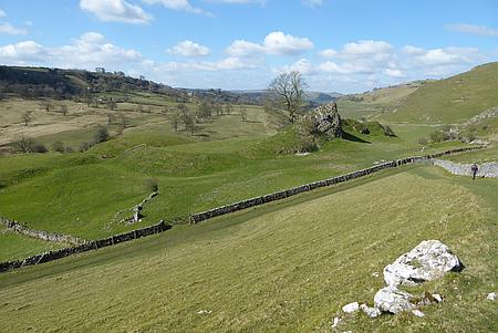 |
|
Looking down on Pilsbury Castle |
|
|
|
|
| |
|
| |
|
|
| |
|
|
|
|
Walk 16037 - 21/03/16 Macclesfield Forest evening walk |
| Area |
Cheshire |
Walking time |
1 hour |
Average speed |
|
| Walk |
Macclesfield Forest evening walk |
Minimum altitude |
|
Maximum altitude |
|
| Start
from |
Trentabank Visitor Centre |
Altitude loss |
|
Altitude gain |
|
| Weather |
Clear
night |
Distance |
2.14
miles |
|
|
| Map |
Explorer 268 |
Information from
Viewranger app on my Samsung S4 phone |
|
Route - Forest trails
in Macclesfield Forest |
|
| Four
of us set off from Trentabank Visitor Centre and did a
circular walk around the forest trails in Macclesfield
Forest. Headtorches still needed. |
|
|
| |
|
|
|
|
| |
|
|
| |
|
| |
|
|
|
Route of our walk |
| |
|
| |
|
|
| |
|
|
|
|
Walk 16038 - 23/03/16 Evening walk around Macclesfield Forest |
| Area |
Cheshire |
Walking time |
1 hour |
Average speed |
|
| Walk |
Evening
walk around Macclesfield Forest |
Minimum altitude |
|
Maximum altitude |
|
| Start
from |
Trentabank Visitor Centre |
Altitude loss |
|
Altitude gain |
|
| Weather |
Clear
night |
Distance |
2
miles |
|
|
| Map |
Explorer 268 |
Information from
Viewranger app on my Samsung S4 phone |
|
Route - Forest trails
in Macclesfield Forest |
|
| Two
of us set off from Trentabank Visitor Centre and did a
circular walk around the forest trails in Macclesfield
Forest. Headtorches still needed. |
|
|
| |
|
|
|
|
| |
|
|
| |
|
| |
|
|
|
Route of our walk |
| |
|
| |
|
|
| |
|
|
|
|
Walk
16039 - 25/03/16 Chatsworth Hall from Calton Lees |
| Area |
Peak
District |
Walking time |
4
hours |
Average speed |
1.3
mph |
| Walk |
Chatsworth House from Calton Lees |
Minimum altitude |
359 ft |
Maximum altitude |
894 ft |
| Start
from |
Calton
Lees Car Park. (Currently £3.00) |
Altitude loss |
800 ft |
Altitude gain |
800 ft |
| Weather |
Sunny
periods |
Distance |
5.63
miles |
|
|
| Map |
OS
White Peak OL24 |
Information from
Viewranger app on my Samsung S4 phone |
|
Route - Calton Lees -
Beeley Hilltop - Swiss Lake - Hunting Tower - Chatsworth
House - Calton Lees |
|
| Chris
and I set off from Calton Lees car park and cross the
River Derwent and followed the lane past Beeley Hilltop
then along the public footpath into the woods above
Chatsworth. A pleasant track leads through the woods
past Swiss Lake to the Hunting Tower where we stopped for
lunch with outstanding views over Chatsworth House and the
surrounding countryside. Afterwards we followed the path
down through the woods to Chatsworth House where stopped
to look around Gift shops in the Courtyard. An enjoyable
walk along the river bank took us back to the start at
Calton Lees. A great days walk with some great scenery. |
|
|
 |
|
Inside Chatsworth'
yard |
|
|
 |
|
The Hunting Tower in
the woods above Chatsworth |
| |
|
 |
|
Heading up to the
woods above Chatsworth |
|
|
 |
|
The
bridge over the River Derwent leading to Chatsworth |
|
|
|
|
| |
|
| |
|
|
| |
|
|
|
|
Walk
16040 - 27/03/16 - Gawsworth, Bosley Locks & North Rode with
Broken Cross Walkers |
| Area |
Cheshire |
Walking time |
3 hours |
Average speed |
|
| Walk |
Gawsworth, Bosley Locks & North Rode with Broken
Cross Walkers |
Minimum altitude |
410 ft |
Maximum altitude |
559 ft |
| Start
from |
Gawsworth Church |
Altitude loss |
516 ft |
Altitude gain |
516 ft |
| Weather |
Sunny
periods |
Distance |
8.16
miles |
|
|
| Map |
Explorer 268 |
Information from
Viewranger app on my Samsung S4 phone |
|
Route Gawsworth
- Mount Farm - Macclesfield Canal - Bosley Locks - North
Rode - Manor Farm - Gawsworth |
|
| 15 of us set off from
Gawsworth and headed across to the Macclesfield Canal
using field paths and tracks. Once on the canal we turned
south along the towpath and followed the canal to Bosley
Locks. Her we left the canal and after a short distance
along the lane we followed the track and fields paths
across to North Rode Church where we stopped for lunch.
Afterwards we headed north through Manor Farm and back
across the fields to Gawsworth. Once back at the cars we
changed from our boots and visited Gawsworth Hall and
enjoyed looking round this beautiful old building followed
by tea and cakes in the Cafe in the grounds. Thanks to
Chris, Kati, Carol, Chris J, Alec, Ruth, Ray, Maureen<
Derek, Janet D, Carolyn, Ros, Mike, and Chris R for coming
along on the walk with me. |
|
|
 |
|
Bosley Locks |
|
|
| |
|
|
| |
|
 |
|
Interesting stile |
|
|
 |
|
Gawsworth Church |
|
|
|
|
| |
|
| |
|
|
| |
|
|
|
|
Walk 16041 - 30/04/16 Circuit of Ridgegate Reservoir |
| Area |
Cheshire |
Walking time |
1 hour |
Average speed |
|
| Walk |
Circuit of Ridgegate Reservoir |
Minimum altitude |
|
Maximum altitude |
|
| Start
from |
Leathers Smithy |
Altitude loss |
|
Altitude gain |
|
| Weather |
Sunny
periods |
Distance |
2
miles |
|
|
| Map |
Explorer 268 |
Information from
Viewranger app on my Samsung S4 phone |
|
Route Leathers Smithy
- Footpaths around the reservoir and through the forest |
|
| Chris
and I set off from Leathers Smithy and followed the path
around the reservoir and through the forest and back to
the start. Afterwards we enjoyed an excellent meal at the
Leathers Smithy |
|
|
 |
|
Croker Hill in the
distance |
|
|
| |
|
|
| |
|
 |
|
Looking across
Ridgegate Reservoir towards Teggs Nose |
|
|
| |
|
|
|
|
|
|
| |
|
| |
|
|
| |
|
|
|
|
Walk 16042 - 31/03/16 - Shutlingsloe from Trentabank Visitor Centre |
| Area |
Cheshire |
Walking time |
1¼
hours |
Average speed |
2.6
mph |
| Walk |
Shutlingsloe
from Trentabank Visitor Centre |
Minimum altitude |
871 ft |
Maximum altitude |
1550
ft |
| Start
from |
Trentabank Visitor Centre |
Altitude loss |
733 ft |
Altitude gain |
733 ft |
| Weather |
Clear
night |
Distance |
3.33
miles |
|
|
| Map |
Explorer 268 |
Information from
Viewranger app on my Samsung S4 phone |
|
Route Trentabank -
Macclesfield Forest - Piggford Moor - Shutlingsloe and
return by same route |
|
|
Richard, John and I set off from Trentabank Visitor Centre
and walked up through Macclesfield Forest and across
Piggford Moor to the summit of Shutlingsloe. Great views
form the summit as darkness fell. We returned by the same
route. |
|
|
 |
|
Myself and John on the
summit of Shutlingsloe |
|
|
| |
|
|
| |
|
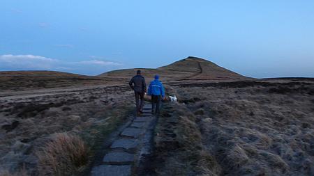 |
|
Heading towards
Shutlingsloe |
|
|
 |
|
Heading back as dusk falls |
|
|
|
|
| |
|
| |
|
|
| |
|
|
|
|
Walk
16043 - 03/04/16 Pym Chair and Shining Tor with Macclesfield
Ramblers |
| Area |
Peak
District |
Walking time |
4
hours |
Average speed |
|
| Walk |
Pym
Chair and Shining Tor with Macclesfield Ramblers |
Minimum altitude |
982 ft |
Maximum altitude |
1834ft |
| Start
from |
Pym
Chair |
Altitude loss |
1266
ft |
Altitude gain |
1266ft |
| Weather |
Sunny
periods |
Distance |
7.48
miles |
|
|
| Map |
OS
White Peak OL24 |
Information from
Viewranger app on my Samsung S4 phone |
|
Route Pym Chair - Cats
Tor - Shining Tor - Thursbitch - Dunge Farm - Wingather
Rocks - Pym Chair |
|
| Ten
of us set off from Pym Chair and followed the path along
the ridge over Cats Tor and onto the summit of Shining
Tor, the highest point in Cheshire at 1834ft (559m) a
coffee stop here gave us some great views over the
surrounding countryside. We then followed the path
westward down the hillside and then north to Thursbitch
where we stopped for lunch. |
|
Thursbitch meaning
"Demon Valley" in Old English is a ruined farmstead on a
desolate hillside with an intriguing history. Afterwards
we followed the path northwards passing through Dunge Farm
and up onto Taxal Edge, we passed over Windgather Rocks
pausing to watch the climbers demonstrating their skill
and then carried on along the ridge and back to the car
park. |
|
Thanks to John for leading this excellent walk and to
Christine, Kati, Ray, Ruth, Peter, Carolyn, Janet D, Janet
B and David for coming along on the walk. |
|
Just for the record
the walk was 7.5 miles long with 1266ft of ascent. |
|
|
 |
|
Heading along the
track away from Thursbitch |
| |
 |
|
The last uphill bit to
Windgather Rocks |
| |
| |
| |
| |
|
A little bit of the History of Thursbitch
|
| |
|
 |
|
Looking down on
Thursbitch, the ruins are by the Land Rover |
|
|
 |
|
Heading across the hillside towards Dunge Farm |
|
|
 |
|
Climbers on Windgather Rocks |
|
| |
|
|
| |
|
|
|
|
Walk
16044 - 04/04/16 Shutlingsloe from Trentabank Visitor Centre |
| Area |
Cheshire |
Walking time |
1¼
hours |
Average speed |
2.5
mph |
| Walk |
Shutlingsloe from Trentabank Visitor Centre |
Minimum altitude |
858 ft |
Maximum altitude |
1551
ft |
| Start
from |
Trentabank Visitor Centre |
Altitude loss |
757 ft |
Altitude gain |
757 ft |
| Weather |
Clear
night |
Distance |
3.45
miles |
|
|
| Map |
Explorer 268 |
Information from
Viewranger app on my Samsung S4 phone |
|
Route Trentabank -
Macclesfield Forest - Piggford Moor - Shutlingsloe and
return by same route |
|
|
Richard and I set off from Trentabank Visitor Centre and
walked up through Macclesfield Forest and across Piggford
Moor to the summit of Shutlingsloe. Great views form the
summit as darkness fell. We returned by the same route. |
|
|
 |
|
Looking towards
Manchester and Stockport from Shutlingsloe |
|
|
|
 |
|
Looking across to
Croker Hill from Shutlingsloe |
|
|
| |
|
|
|
|
|
|
| |
|
| |
|
|
| |
|
|
|
|
Walk
16045 - 06/04/16 Circuit of the Great Orme at Llandudno |
| Area |
Wales |
Walking time |
2¾
hours |
Average speed |
1.8
mph |
| Walk |
Circuit of the Great Orme at Llandudno |
Minimum altitude |
8 ft |
Maximum altitude |
399 ft |
| Start
from |
Llandudno |
Altitude loss |
1920 |
Altitude gain |
1920 |
| Weather |
Sunny
periods, breezy |
Distance |
5.81
miles |
|
|
| Map |
Explorer OL17 Conwy Valley |
Information from
Viewranger app on my Samsung S4 phone |
|
Route Llandudno -
Marine Drive - Rest and be Thankful Cafe - Invalids Walk -
Haulfre Gardens - Llandudno |
|
| Chris
and I set off from Llandudno along Marine Drive which
winds it way around the Great Orme. About halfway along
the walk we stopped refreshments at the Rest and be
Thankful Cafe. Ideally placed for a rest break with
excellent views out to sea. Afterwards we carried on along
the road with excellent views towards Conwy and Deganwy
and the along the hillside on Invalids Walk and back
through Haulfre Gardens to our start point in Llandudno.
An excellent walk we have done many times. |
|
|
 |
|
Marine Drive |
|
|
 |
|
Looking across
Llandudno from Haulfre Gardens |
| |
|
 |
|
Looking along the
coast from near Llandudno Pier |
|
|
 |
|
Looking across to Conwy |
|
|
|
|
| |
|
| |
|
|
| |
|
|
|
|
Walk
16046 - 07/04/16 Circular evening walk around Macclesfield Forest |
| Area |
Cheshire |
Walking time |
1 hour |
Average speed |
|
| Walk |
Circular
evening walk around Macclesfield Forest |
Minimum altitude |
|
Maximum altitude |
|
| Start
from |
Trentabank Visitor Centre |
Altitude loss |
|
Altitude gain |
|
| Weather |
Clear
night |
Distance |
2.65
miles |
|
|
| Map |
Explorer 268 |
Information from
Viewranger app on my Samsung S4 phone |
|
Route Trentabank
Visitor Centre - Forest paths |
|
|
Richard and I set off from Trentabank and did a circular
walk around Macclesfield Forest |
|
|
| |
|
|
|
|
| |
|
|
| |
|
| |
|
|
|
Route of our walk |
| |
|
| |
|
|
| |
|
|
|
|
Walk 16047 - 10/04/16 Millers Dale and Monsal Head with
Broken Cross Walkers |
| Area |
Peak
District |
Walking time |
3
hours |
Average speed |
|
| Walk |
Millers
Dale and Monsal Head with Broken Cross Walkers |
Minimum altitude |
578 ft |
Maximum altitude |
911 ft |
| Start
from |
Ravenstor, Millers Dale |
Altitude loss |
1551
ft |
Altitude gain |
1551
ft |
| Weather |
Sunny
periods |
Distance |
7
miles |
|
|
| Map |
OS
White Peak OL24 |
Information from
Viewranger app on my Samsung S4 phone |
|
Route Ravenstor -
Litton Mill - Water cum Jolly - Cressbrook Mill - Monsal
Head - Monsal Trail - Millers Dale - Ravenstor |
|
| Nine
of us set off from the layby at Ravenstor and followed the
path alongside the Rive Wye passing Litton Mill,
Water-cum-Jolly and Cressbrook Mill and then up to Monsal
Head for a coffee stop and an ice cream. We then descended
down to the Monsal Viaduct and then along the Monsal Trail
passing through Cressbrook Tunnel and Litton Tunnel
stopping for lunch with some great views down to the River
Wye. Afterwards we continued along the Monsal Trail to
near Millers Dale Station where we descended down to the
River Wye and followed the lane back to Ravenstor. A
pleasant riverside walk on a nice sunny spring day.
Thanks to Chris,
Wendy, Chris J, Maureen, Derek, Chris R and Ros and Mike
for joining me on the walk. |
|
|
 |
|
Looking down on the
Monsal Viaduct |
|
|
| |
|
|
| |
|
 |
|
Water cum Jolly |
|
|
 |
|
River Wye in Millers Dale |
|
|
|
|
| |
|
| |
|
|
| |
|
|
|
|
Walk
16048 - 11/04/16 - Evening walk Shutlingsloe from Trentabank |
| Area |
Cheshire |
Walking time |
1½ hours |
Average speed |
|
| Walk |
Evening
walk Shutlingsloe from Trentabank |
Minimum altitude |
|
Maximum altitude |
|
| Start
from |
Trentabank Visitor Centre |
Altitude loss |
|
Altitude gain |
|
| Weather |
Clear evening |
Distance |
3.37 miles |
|
|
| Map |
Explorer 268 |
Information from
Viewranger app on my Samsung S4 phone |
|
Route Trentabank
Visitor Centre - Macclesfield Forest - Piggford Moor and
return by same route. |
|
| Four
of us set off from Trentabank Visitor Centre and walked up
through Macclesfield Forest and over Piggford Moor and up
to the summit of Shutlingsloe. Great views from the
summit. return by the same route |
|
|
| |
|
|
|
|
| |
|
|
| |
|
|
| |
|
|
| |
|
|
|
|
Walk 16049 - 12/05/16 Evening walk around Macclesfield
Forest |
| Area |
Cheshire |
Walking time |
1 hour |
Average speed |
|
| Walk |
Evening
walk around Macclesfield
Forest |
Minimum altitude |
|
Maximum altitude |
|
| Start
from |
Trentabank Visitor Centre |
Altitude loss |
|
Altitude gain |
|
| Weather |
Clear
evening |
Distance |
2
miles |
|
|
| Map |
Explorer 268 |
Information from
Viewranger app on my Samsung S4 phone |
|
Route Trentabank
- Macclesfield Forest paths and return to Trentabank |
|
|
Richard and I set off from Trentabank Visitor Centre
followed our usual route around Macclesfield Forest |
|
|
| |
|
|
|
|
| |
|
|
| |
|
| |
|
 |
|
The
view from Nessit Hill |
| |
|
| |
|
|
| |
|
|
|
|
Walk
16050 - 13/04/16 Circuit of Ridgegate Reservoir |
| Area |
Cheshire |
Walking time |
1 hour |
Average speed |
|
| Walk |
Circuit
of Ridgegate Reservoir |
Minimum altitude |
|
Maximum altitude |
|
| Start
from |
Leathers Smithy, Langley |
Altitude loss |
|
Altitude gain |
|
| Weather |
Sunny
evening |
Distance |
2
miles |
|
|
| Map |
Explorer 268 |
Information from
Viewranger app on my Samsung S4 phone |
|
Route Leathers Smithy
- Circuit of Ridgegate Reservoir - Macclesfield
Forest - Leathers Smithy. |
|
| Chris
and I set off from Leathers Smithy and walked around the
Ridgegate Reservoir and through Macclesfield Forest and
back to the start. |
|
|
| |
|
|
|
|
| |
|
|
| |
|
| |
|
 |
|
Macclesfield Forest |
| |
|
| |
|
|
| |
|
|
|
|
Walk 16051 - 15/04/16 Backpacking Burbage to Shining Tor |
| Area |
Peak
District |
Walking time |
3
hours |
Average speed |
|
| Walk |
Backpacking Burbage to Shining Tor |
Minimum altitude |
|
Maximum altitude |
|
| Start
from |
Burbage near Buxton |
Altitude loss |
|
Altitude gain |
|
| Weather |
Rain
then sleet |
Distance |
6
miles |
|
|
| Map |
OS The
Peak District OL24 |
Information from
Viewranger app on my Samsung S4 phone |
|
Route - Burbage -
Bishops Lane - Dismantled Railway - Goyt Valley -
Goytsclough Quarry - Stake Clough - Shining Tor |
|
| This
was my first wild camp of the year, as I'm off to the
Cairngorms in a couple of weeks it seems a good idea to
check all my equipment works and everything is OK. On
Friday 15th April I caught the afternoon bus to Buxton and
alighted at Burbage. The plan was to walk back to
Macclesfield with a wild camp on the way, rain was
forecast for the evening turning to snow during the night
so it seemed like a good test for me as well as the tent.
Almost as soon as I got off the
bus it started to rain so it was on with the waterproofs
and off up the lane. I headed up Bishops Lane and through
Beet Wood and onto the moor, A steady walk along the
dismantled railway track brought me to the foot of Errwood
Reservoir and then south along the moorland path to Goyts
Clough Quarry. A steady climb out of the Goyt Valley took
me up Stake Clough and onto the summit of Shining Tor, the
highest point in Cheshire. This was my intended camping
spot and as it was now 7.00pm I quickly errected my tent,
not an easy task with the rain and the wind, I was glad to
get it secure and quickly got in for some respite from the
weather. After stripping off my wet clothes I cooked my
meal of noodles and meat balls and after watching a film
on my tablet I was soon asleep, the rain and wind were
buffeting the tent but about 2.00am it calmed down and I
slept until just after 6.00am, |
|
|
 |
|
Heading towards
Errwood Reservoir in the rain |
|
|
| |
|
|
| |
|
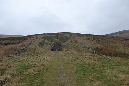 |
|
The blocked up Railway
Tunnel on Wild Moor |
|
|
 |
|
The
Packhorse Bridge in the Goyt Valley |
|
|
|
|
| |
|
| |
|
|
| |
|
|
|
|
Walk
16052 - 16/04/16 Backpacking Shining Tor to Macclesfield |
| Area |
Peak
District |
Walking time |
4½
hours |
Average speed |
|
| Walk |
Backpacking
Shining Tor to Macclesfield |
Minimum altitude |
|
Maximum altitude |
|
| Start
from |
Shining Tor |
Altitude loss |
|
Altitude gain |
|
| Weather |
Frosty
am then sunny periods |
Distance |
8
miles |
|
|
| Map |
OS The
Peak District OL24 |
Information from
Viewranger app on my Samsung S4 phone |
|
Route Shining Tor -
Lamaload - Vale Royal - Walker Barn - Teggs Nose -
Macclesfield |
|
|
I awoke at 6.15 am and not
long after I heard voices. On looking outside I found the
weather had changed dramatically, there was a lovely blue
sky and snow all around the tent. My boots in the porch
were frozen and it took me a while to get them on. The
voices were from two mountain bikers who had ridden along
the ridge from Pym Chair, there were brewing up by the
trig point and we discussed the weather and the icy
conditions. I cooked my breakfast and I packed up and set
off for home. My route took me over the moors to Lamaload
Reservoir and then up Walker Barn and Teggs Nose where I
stopped at the Cafe for tea and a bacon sandwich. Suitably
refreshed I walked down to Macclesfield and across town to
my home. A great start to my camping year, about 14 miles
with a pack weight off almost 13 kilos. Next stop the
Cairngorms in a few weeks. |
|
|
 |
|
Its been a wild and
cold night |
|
|
 |
|
Heading down towards
Lamaload |
| |
|
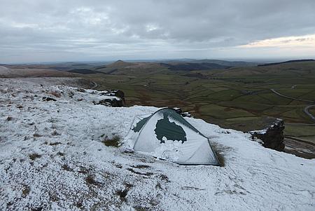 |
|
Looking towards
Shutlingsloe |
|
|
 |
|
Breakfast time |
|
|
|
|
| |
|
| |
|
|
| |
|
|
|
|
Walk 16053 - 17/04/16 Bollington, Rainow and Lamaload with
Macclesfield Ramblers |
| Area |
Cheshire |
Walking time |
3 hours |
Average speed |
|
| Walk |
Bollington, Rainow and Lamaload with Macclesfield
Ramblers |
Minimum altitude |
|
Maximum altitude |
|
| Start
from |
Bollington |
Altitude loss |
|
Altitude gain |
|
| Weather |
Sunny
periods |
Distance |
7 miles |
|
|
| Map |
Explorer 268 |
Information from
Viewranger app on my Samsung S4 phone |
|
Route - Bollington -
Waulkmill Farm - Rainow - Snipe House - Yearns Low -
Clarke House - Kishill Lane - Winterside Farm - Hedge Row
- Bollington. |
|
Eleven of us set off from Bollington on a nice sunny day
and followed the lane to Waulkmill Farm and then along the
stone flagged paths to Rainow, we crossed the main road
and followed the tracks and field paths up to Snipe House
with its excellent views back down the valley. At the end
of the lane by Lamaload Dam we climbed the hillside track
on Yearns Low stopping for lunch overlooking the valley.
Afterwards more field paths and tracks took
us along Kiskhill Lane and Jumper Lane and aroung Billinge
Hill, we descended to Hedge Row and then an easy walk led
us back into Bollington. A great walk of seven miles with
a few ups and downs and some wonderful views over the
hills and valleys.
On the walk today were David, Christine, Peter, Hans,
Maureen, Derek, Nigel, Carolyn, Sue and John with many
thanks to Janet for leading this excellent walk. |
|
|
| |
 |
|
Macclesfield Ramblers
near the end of the walk |
| |
|
|
| |
|
 |
|
The
waterfall by Waulkmill Farm |
| |
|
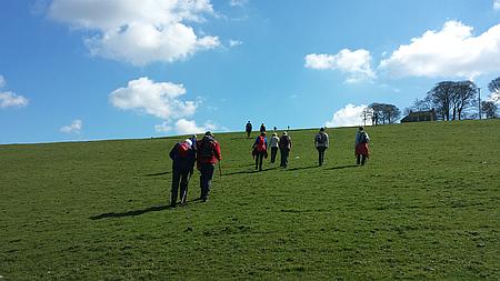 |
|
Heading up towards Snipe House |
| |
|
|
|
|
|
|
| |
|
| |
|
|
| |
|
|
|
|
Walk
16054 - 18/04/16 Evening walk to Shutlingsloe from
Trentabank |
| Area |
Cheshire |
Walking time |
1½
hours |
Average speed |
|
| Walk |
Evening walk to Shutlingsloe from Trentabank |
Minimum altitude |
|
Maximum altitude |
|
| Start
from |
Trentabank Visitor Centre |
Altitude loss |
|
Altitude gain |
|
| Weather |
Clear
evening |
Distance |
3
miles |
|
|
| Map |
Explorer 268 |
Information from
Viewranger app on my Samsung S4 phone |
|
Route Trentabank
Visitor Centre Macclesfield Forest - Piggford Moor and
return by the same route |
|
| Five
of set off from Trentabank Visitor Centre up through
Macclesfield Forest and over Piggford Moor, returned by
the same route back to the Visitor Centre |
|
|
 |
|
On the summit of
Shutlingsloe |
|
|
| |
|
|
| |
|
| |
|
 |
|
Heading up towards Shutlingsloe |
| |
|
|
|
|
|
|
| |
|
| |
|
|
| |
|
|
|
|
Walk 16055 - 20/05/16 Ashford in the Water and Bakewell |
| Area |
Peak
District |
Walking time |
3
hours |
Average speed |
|
| Walk |
Ashford in the Water and Bakewell |
Minimum altitude |
|
Maximum altitude |
|
| Start
from |
Ashford in the Water |
Altitude loss |
|
Altitude gain |
|
| Weather |
Sunny
periods |
Distance |
6
miles |
|
|
| Map |
OS
Peak District OL24 |
Information from
Viewranger app on my Samsung S4 phone |
|
Route Ashfor in the
Water - Riverside path to Bakewell and return by the same
route. |
|
| Chris
and I parked at Ashford in the Water and followed the
riverside path into Bakewell, A few visits to the Outdoors
Shops, lunch on the riverbank and we returned by the same
route. An enjoyable day out. |
|
|
 |
|
River Wye near Ashford
in the Water |
|
|
| |
|
|
| |
|
 |
|
Holy Trinity Church in
Ashford in the Water |
|
|
 |
|
River Wye near Bakewell |
|
|
|
|
| |
|
| |
|
|
| |
|
|
|
|
Walk
16056 - 24/04/16 - Styal Mill and Lindow with
Broken Cross Walkers |
| Area |
Cheshire |
Walking time |
3
hours |
Average speed |
|
| Walk |
Styal
Mill and Lindow with Broken Cross Walkers |
Minimum altitude |
|
Maximum altitude |
|
| Start
from |
Lindow |
Altitude loss |
|
Altitude gain |
|
| Weather |
Sunny
periods |
Distance |
7
miles |
|
|
| Map |
Explorer 268 |
Information from
Viewranger app on my Samsung S4 phone |
|
Route Lindow - The
Carrs - Styal Mill - North Cheshire Way - Oak Farm -
Burley Hurst farm - Lindow Moss. |
|
| Nine
of us set off from Lindow and followed the path across to
the Carrs and then alongside the River Bollin to Styal
Mill. The riverside path took us past Giants Castle to
Oversley Ford and then across the main road onto the North
Cheshire Way which follows the perimeter of the Manchester
Airport Runway. Plenty of plane spotting opportunities. We
then left the North Cheshire Way and crossed the fields
past Oak Farm and Burley Hurst Farm and back over Lindow
Moss. |
|
Thanks to Christine,
Ros, Mike, Pat, Dave, Chris R, Wendy and Carol for coming
along on the walk. |
| |
 |
|
River Bollin in Styal
Woods |
| |
|
|
| |
|
 |
|
Bluebells are starting
to come out |
|
|
 |
|
Time
for a bit of plane spotting |
|
|
|
|
| |
|
| |
|
|
| |
|
|
|
|
Walk 16057 - 25/04/16 Evening walk around Macclesfield Forest |
| Area |
Cheshire |
Walking time |
1 hour |
Average speed |
|
| Walk |
Evening
walk around Macclesfield Forest |
Minimum altitude |
|
Maximum altitude |
|
| Start
from |
Trentabank Visitor Centre |
Altitude loss |
|
Altitude gain |
|
| Weather |
Clear evening |
Distance |
2 miles |
|
|
| Map |
|
Information from
Viewranger app on my Samsung S4 phone |
|
Route Trentabank
Visitor Centre - Macclesfield Forest paths - Nessit Hill
Trentabank Visitor Centre |
|
|
Myself, Richard and John set off on our regular evening
walk around Macclesfield Forest and over Nessit Hill |
|
|
| |
|
|
|
|
| |
|
|
| |
|
| |
|
|
|
Route of our walk |
| |
|
| |
|
|
| |
|
|
|
|
Walk 16058 - 01/05/16 Backpacking - Glenmore to Fords of Avon |
| Area |
Cairngorms |
Walking time |
6
hours |
Average speed |
|
| Walk |
Backpacking - Glenmore to Fords of Avon |
Minimum altitude |
|
Maximum altitude |
|
| Start
from |
Glenmore |
Altitude loss |
|
Altitude gain |
|
| Weather |
Sunny
periods then rain, sleet |
Distance |
10
miles |
|
|
| Map |
OS
Cairngorm and Aviemore 403 |
Information from
Viewranger app on my Samsung S4 phone |
|
Route Glenmore -
Bynack More - Lairig An Laoigh - Fords of Avon Refuge |
|
| Four
of us have just completed a great five day backpacking
trip in the Cairngorms. Our trip started with the
long drive up to Glenmore near Aviemore from Macclesfield
. After the first night camp at the Campsite at Glenmore
we prepared to set off on Sunday morning for our five day
trip, the forecast was for 50mph winds during the night on
the tops so after some discussion we decided to reverse
the route to keep us at a lower altitude until the weather
had improved in the coming days.
Sunday 1st May
We left Glenmore and headed east along the track heading
towards The Ryvoan Pass and then took the path towards
Bynack More.
We crossed the mountainside below the summit and followed
the path down to Fords of Avon Refuge. The path was very
wet with slush and melting snow and it had started to
rain.
It was almost six o' clock when we arrived at the refuge
and we were wet and tired so a decision was made to stay
in the small refuge for the night instead of continuing on
to our original destination of the Faindouran Bothy. The
weather deteriorated during the night and we realised we
had made the correct decision. It was quite cosy in the
Refuge with four men, a dog and four rucksacks but a least
we were drying out away from the bad weather outside. The
distance today was around 10 miles.
|
 |
|
Heading through the
forest away from Glenmore |
|
|
|
 |
|
Looking back towards
Meall a' Bhuachaille |
|
|
| |
|
 |
|
Ready for the start of
our trip |
|
|
 |
|
A
bit of route planning due to the wet conditions underfoot |
|
|
 |
|
heading up towards Bynack More |
|
| |
|
|
| |
|
|
|
|
Walk
16059 - 02/05/16 Backpacking - Fords of Avon to Derry
Lodge |
| Area |
Cairngorms, Scotland |
Walking time |
8
hours |
Average speed |
|
| Walk |
Backpacking - Fords of Avon to Derry Lodge |
Minimum altitude |
|
Maximum altitude |
|
| Start
from |
Fords
of Avon Refuge |
Altitude loss |
|
Altitude gain |
|
| Weather |
Rain
the sunny periods and showers |
Distance |
10
miles |
|
|
| Map |
OS
Cairngorm and Aviemore 403 |
Information from
Viewranger app on my Samsung S4 phone |
|
Route Fords of Avon
Refuge - Glen Derry - Derry Lodge - Bob Scotts Bothy |
|
The
weather was still poor with wind and rain when we left the
Refuge next morning and we changed our plans and decided
to head south for Braemar, after two river crossings took
us almost and hour and a half and we were still only 400
yards from the Refuge we felt we had made the right
decision.
The weather started to improve later in the morning with
the occasional glimpse of blue sky but all the paths were
still flooded and after about another 90 minutes we
reached a main stream, Glas Alt Mor cascading down the
hillside, about 20 feet across but clearly in spate we
looked for a safe place to cross, we climbed high up the
hillside and then down to the junction with Derry Burn but
there was no chance of crossing it safely.
We reluctantly headed back the way we had come for over a
mile and crossed the small footbridge on the Hutchison Hut
path and then headed south along the west bank for three
and a half pathless boggy miles until we reached Derry Dam
and a decent path. Another hour brought us to the Bob
Scott Memorial Hut.
Our plan for a night in Braemar would have to wait till
next day. We pitched our tents on the river bank by the
Hut. A great dry pitch for a change. There was room in the
Bothy but we decided to camp. We spent a great evening in
the bothy by a roaring fire with great company. Exchanging
tales with Richard from Amsterdam, Ruth from Edinburgh and
her companion. Distance was around 10 miles. |
|
|
 |
|
River Avon in spate,
we just managed to wade across this, any deeper would have
been a problem |
|
|
 |
|
Looking back over the
River Avon, the Refuge is visible in the centre |
| |
 |
|
Heading down the
valley and the weather has improved |
| |
 |
|
Looking back up the
valley, we needed to be on the other bank |
| |
| |
| |
| |
| |
|
|
 |
|
Fords of Avon Refuge |
|
|
 |
|
Richard looking for a suitable crossing place |
|
|
 |
|
Looking upthe valley where the Hutchinson Memorial Hut is
situated. Creagan a' Choire Etchachan ahead with Sgurr an
Lochan Uaine on the left |
| |
.png) |
|
The
Glas Alt Mor was in spate and we could not cross it |
| |
 |
|
Bob
Scotts Memorial Hut |
| |
| |
| |
| |
|
| |
|
|
| |
|
|
|
|
Walk
16060 - 03/05/16 Backpacking - Derry Lodge to Braemar |
| Area |
Cairngorms Scotland |
Walking time |
5
hours |
Average speed |
|
| Walk |
Backpacking
- Derry Lodge to Braemar |
Minimum altitude |
|
Maximum altitude |
|
| Start
from |
Derry
Lodge, Bob Scotts Memorial Hut |
Altitude loss |
|
Altitude gain |
|
| Weather |
Sunny
periods |
Distance |
8
miles |
|
|
| Map |
OS
Cairngorm and Aviemore 403 |
Information from
Viewranger app on my Samsung S4 phone |
|
Route Bob Scotts Bothy
- Glen Lui - Mars Lodge - Braemar |
|
After
breakfast we packed up and set off for Braemar accompanied
by Richard, it was and easy eight mile walk after what we
had done the previous days and the weather stayed fine
with even a bit of sunshine.
We arrived in Braemar and after a quick pint we checked
into the Hostel, a quick shower and we were off out again
as the five of us had booked a table for a meal at the
Moorfield House Hotel. Around 8 miles |
|
|
|
|
|
The Bob Scott Bothy |
|
|
 |
|
Lookling back from the
hillside near Braemar |
| |
|
 |
|
My tent by the Bob
Scott Bothy |
|
|
 |
|
Ready to set off for Braemar |
|
|
 |
|
A
welcome pint in Braemar |
|
| |
|
|
| |
|
|
|
|
Walk
16061 - 04/05/16 Backpacking - Braemar to Corrour Bothy |
| Area |
Cairngorms, Scotland |
Walking time |
8
hours |
Average speed |
|
| Walk |
Backpacking
- Braemar to Corrour Bothy |
Minimum altitude |
|
Maximum altitude |
|
| Start
from |
Braemar Youth Hostel |
Altitude loss |
|
Altitude gain |
|
| Weather |
Sunny
periods the rain |
Distance |
16
miles |
|
|
| Map |
OS
Cairngorm and Aviemore 403 |
Information from
Viewranger app on my Samsung S4 phone |
|
Route Braemar - Linn
of Dee - White Bridge - Glenn Dee - Corrour Bothy |
|
After
breakfast Richard set off for Amsterdam and the four of us
followed the road west out of Braemar as far as Victoria
Bridge and then the track past Mars Lodge and the Linn of
Dee to White Bridge where we stopped for lunch, it had
remained dry all morning although we could see that
showers were on the way. After lunch we followed the path
north west alongside the River Dee past some spectacular
waterfalls with plenty of deep pools.
A steady climb took us towards the Lairig Ghru with some
great views of the Devils Point and Cairn Toul.
We eventually arrived at Corrour Bothy as the rain set in
and were pleased to find it unoccupied. After water had
been collected from the river we settled down for the
night enjoying a good meal and hot chocolate with a touch
of whisky. We all slept soundly that night. A long day of
around 16 miles. |
|
|
 |
|
The Chest of Dee Pools
near White Bridge |
|
|
 |
|
Corrour Bothy in sight
and its raining |
| |
|
| |
|
 |
|
Pausing for a brerather at the Linn of Dee Car Park |
| |
 |
|
Heading up the valley towards the Devils Point |
|
|
| |
|
| |
|
|
| |
|
|
|
|
Walk
16062 - 05/05/16 Backpacking - Corrour Bothy to Glemore |
| Area |
Cairngorms, Scotland |
Walking time |
8
hours |
Average speed |
|
| Walk |
Backpacking - Corrour Bothy to Glemore |
Minimum altitude |
|
Maximum altitude |
|
| Start
from |
Corrour Bothy |
Altitude loss |
|
Altitude gain |
|
| Weather |
Sunny
periods, very windy |
Distance |
13
miles |
|
|
| Map |
OS
Cairngorm & Aviemore 403 |
Information from
Viewranger app on my Samsung S4 phone |
|
Route - Corrour Bothy
- Pools of Dee - Lairig Ghru - Rochiemurchus Forest -
Glenmore |
|
After
breakfast we swept the hut out and set off along the
riverside track climbing constantly eventually crossing
many boulder strewn areas frequently covered in several
feet of snow.
Sometimes when crossing the snowfields you would break
through the surface and the snow could be any depth
between one and three feet deep covering the boulders.
Very tricky and potententionally dangerous.
Eventually we passed the last snowfield and started to
drop down towards the Rothiemurchus Forest.
A long walk through the forest brought us to Cairngorm
Lodge Youth Hostel at Glenmore where we spent our final
night. A great place to stay with good food. Around 13
miles on this our final day. |
|
|
| The
following morning we set off on the long drive home having
had a great five days walking, a total of 57 miles with
7200ft of ascent. The four of us, Richard, John, Barry and
myself thoroughly enjoyed ourselves and many thanks to
Richard for driving. |
|
|
|
 |
|
Ready to leave the
Corrour Bothy |
|
|
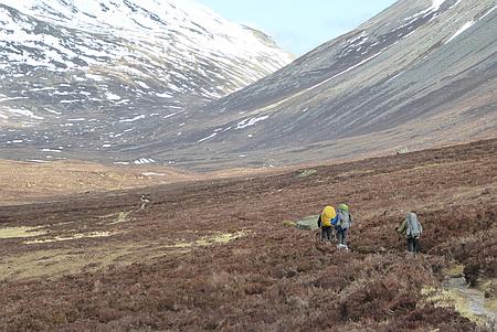 |
|
Heading towards the
Lairig Ghru |
|
|
 |
|
Looking ahead and the
path drops down to the Rothiemurchus Forest |
|
|
 |
|
Journeys end and time
for a pint, we've earned it. |
|
|
|
|
|
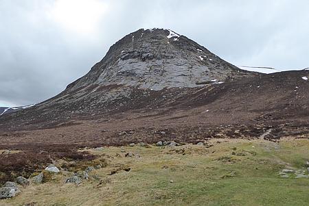 |
|
The Devils Point
towering above the Corrour Bothy |
|
|
 |
|
Looking back towards the Corrour Bothy |
|
|
 |
|
Crossing one of the snow fields near the Pools of Dee |
|
|
 |
|
Looking back towards the Lairig Ghru |
|
|
|
|
|
|
|
|
|
|
|
|
|
|
|
|
|
|
|
|
|
|
| |
|
| |
|
|
| |
|
|
|
|
Walk 16063 - 08/05/16 Rushton Spencer and Danebridge with
Broken Cross Walkers |
| Area |
Staffordshire |
Walking time |
3
hours |
Average speed |
|
| Walk |
Rushton Spencer and Danebridge with Broken Cross
Walkers |
Minimum altitude |
|
Maximum altitude |
|
| Start
from |
Rushton Spencer |
Altitude loss |
|
Altitude gain |
|
| Weather |
Sunny
periods |
Distance |
7
miles |
|
|
| Map |
Explorer 268 |
Information from
Viewranger app on my Samsung S4 phone |
|
Route Rushton Spencer
- Gritstone Trail - Barleigh Fold Bridge - Dumkins -
Wincle Grange - Dane Bridge - Dane Valley Way - Rushton
Spencer |
|
| Nine
of us set off from Rushton Spencer and after a short
distance along the dismantled railway joined the Gritstone
Trail and followed this past Barleigh Fold Bridge as far
as Dumkins, then it was along the field paths towards Wincle
Grange with a lunch break on the way and then down to Danebridge.
A brief stop to sample the Ales at Wincle Brewery and then
we set off along the Dane Valley Way which runs alongside
the River Dane. We followed the path back to Barleigh Fold
Bridge and the up the lane and across the fields back to
Rushton Spencer. |
|
Thanks to Christine,
Doreen, Kati, Wendy, Ruth, Ray, Janet D and Janet B for
joining me on this walk |
| |
 |
|
Some of the group
enjoying refreshments out side Wincle Brewery |
| |
|
|
| |
|
| |
|
 |
|
River Dane |
| |
 |
|
Heading back along the Dane Valley Way |
|
|
| |
|
| |
|
|
| |
|
|
|
|
Walk
16064 - 09/05/16 Evening walk around Macclesfield Forest |
| Area |
Cheshire |
Walking time |
1 hour |
Average speed |
|
| Walk |
Evening
walk around Macclesfield Forest |
Minimum altitude |
|
Maximum altitude |
|
| Start
from |
Trentabank Visitor Centre |
Altitude loss |
|
Altitude gain |
|
| Weather |
Clear
evening |
Distance |
2
miles |
|
|
| Map |
Explorer 268 |
Information from
Viewranger app on my Samsung S4 phone |
|
Route Trentabank
Visitor Centre - Macclesfield Forest paths. |
|
| Four
of us set off on one of our regular walks around
Macclesfield Forest, quite a few deer around grazing in
the clearings of the forest. |
|
|
| |
|
|
|
|
| |
|
|
| |
|
| |
|
 |
|
Macclesfield Forest |
| |
|
| |
|
|
| |
|
|
|
|
Walk
16065 - 12/05/16 Evening walk to Shutlingsloe from
Trentabank |
| Area |
Cheshire |
Walking time |
1½
hours |
Average speed |
|
| Walk |
Evening
walk to Shutlingsloe from Trentabank |
Minimum altitude |
|
Maximum altitude |
|
| Start
from |
Trentabank Visitor Centre |
Altitude loss |
|
Altitude gain |
|
| Weather |
Clear
evening |
Distance |
3
miles |
|
|
| Map |
Explorer 268 |
Information from
Viewranger app on my Samsung S4 phone |
|
Route Trentabank -
Macclesfield Forest - Piggford Moor - Shutlingsloe and
return by the same route. |
|
|
Richard and I set off from Trentabank Visitor Centre and
headed up through the forest and across Piggford Moor, once
over the moor it was a short steep climb up to the summit
of Shutlingsloe. We returned back to the car by the same
route. |
|
|
 |
|
Richard heading across
Piggford Moor towards Shutlingsloe |
|
|
| |
|
|
| |
|
 |
|
The setting sun seen
through the trees in Macclesfield Forest |
|
|
| |
|
|
|
|
|
|
| |
|
| |
|
|
| |
|
|
|
|
Walk
16066 - 14/05/16 - Gawsworth circular walk |
| Area |
Cheshire |
Walking time |
|
Average speed |
|
| Walk |
Gawsworth circular walk |
Minimum altitude |
|
Maximum altitude |
|
| Start
from |
Gawsworth Church |
Altitude loss |
|
Altitude gain |
|
| Weather |
Sunny
pedriods |
Distance |
7
miles |
|
|
| Map |
Explorer 268 |
Information from
Viewranger app on my Samsung S4 phone |
|
Route Gawsworth Church
- Cloverbank Farm - Shellow Lane - Great Tidnock Farm -
Heskey Wood - Marton Lane Gawsworth |
|
| After
parking at Gawsworth I followed the field path south past
Cloverbank Farm onto Shellow Lane, I then headed west
along the lane and then along the track past Great Tidnock
Farm, stopping for lunch ion a sunny spot. Once on
Maton Lane I headed north through Heskey Wood to Henshaw
Hall Farm and the it was east and back onto Marton Lane
and back to Gawsworth Church. This was a route check for a
walk I plan to do in the future with the walking club. |
|
|
 |
|
A field of Oil Seed
Rape |
|
|
| |
|
|
| |
|
 |
|
A lovely display of
Bluebells |
|
|
 |
|
Gawsworth Church through the trees |
|
|
|
|
| |
|
| |
|
|
| |
|
|
|
|
Walk
16067 - 15/05/16 Bramall Hall circular with Macclesfield
Ramblers |
| Area |
Cheshire |
Walking time |
3
hours |
Average speed |
|
| Walk |
Bramall Hall circular with Macclesfield Ramblers |
Minimum altitude |
|
Maximum altitude |
|
| Start
from |
Norbury House Farm, Jacksons Lane |
Altitude loss |
|
Altitude gain |
|
| Weather |
Sunny
periods |
Distance |
7
miles |
|
|
| Map |
Explorer 268 |
Information from
Viewranger app on my Samsung S4 phone |
|
Route Jacksons Lane -
Happy Valley - Bramall Hall - Happy Valley - Jacksons
Lane. |
|
| Nine
of us set off from Jacksons Lane and followed the footpath
through Happy Valley and into the grounds of Bramall Hall.
We took various paths through the grounds and then and
then back along Happy Valley and back to the start |
|
The group today were
Sue, Janet B, Sue, Nichola, John L, Pat , Paddy, Christine
and myself. Many thanks to Pat for leading the walk. |
| |
 |
|
Very busy in Bramall
Park |
| |
|
|
| |
|
 |
|
A quiet lane |
|
|
 |
|
Lady
Brook |
|
|
|
|
| |
|
| |
|
|
| |
|
|
|
|
Walk 16068 - 16/05/16
Evening walk to Croker Hill from Lowerhouse |
| Area |
Cheshire |
Walking time |
1½
hours |
Average speed |
|
| Walk |
Evening walk to Croker Hill from Lowerhouse |
Minimum altitude |
|
Maximum altitude |
|
| Start
from |
Lowerhouse |
Altitude loss |
|
Altitude gain |
|
| Weather |
Clear
night |
Distance |
4
miles |
|
|
| Map |
Explorer 268 |
Information from
Viewranger app on my Samsung S4 phone |
|
Route Lowerhouse -
Fox's Bank - Hill of Rossenclowes - Croker Hill - Higher
Pethills Farm - Lower Pethills - Lowerhouse |
|
| Four
of us set off on a lovely spring evening from Lowerhouse,
we walked up Fox's Bank and followed the Gritstone Trail
over the Hill of Rossenclough and Croker Hill, we passed
the Radio Tower and then down to Higher Pethills Farm and
Lower Pethills and back to our start at Lowerhouse. A
really enjoyable evenings walk. |
|
|
 |
|
Zooming in on
Shutlingsloe |
|
|
| |
|
|
| |
|
 |
|
Heading up Fox's Bank |
|
|
 |
|
Approaching the Radio Tower on Croker Hill |
|
|
|
|
| |
|
| |
|
|
| |
|
|
|
|
Walk
16069 - 22/05/16 Goostrey and Twemlow with Broken
Cross Walkers |
| Area |
Cheshire |
Walking time |
3
hours |
Average speed |
|
| Walk |
Goostrey and Twemlow
with Broken Cross Walkers |
Minimum altitude |
|
Maximum altitude |
|
| Start
from |
Goostrey Railway Station |
Altitude loss |
|
Altitude gain |
|
| Weather |
Sunny
periods |
Distance |
7
miles |
|
|
| Map |
Explorer 268 |
Information from
Viewranger app on my Samsung S4 phone |
|
Route Goostrey -
Kermincham Hall - Brook Farm- Dane Valley Way - Twemlow
Viaduct - Hermitage Bridge - Dromedary Lodge - Goostrey |
|
| Five
of us set off on a lovely sunny day from Goostrey Station,
we followed the field paths across to Kermincham Hall and
Brook Farm and then headed west along the Dane Valley Way
where there were some superb displays of Hawthorne
in flower. We passed under the magnificent Twemlow
Viaduct. where we stopped for lunch on the river bank.
afterwards we reached Hermitage Bridge and sheltered from
a quick shower before heading north past Dromedary Lodge
and into Goostrey Village. Refreshments in the sunshine at
the Red Lion and then the short walk back to the Station.
Thanks to
Christine, Kati, Carol and Chris R for joining me on this
walk |
|
|
 |
|
The hawthorne tree's
are superb |
|
|
 |
|
The magnificent
railway vidauct near Holmes Chapel |
| |
|
| |
|
 |
|
A
quiet lane |
| |
 |
|
Another superb hawthorne tree |
|
|
| |
|
| |
|
|
| |
|
|
|
|
Walk
16070 - 23/05/16 Shutlingsloe from Trentabank |
| Area |
Cheshire |
Walking time |
1½
hours |
Average speed |
|
| Walk |
Shutlingsloe from Trentabank |
Minimum altitude |
|
Maximum altitude |
|
| Start
from |
Trentabank |
Altitude loss |
|
Altitude gain |
|
| Weather |
Clear
evening |
Distance |
3
miles |
|
|
| Map |
Explorer 268 |
Information from
Viewranger app on my Samsung S4 phone |
|
Route |
|
| Four
of us on myself, Richard, Barry and John set off from
Trentabank for an evening walk to the summit of
Shutlingsloe |
|
|
 |
|
Croker Hill in the
distance |
|
|
 |
|
Heading back down from
Shutlingsloe |
| |
|
| |
|
 |
|
Looking up to Nessit Hill |
| |
 |
|
Looking down on Macclesfield Forest from Shutlingsloe |
|
|
| |
|
| |
|
|
| |
|
|
|
|
Walk
16071 - 25/05/16 Axe Edge Moor and Cheeks Hill |
| Area |
Peak
District |
Walking time |
2
hours |
Average speed |
|
| Walk |
Axe
Edge Moor and Cheeks Hill |
Minimum altitude |
|
Maximum altitude |
|
| Start
from |
Dane
Head |
Altitude loss |
|
Altitude gain |
|
| Weather |
Overcast |
Distance |
3
miles |
|
|
| Map |
OS The
Peak District OL24 |
Information from
Viewranger app on my Samsung S4 phone |
|
Route Dane Head - Axe
Edge Moor - Cheeks Hill - Dane Head |
|
| After
parking on the narrow lane at Dane Head I headed across
the pathless moor up to the Trig Point on Axe Edge Moor, I
then headed south crossing the lane again and onto the
summit of Axe Edge. No actual summit marked but I
visited every high point and then set off north west
across the moorland heading for Cheeks Hill. Another
unmarked high point, I then followed the track northwards
and back to the car. Some interesting views across the
landscape that was once quite heavily quarried and mines.
Fortunately not really visible but you can see old tracks
and spoil heaps. |
|
|
| |
 |
|
Looking east towards
Chrome Hill |
| |
|
|
| |
|
| |
|
 |
|
The
trig point on Axe Edge Moor |
| |
|
|
|
|
|
|
| |
|
| |
|
|
| |
|
|
|
|
Walk 16072 - 28/05/16 Macclesfield Forest and Shutlingsloe |
| Area |
Cheshire |
Walking time |
1½
hours |
Average speed |
|
| Walk |
Macclesfield Forest and Shutlingsloe |
Minimum altitude |
|
Maximum altitude |
|
| Start
from |
Trentabank |
Altitude loss |
|
Altitude gain |
|
| Weather |
Clear
night |
Distance |
4
miles |
|
|
| Map |
Explorer 268 |
Information from
Viewranger app on my Samsung S4 phone |
|
Route Trentabank -
Piggford Moor - Shutlingsloe - Piggford Moor - Nessit Hill
- Trentabank |
|
|
Richard and I set off from Trentabank and headed up
through the forest and across Piggford Moor and up to the
summit of Shutlingsloe, we then headed south down the
steep hillside and back across Piggford Moor to join the
path down through the forest to the car park. |
|
|
| |
 |
|
On the summit of Shutlingsloe |
| |
|
|
| |
|
| |
|
 |
|
Small pool in Macclesfield Forest |
| |
|
|
|
|
|
|
| |
|
| |
|
|
| |
|
|
|
|
Walk
16073 - 29/05/16 Danebridge and Turners Pool with
Macclesfield Ramblers |
| Area |
Staffordshire |
Walking time |
4
hours |
Average speed |
|
| Walk |
Danebridge and Turners Pool with Macclesfield
Ramblers |
Minimum altitude |
|
Maximum altitude |
|
| Start
from |
Danebridge |
Altitude loss |
|
Altitude gain |
|
| Weather |
Sunny
periods |
Distance |
7
miles |
|
|
| Map |
Explorer 268 |
Information from
Viewranger app on my Samsung S4 phone |
|
Route |
|
| Nine
of us set off from Danebridge and headed up through the
forest and past Hangingstone Farm, our route then followed
the hillside path towards the Roaches and then down past
Clough Head to Turners Pool where we stopped for lunch.
Afterwards we followed the path past Old Hag to Gun End
and then it was along the track down to Gig Hall and back
along the Dane Valley Way which follows the River Dane
back to Dane Bridge |
|
Thanks to Christine,
Kati, Janet, Peter, John, Ray, Roy and Patricia for
joining me on this walk. |
| |
|
|
|
 |
|
Turners Pool |
|
|
| |
|
 |
|
Looking back along the
ridge |
|
|
 |
|
Haymaking is in full swing |
|
|
|
|
| |
|
| |
|
|
| |
|
|
|
|
Walk
16074 - 31/05/16 Macclesfield Forest circular |
| Area |
Cheshire |
Walking time |
1 hour |
Average speed |
|
| Walk |
Macclesfield Forest circular |
Minimum altitude |
|
Maximum altitude |
|
| Start
from |
Trentabank Visitor Centre |
Altitude loss |
|
Altitude gain |
|
| Weather |
Clear
night |
Distance |
3
miles |
|
|
| Map |
Explorer 268 |
Information from
Viewranger app on my Samsung S4 phone |
|
Route Trentabank -
Macclesfield Forest - Nessit Hill - Trentabank |
|
| Four
of us set off on our regular walk around Macclesfield
Forest, a clear night with some great views in the forest. |
|
|
| |
|
|
|
|
| |
|
|
| |
|
| |
|
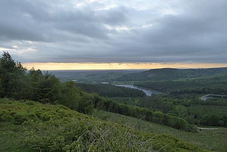 |
|
Looking west from Nessit Hill |
| |
|
| |
|
|
| |
|
|
|
|
Walk
16075 - 05/06/16 Whaley Bridge and Chapel Milton with
Broken Cross Walkers |
| Area |
Peak
District |
Walking time |
3½
hours |
Average speed |
|
| Walk |
Whaley
Bridge and Chapel Milton with Broken Cross Walkers |
Minimum altitude |
|
Maximum altitude |
|
| Start
from |
Whaley
Bridge |
Altitude loss |
|
Altitude gain |
|
| Weather |
Sunny |
Distance |
8
miles |
|
|
| Map |
|
Information from
Viewranger app on my Samsung S4 phone |
|
Route Whaley bridge -
Buxsworth - Halhill Farm - Chapel Milton - Bridgeholme
Green - Bugsworth Canal Basin - Whaley Bridge |
|
| Eight
of us set off from Whaley Bridge on a lovely sunny day, we
passed through the village of Buxsworth and then along the
hillside to Chapel Milton. A lunch stop at Bridgeholme
Green and then it was along the Tramway Trail to Bugsworth
Canal Basin where we stopped for Ice Cream, then it was
along the canal towpath and back into Whaley bridge |
|
Thanks to Christine,
Pat G, Kati, Maureen, Derek, Hans and Chris R for joining
me on this walk |
| |
 |
|
Looking back towards
Whaley Bridge |
| |
|
|
| |
|
 |
|
Looking along the
track beneath Eccles Pike |
|
|
 |
|
Descending the hillside towards Chapel Milton |
|
|
|
|
| |
|
| |
|
|
| |
|
|
|
|
Walk
16076- 06/06/16 Macclesfield Forest and Hanging Gate |
| Area |
Cheshire |
Walking time |
2
hours |
Average speed |
|
| Walk |
Macclesfield Forest and Hanging Gate |
Minimum altitude |
|
Maximum altitude |
|
| Start
from |
Roadside parking in Macclesfield Forest |
Altitude loss |
|
Altitude gain |
|
| Weather |
Sunny
evening |
Distance |
5
miles |
|
|
| Map |
Explorer 268 |
Information from
Viewranger app on my Samsung S4 phone |
|
Route - Macclesfield
Forest - Piggford Moor - Greenway bridge - Oakenclough -
Hanging gate Inn - Macclesfield Forest |
|
| Four
of us set off from the layby in Macclesfield Forest and
followed the path up through the forest and over Piggford
Moor, we descended to the lane and then past Greenway
Bridge, Oakenclough and the Hanging Gate Inn. It was a
steady walk along the lane and back to the car. |
|
|
| |
|
|
|
 |
|
Heading down from
Piggford Moor |
|
|
| |
|
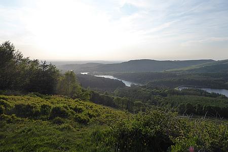 |
|
Looking down from
Nessit Hill |
|
|
 |
|
Heading towards the Hanging Gate Inn |
|
|
|
|
| |
|
| |
|
|
| |
|
|
|
|
Walk 16077 - 08/06/16 - Nessit Hill from Trentabank |
| Area |
Cheshire |
Walking time |
1 hour |
Average speed |
|
| Walk |
Nessit Hill from Trentabank |
Minimum altitude |
|
Maximum altitude |
|
| Start
from |
Trentabank Visitor Centre |
Altitude loss |
|
Altitude gain |
|
| Weather |
Clear
night |
Distance |
2
miles |
|
|
| Map |
Explorer 268 |
Information from
Viewranger app on my Samsung S4 phone |
|
Route Trentabank
Visitor Centre - Nessit Hill - forest paths - Trentabank
Visitor Centre |
|
|
Richard and I did a circular walk around Macclesfield
Forest and over Nessit Hill and back to the start |
|
|
| |
|
|
|
 |
|
Evening sunlight in
the forest |
|
|
| |
|
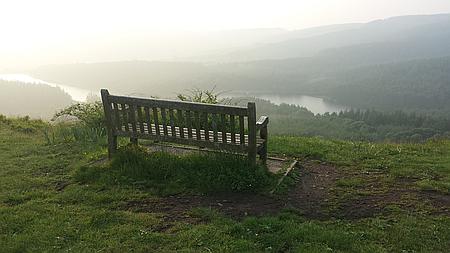 |
|
A bench with a view, a
bit hazy though |
|
|
| |
|
|
|
|
|
|
| |
|
| |
|
|
| |
|
|
|
|
Walk 16078 - 12/06/16 Sorrento
Marina Grande to Priora |
| Area |
Sorrento, Italy |
Walking time |
2
hours |
Average speed |
|
| Walk |
Sorrento Marina Grande to Priora |
Minimum altitude |
|
Maximum altitude |
|
| Start
from |
Marina
Grande |
Altitude loss |
|
Altitude gain |
|
| Weather |
Sunny |
Distance |
3
miles |
|
|
| Map |
|
Information from
Viewranger app on my Samsung S4 phone |
|
Route Marina Grande -
Sant Antonio - Priora - Sant Antonio - Marina Grande |
|
| I
headed up from the Marina Grande Harbour using one the
beautiful small alleyways, once reaching the main road I
crossed and followed the path that headed up the hillside
to the Church of Sant Antonio. From here I followed the
stepped path that zig zags up the hillside, there was a
Shrine at each corner, probably around 20 and I
photographed several on my way up. Once up the hillside I
followed the quiet lane along through the olive groves to
the small village of Priora. After a brief look
round the village I returned the way I had come down the
steps and back to the Marina Grande. |
|
|
 |
|
One of the many
Shrines on the way up the hillside path |
|
|
| |
|
|
| |
|
 |
|
Looking out over
Sorrento from the hillside path |
|
|
 |
|
The
path up the hillside |
| |
|
| |
|
|
| |
|
|
|
|
Walk
16079 - 13/06/16 Sant Agata to Marina Grande |
| Area |
Sorrento, Italy |
Walking time |
2 hours |
Average speed |
|
| Walk |
Sant Agata
to Marina Grande |
Minimum altitude |
|
Maximum altitude |
|
| Start
from |
Sant Agata |
Altitude loss |
|
Altitude gain |
|
| Weather |
Sunny |
Distance |
3 miles |
|
|
| Map |
|
Information from
Viewranger app on my Samsung S4 phone |
|
Route Sant Agata -
Circumpiso - Talagnano - Sant Lucia - Parsano - Marina
Grande |
|
| We
caught the bus from the Main Bus Station to the small town
of Sant Agata. €1:20 for the single trip. After a stroll
around the town and a coffee we set of down a narrow lane
which soon became a track and followed this for several
miles through farmland with many attractive houses that
had recently been renovated. We eventually arrived back to
the main road in Sorrento and back down to the Marian
Grande and the Hotel Admiral where we were staying. |
|
|
| |
|
|
|
|
| |
|
|
| |
|
|
|
|
 |
|
Back
at the Marina Grande |
| |
|
| |
|
|
| |
|
|
|
|
Walk 16080 - 14/06/16 Marina
Grande to Tasso Square and return |
| Area |
Sorrento , Italy |
Walking time |
|
Average speed |
|
| Walk |
Marina
Grande to Tasso Square and return |
Minimum altitude |
|
Maximum altitude |
|
| Start
from |
Marina
Grande |
Altitude loss |
|
Altitude gain |
|
| Weather |
Sunny |
Distance |
2
miles |
|
|
| Map |
|
Information from
Viewranger app on my Samsung S4 phone |
|
Route - Marina Grande
to Tasso Square and return |
|
| A
walk from our Hotel to the Tasso Square for coffee and
lunch and then back via a different route through the
narrow alleyways to the Marina Grande |
|
|
| |
|
|
|
|
| |
|
|
| |
|
|
|
|
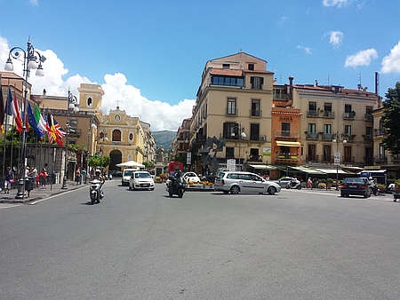 |
|
Tasso Square |
| |
|
| |
|
|
| |
|
|
|
|
Walk
16081 - 15/06/16 Sant Agata to Crapolla |
| Area |
Sorrento Italy |
Walking time |
2
hours |
Average speed |
|
| Walk |
Sant Agata
to Crapolla |
Minimum altitude |
|
Maximum altitude |
|
| Start
from |
Sant
Agata |
Altitude loss |
|
Altitude gain |
|
| Weather |
Sunny |
Distance |
3
miles |
|
|
| Map |
|
Information from
Viewranger app on my Samsung S4 phone |
|
Route |
|
| After
a bus journey from Sorrento to Sant Agata four of us set
off from the town along a quite lane heading for Marina di
Crapolla on the coast, once at the end of the lane the
path became overgrown and we eventually arrived at the two
bridges which were indicated on the map, the guide book
said turn left and immediately left again, the good path
soon deteriorated to a difficult traverse along the
hillside eventually bringing us out onto the headland
overlooking the sea. Mariana di Crapolla was beneath us.
Unfortunately we were the wrong side of the ravine so we
had to content ourselves with the great views down to the
sea and were not able to visit the Chapel of San Pietro,
an erstwhile Benedictine monastery. As the route had been
quite tiring we decided to head back up the lane and leave
the Chapel visit for another day. Once back to Sant Agata
we caught the regular bus service back to Sorrento and
back down the narrow alleyway to the harbour. |
|
|
| |
|
|
|
|
| |
|
|
|
|
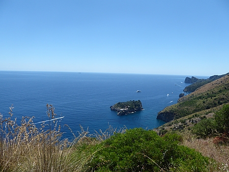 |
|
The
Chapel of San Pietro is down the hillside |
| |
|
| |
|
|
| |
|
|
|
|
Walk
16082 - 16/06/16 Marina Grande to Regina Giovanni |
| Area |
Sorrento, Italy |
Walking time |
2
hours |
Average speed |
|
| Walk |
Marina
Grande to Regina Giovanni |
Minimum altitude |
|
Maximum altitude |
|
| Start
from |
Marina
Grande |
Altitude loss |
|
Altitude gain |
|
| Weather |
Sunny |
Distance |
4
miles |
|
|
| Map |
|
Information from
Viewranger app on my Samsung S4 phone |
|
Route - Marina Grande
- Capi di Sorento - Regina Giovanna and return by same
route |
|
| I set
off from Marina Grande and on reaching the main road
headed towards Capo di Sorrento, the road had mostly no
footpath and one needed to be alert to the traffic, once
at the small village I took the narrow alleyway towards
the sea eventually arriving at Regina Giovanna, the ruins
of a 1st century Roma Villa. It is set on the cliff top
with magnificent views across the Gulf of Naples towards
Vesuvius. After a good look round the ruins I returned
back to Marina Grande using the same route. |
|
|
| |
|
|
|
|
| |
|
|
| |
|
|
|
|
 |
|
Regina
Giovanna ruins on the headland with Vesuvius across the
bay, one can only speculate what was going on when
Vesuvius errupted. |
| |
|
| |
|
|
| |
|
|
|
|
Walk 16083 - 21/06/16
Nessit Hill and Macclesfield Forest |
| Area |
Cheshire |
Walking time |
1 hour |
Average speed |
|
| Walk |
Nessit
Hill and Macclesfield Forest |
Minimum altitude |
|
Maximum altitude |
|
| Start
from |
Trentabank Visitor Centre |
Altitude loss |
|
Altitude gain |
|
| Weather |
Clear
evening |
Distance |
3
miles |
|
|
| Map |
Explorer 268 |
Information from
Viewranger app on my Samsung S4 phone |
|
Route Trentabank -
Macclesfield Forest - Nesstit Hill - Forest paths -
Trentabank. |
|
| Five
of us set off from Trentabank and using forest paths
walked up to the summit of Nessit Hill and returned using
a variety of paths back down to the start at the Visitor
Centre. |
|
|
| |
|
|
|
|
| |
|
|
| |
|
|
|
|
|
|
Route of our walk |
| |
|
| |
|
|
| |
|
|
|
|
Walk
16084 - 22/06/16 Teggs Nose from Langley |
| Area |
Cheshire |
Walking time |
1½
hours |
Average speed |
|
| Walk |
Teggs
Nose from Langley |
Minimum altitude |
|
Maximum altitude |
|
| Start
from |
Teggs
Nose Reservoir, Langley |
Altitude loss |
|
Altitude gain |
|
| Weather |
Clear
evening |
Distance |
3
miles |
|
|
| Map |
Explorer 268 |
Information from
Viewranger app on my Samsung S4 phone |
|
Route - Langley -
Clough House - Teggs Nose Visitor Centre - Teggs Nose
Quarry - Langley |
|
| I set
off from the car park at the foot of Teggs Nose and
followed the track past Clough House and up the Saddlers
Way to the Teggs Nose Visitor Centre. I then followed the
path back through the quarry and back down the hillside to
the car park. |
|
|
 |
|
Bench with a view from
Teggs Nose |
|
|
| |
|
|
| |
|
|
|
|
 |
|
Shutlingloe in the distance from Teggs Nose |
| |
 |
|
Evening sunlight on the hills from Teggs Nose |
|
|
| |
|
| |
|
|
| |
|
|
|
|
Walk
16085 - 25/06/16 Pickmere and Great Budworth |
| Area |
Cheshire |
Walking time |
4
hours |
Average speed |
|
| Walk |
Pickmere and Great Budworth |
Minimum altitude |
|
Maximum altitude |
|
| Start
from |
Pickmere |
Altitude loss |
|
Altitude gain |
|
| Weather |
Sunny
periods |
Distance |
8
miles |
|
|
| Map |
|
Information from
Viewranger app on my Samsung S4 phone |
|
Route - Pickmere -
Gravestone Farm - Willow Lodge - Back Lane - Arley - Morth
Cheshire Way - Great Budworth - Pickmere |
|
| I set
off from Pickmere on a reconnaissance for a future club
walk, after leaving the village I followed the field paths
past Gravestones Farm and around Arley Park. I then
followed the North Cheshire Way back towards Great
Budworth stopping off for Ice Cream at the Farm on the
outskirts of Great Budworth, In the village I stopped to
look round the magnificent Church with parts dating from
the 14th Century. More field paths brought me past
Pickmere Lake and back to the start. |
|
|
| |
|
|
|
|
| |
|
|
| |
|
|
|
|
 |
|
Great Budworth |
| |
|
| |
|
|
| |
|
|
|
|
Walk
16086 - 26/06/16 Youlgreave and Lathkill Dale with
Macclesfield Ramblers |
| Area |
Peak
District |
Walking time |
Sunny
periods |
Average speed |
|
| Walk |
Youlgreave and Lathkill Dale with Macclesfield
Ramblers |
Minimum altitude |
|
Maximum altitude |
|
| Start
from |
Youlgreave |
Altitude loss |
|
Altitude gain |
|
| Weather |
Sunny
periods |
Distance |
8
miles |
|
|
| Map |
Ordnance Survey The Peak District OL24 |
Information from
Viewranger app on my Samsung S4 phone |
|
Route Youlgreave
- Conkesbury Bridge - Meadow Place Grange - Bradford Dale
- Gratton Grange Farm - Mawstone Farm - Youlgreave |
|
| Seven
of us set off from Youlgreave to Conkesbury Bridge on the
River Lathkill, we followed the river westwards and then
ascended the hillside and across the fields past Meadow
Place Grange to Middleton. After a lunch break by the
River Bradford we past Gratton Grange Farm and Mawstone
Farm and then back into Youlgreave. A great walk with
Doreen, Kati, Peter, Janet, Wendy and John. |
|
|
| |
|
|
|
|
| |
|
|
| |
|
|
|
|
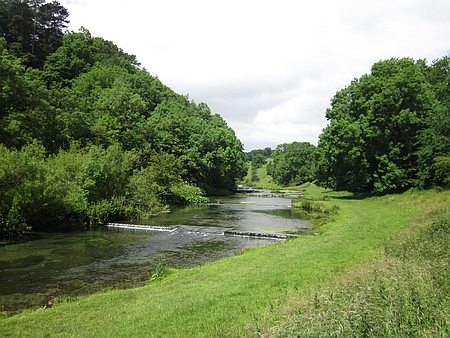 |
|
Walking alongside the River Lathkill |
| |
|
| |
|
|
| |
|
|
|
|
Walk 16087 - 28/06/16 Nessit Hill and Macclesfield Forest |
| Area |
Cheshire |
Walking time |
1 hour |
Average speed |
|
| Walk |
Nessit
Hill and Macclesfield Forest |
Minimum altitude |
|
Maximum altitude |
|
| Start
from |
Trentabank Visitor Centre |
Altitude loss |
|
Altitude gain |
|
| Weather |
Overcast |
Distance |
2
miles |
|
|
| Map |
Explorer 268 |
Information from
Viewranger app on my Samsung S4 phone |
|
Route Trentabank -
Nessit Hill - Macclesfield Forest - Trentabank |
|
| I set
off with Barry and John for our regular evening walk
around Macclesfield Forest climbing to the summit of
Nessit Hill and then back through the forest to the start. |
|
|
| |
|
|
|
|
| |
|
|
| |
|
|
|
|
|
|
Map
of our route |
| |
|
| |
|
|
| |
|
|
|
|
Walk
16088 - 03/07/16 Pickmere and Great Budworth with Broken Cross
Walkers |
| Area |
Cheshire |
Walking time |
4
hours |
Average speed |
|
| Walk |
Pickmere and Great Budworth with Broken Cross Walkers |
Minimum altitude |
|
Maximum altitude |
|
| Start
from |
Pickmere |
Altitude loss |
|
Altitude gain |
|
| Weather |
Sunny
periods |
Distance |
7
miles |
|
|
| Map |
|
Information from
Viewranger app on my Samsung S4 phone |
|
Route Pickmere -
Gravestone Farm - Willow Lodge - Back Lane - Arley - Morth
Cheshire Way - Great Budworth - Pickmere |
|
|
Twelve of us set off from Pickmere across the fields to
Gravestones Farm and then through Arley Park to join the
North Cheshire Way, we followed this south towards Great
Budworth stopping for Ice Cream at Great Budworth Tea Room
and Ice Cream Farm. Once at Great Budworth we took
time to look around this charming village and its
beautiful Church with parts dating from the 14th Century.
More field paths then took us past Pickmere Lake and back
to the start in Pickmere Village where we finished the
afternoon walk with tea and cakes while listening to the
Village Choir on the Lakeside. A great walk and thanks to
Christine, Alec, Carol, Chris R, Wendy, Hans, Maurenn ,
Derek, Doreen, Pat and Dave for joining me. |
|
|
 |
|
Broken Cross Walkers
by Pickmere Lake |
|
|
 |
|
We were entertained by
a Choir at Pickmere who were raising money for Church
Funds. Excellent singers |
| |
|
 |
|
Plenty of horses on
the lane near Arley Hall |
|
|
 |
|
Zooming in on Great Budworth Church on the far side of
Pickmere |
|
|
|
|
| |
|
| |
|
|
| |
|
|
|
|
Walk
16089 - 04/07/16 Nessit Hill and Macclesfield Forest |
| Area |
Cheshire |
Walking time |
1 hour |
Average speed |
|
| Walk |
Nessit
Hill and Macclesfield Forest |
Minimum altitude |
|
Maximum altitude |
|
| Start
from |
Trentabank |
Altitude loss |
|
Altitude gain |
|
| Weather |
Clear
evening |
Distance |
2
miles |
|
|
| Map |
Explorer 268 |
Information from
Viewranger app on my Samsung S4 phone |
|
Route Trentabank -
Nessit Hill - Macclesfield Forest - Trentabank |
|
|
.Four of us myself, Richard, Kevin and John set off from
Trentabank and walked up through the forest to Nessit
Hill and back through the forest to our start at the
Trentabank Visitor Centre. |
|
|
| |
|
|
|
|
| |
|
|
| |
|
|
|
|
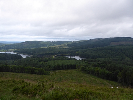 |
|
Looking down from Nessit Hill |
| |
|
| |
|
|
| |
|
|
|
|
Walk 16090 - 08/07/16
Coombe Door Top from Stonethwaite with the MaccPackers |
| Area |
Lake
District |
Walking time |
4
hours |
Average speed |
|
| Walk |
Coombe
Door Top from Stonethwaite with the MaccPackers |
Minimum altitude |
|
Maximum altitude |
|
| Start
from |
Chapel
House Farm Campsite, Stonethwaite |
Altitude loss |
|
Altitude gain |
|
| Weather |
Sunny
periods |
Distance |
6
miles |
|
|
| Map |
Ordnance Survey OL4 The English Lakes North West Area |
Information from
Viewranger app on my Samsung S4 phone |
|
Route Stonethwaite -
Bessy Boot - Tarn at Leaves - Rosthwaite Fell - Coome Door
Top and return by same route |
|
|
Myself, Richard and Alan set off from the campsite and
followed the path up to Bessy Boot and Tarn at Leaves. We
ate our lunch in a sheltered spot and the carried on to
the summit of Coombe Door Top which is one of the Nuttalls
summits that I was keen to climb, on the way down Richard
discovered his camera was missing and we spent quite a
while retracing our exact route but unfortunately were
unable to find it. We returned back to the campsite using
the same route. |
|
|
 |
|
Looking down on
Borrowdale as we climb up to Bessyboot |
|
|
 |
|
Looking across to
Glaramara |
| |
|
|
|
|
 |
|
Its
a good campsite at Chapel House Farm in Borrowdale |
| |
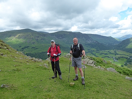 |
|
Alan
and Richard with Borrowdale behind |
|
|
| |
|
| |
|
|
| |
|
|
|
|
Walk
16091 - 09/07/16 Seathwaite and Esk Hause with the
MaccPackers |
| Area |
Lake
District |
Walking time |
8
hours |
Average speed |
|
| Walk |
Seathwaite and Esk Hause with the MaccPackers |
Minimum altitude |
|
Maximum altitude |
|
| Start
from |
Seathwaite |
Altitude loss |
|
Altitude gain |
|
| Weather |
Rain |
Distance |
10
miles |
|
|
| Map |
Ordnance Survey OL6 The English Lakes South West Area |
Information from
Viewranger app on my Samsung S4 phone |
|
Route Seathwaite -
Stockley Bridge - Grains Gill - Esk Hause - Angle Tarn -
Angle Tarn Gill - Langstrath - Stonethwaite |
|
| Five
of us myself, Richard, Kevin, Alan and John set off from
Seathwaite on a rather damp morning, it was showery with
gusting wind and our objective was Great End. We followed
the path past Stockley Bridge and up Grains Gill, as we
neared Esk Hause the weather continued to deteriorate and
we decided to head back using the path down Langstrath. We
continued on to Angle Tarn and then descended alongside
Angle Tarn Beck into Langstrath. All the streams were in
spate and we experienced great difficulty crossing some of
them especially Angle Tarn Beck and I slipped and just
prevented myself from falling in and being swept away in
the torrent. Unfortunately I dropped one of my walking
poles and it disappeared into the raging stream. Once
across we followed the rugged path back to our campsite at
Chapel House farm at Stonethwaite. An enjoyable day
despite the weather but definitely one of the wettest days
we have had for a long time. |
|
|
| |
|
|
|
|
| |
|
|
| |
|
|
|
|
 |
|
A rather rainy morning as we set off for
Great End |
| |
|
| |
|
|
| |
|
|
|
|
Walk 16092- 11/07/16 Nessit Hill and
Macclesfield Forest |
| Area |
Cheshire |
Walking time |
1 hour |
Average speed |
|
| Walk |
Nessit
Hill and Macclesfield Forest |
Minimum altitude |
|
Maximum altitude |
|
| Start
from |
Trentabank |
Altitude loss |
|
Altitude gain |
|
| Weather |
Clear
evening |
Distance |
2
miles |
|
|
| Map |
Explorer 268 |
Information from
Viewranger app on my Samsung S4 phone |
|
Route Trentabank -
Nessit Hill - Macclesfield Forest - Trentabank |
|
|
Four of us myself, Richard, Kevin and John set off from Trentabank and walked up through the forest to Nessit
Hill and back through the forest to our start at the
Trentabank Visitor Centre. |
|
|
| |
|
|
|
|
| |
|
|
| |
|
|
|
|
|
|
Map
of our route |
| |
|
| |
|
|
| |
|
|
|
|
Walk
16093 - 14/07/16 Nessit Hill and Macclesfield Forest |
| Area |
Cheshire |
Walking time |
1 hour |
Average speed |
|
| Walk |
Nessit
Hill and Macclesfield Forest |
Minimum altitude |
|
Maximum altitude |
|
| Start
from |
Trentabank Visitor Centre |
Altitude loss |
|
Altitude gain |
|
| Weather |
Dry,
clear evening |
Distance |
2.25
miles |
|
|
| Map |
Explorer 268 |
Information from
Viewranger app on my Samsung S4 phone |
|
Route Trentabank
Visitor Centre - Forest paths - Nessit Hill - Forest paths
- Trentabank Visitor Centre |
|
|
Richard and I set off from Trentabank and walked up through the forest to Nessit
Hill and back through the forest to our start at the
Trentabank Visitor Centre. |
|
|
| |
|
|
|
|
| |
|
|
| |
|
|
|
|
|
|
Map
of our route |
| |
|
| |
|
|
| |
|
|
|
|
Walk 16094 - 17/07/16 Macclesfield Forest and Piggford Moor
with Broken Cross Walkers |
| Area |
Cheshire |
Walking time |
3
hours |
Average speed |
|
| Walk |
Macclesfield Forest and Piggford Moor
with Broken Cross Walkers |
Minimum altitude |
|
Maximum altitude |
|
| Start
from |
Langley |
Altitude loss |
|
Altitude gain |
|
| Weather |
Sunny
periods |
Distance |
7
miles |
|
|
| Map |
Explorer 268 |
Information from
Viewranger app on my Samsung S4 phone |
|
Route Langley -
Macclesfield Forest - Piggford Moor - Greenway Bridge -
Hanging Gate Inn - Macclesfield Forest - Langley |
|
| Six
of us set off from the Leathers Smithy and walked
alongside Ridgegate Reservoir and up through Macclesfield
Forest, we crossed Piggford Moor an important wildlife
area and the descended to Greenway Bridge where we stopped
for lunch. Afterwards we walked up Oaken Clough and across
the moor to the Hanging Gate where we stopped for
refreshments with outstanding views across the valley.
Suitably refreshed we carried on along the lane and down
through the forest to the Leathers Smithy.
Thanks to Christine,
Doreen, Kati, Chris J and Alec for joining me on the walk
and also to Chris and Alec for the wildlife information.
|
|
|
 |
|
Lunch near Greenway
Bridge |
|
|
| |
|
|
| |
|
 |
|
Shutlingsloe in the
distance |
|
|
 |
|
Ridgegate Reservoir |
|
|
|
|
| |
|
| |
|
|
| |
|
|
|
|
Walk
16095 - 18/07/16 - Nessit Hill and Macclesfield
Forest |
| Area |
Cheshire |
Walking time |
1 hour |
Average speed |
|
| Walk |
Nessit
Hill and Macclesfield Forest |
Minimum altitude |
|
Maximum altitude |
|
| Start
from |
Trentabank Visitor Centre |
Altitude loss |
|
Altitude gain |
|
| Weather |
Dry |
Distance |
2.25
miles |
|
|
| Map |
Explorer 268 |
Information from
Viewranger app on my Samsung S4 phone |
|
Route Trentabank
Visitor Centre - Forest paths - Nessit Hill - Forest paths
- Trentabank Visitor Centre |
|
|
Richard, John and I set off from Trentabank and walked up through the forest to Nessit
Hill and back through the forest to our start at the
Trentabank Visitor Centre. Very warm with the temperature
touching 25c in the evening. |
|
|
| |
|
|
|
|
| |
|
|
| |
|
|
|
|
|
|
Map
of our route |
| |
|
| |
|
|
| |
|
|
|
|
Walk 16096 - 24/07/16 -
Rosthwaite to Grange via Castle Crag |
| Area |
Lake
District |
Walking time |
|
Average speed |
|
| Walk |
Rosthwaite
to Grange via Castle Crag |
Minimum altitude |
|
Maximum altitude |
|
| Start
from |
Rosthwaite |
Altitude loss |
|
Altitude gain |
|
| Weather |
Sunshine and showers |
Distance |
3
miles |
|
|
| Map |
|
Information from
Viewranger app on my Samsung S4 phone |
|
Route - Rosthwaite -
Cumbria Way - Castle Crag - Broadslack Gill - Cumbria Way
- Grange |
|
| Chris
and I caught the bus from Keswick to Rosthwaite and
followed the footpath alongside the River Derwent and then
up the hillside to the summit of Castle Crag, superb views
all round. After eating our lunch we descended down
Broadslack Gill and onto the Cumbria Way which took us
into Grange to catch the bus back to Keswick. A superb
short walk. |
|
|
 |
|
Another view along
Borrowdale |
|
|
| |
| |
| |
| |
| |
| |
| |
|
|
| |
|
 |
|
Looking towards Castle
Crag from Rosthwaite |
|
|
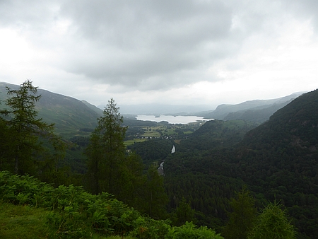 |
|
Looking towards Derwentwater from Castle Crag |
|
|
|
| |
|
|
| |
|
|
|
|
Walk 16097 25/07/16
Macclesfield Forest and Nessit Hill |
| Area |
Cheshire |
Walking time |
1 hour |
Average speed |
|
| Walk |
Macclesfield
Forest and Nessit Hill |
Minimum altitude |
|
Maximum altitude |
|
| Start
from |
Trentabank Visitor Centre |
Altitude loss |
|
Altitude gain |
|
| Weather |
Clear
evening |
Distance |
2.25
miles |
|
|
| Map |
Explorer 268 |
Information from
Viewranger app on my Samsung S4 phone |
|
Route - Trentabank
Visitor Centre - Forest paths - Nessit Hill - Forest paths
- Trentabank Visitor Centre |
|
|
Myself, Barry and John set off from Trentabank and walked up through the forest to Nessit
Hill and back through the forest to our start point at the Trentabank Visitor Centre. |
|
|
| |
|
|
|
|
| |
|
|
| |
|
|
|
|
|
|
Map
of our route |
| |
|
| |
|
|
| |
|
|
|
|
Walk 16098 - 29/07/16 - Mam Tor, Lose Hill and
Castleton |
| Area |
Peak
District |
Walking time |
4
hours |
Average speed |
|
| Walk |
Mam
Tor, Lose Hill and Castleton |
Minimum altitude |
|
Maximum altitude |
|
| Start
from |
Treak
Cliff Cavern |
Altitude loss |
|
Altitude gain |
|
| Weather |
Sunshine and showers |
Distance |
8
miles |
|
|
| Map |
|
Information from
Viewranger app on my Samsung S4 phone |
|
Route - Treak Cliff
Cavern - Mam Tor - Hollins Cross - Back Tor - Lose Hill -
Hope - Castleton - Treak Cliff Cavern |
|
| After
parking at the roadside by Treak Cliff Cavern I climbed to
the top of Mam Tor and then followed the ridge along and
over Hollins Cross and Back Tor and then up to the summit
of Lose Hill, I found some shelter from the wind on the
east side of the top and then descended down into Hope and
then along the riverside path back into Castleton. An easy
walk along the road brought me back to my car near the
Treak Cliff Cavern. |
|
|
 |
|
Back Tor |
|
|
| |
|
|
| |
|
 |
|
Looking along the
ridge from Mam Tor towards Lose Hill with a rain shower
passing over |
|
|
 |
|
Looking down into Edale |
|
|
|
|
| |
|
| |
|
|
| |
|
|
|
|
Walk
16099 - 31/07/16 Rushton Spencer and Bosley Cloud |
| Area |
Staffordshire |
Walking time |
4
hours |
Average speed |
|
| Walk |
Rushton Spencer and Bosley Cloud |
Minimum altitude |
|
Maximum altitude |
|
| Start
from |
Rushton Spencer |
Altitude loss |
|
Altitude gain |
|
| Weather |
Sunny
periods |
Distance |
7
miles |
|
|
| Map |
Explorer 268 |
Information from
Viewranger app on my Samsung S4 phone |
|
Route - Rushton
Spencer - Staffordshire Way - Gritstone Trail - Bosley
Cloud - Bridestones - Woodhouse Green - Rushton Spencer |
|
|
Eleven of us set off on a lovely sunny day along the
Staffordshire Way, we then headed south along the
Gritstone Trail with a steep uphill section onto the
summit of Bosley Cloud where we stopped for lunch. The
views were outstanding towards the Peak District,
Manchester, the Wirral and the Welsh Hills. Afterwards we
headed through the woods and across to the Bridestones,
originally a Neolithic Chambered Cairn. We then followed
the lane to Woodhouse Green and then back across the
fields to Rushton Spencer |
|
Thanks to Christine,
Doreen, Carol, Maureen, Derek, Ruth, Ray, Sue, Wendy
and Chris R for joining me on this walk. |
| |
 |
|
On the summit of
Bosley Cloud |
| |
 |
|
Heading back to
Rushton Spencer |
| |
|
All about the Bridestones on Wikipedia |
| |
|
 |
|
Heading up to Bosley
Cloud |
|
|
 |
|
Looking across to Croker Hill from Bosley Cloud. A
magnificent view. |
|
|
|
|
| |
|
| |
|
|
| |
|
|
|
|
Walk
16100 - 03/08/16 Nessit Hill and Macclesfield Forest |
| Area |
Cheshire |
Walking time |
1 hour |
Average speed |
|
| Walk |
Nessit
Hill and Macclesfield Forest |
Minimum altitude |
|
Maximum altitude |
|
| Start
from |
Trentabank Visitor Centre |
Altitude loss |
|
Altitude gain |
|
| Weather |
Sunny
evening |
Distance |
2
.25 miles |
|
|
| Map |
Explorer 268 |
Information from
Viewranger app on my Samsung S4 phone |
|
Route Trentabank -
Nessit Hill - Macclesfield Forest paths - Trentabank |
|
|
Richard and I set off from Trentabank Visitor Centre on
our usual eveing walk which takes us up onto the top of
Nessit Hill and back through the forest to the start. |
|
|
| |
|
|
|
|
| |
|
|
| |
|
|
|
|
|
|
Map
of our route |
| |
|
| |
|
|
| |
|
|
|
|
Walk 16101 - 07/08/16 Timbersbrook with Macclesfield Ramblers |
| Area |
Staffordshire |
Walking time |
|
Average speed |
|
| Walk |
Timbersbrook
with Macclesfield Ramblers |
Minimum altitude |
|
Maximum altitude |
|
| Start
from |
Timbersbrook |
Altitude loss |
|
Altitude gain |
|
| Weather |
Sunny
periods |
Distance |
|
|
|
| Map |
|
Information from
Viewranger app on my Samsung S4 phone |
|
Route -
Timbersbrook - Gritstone Trail - Dane in Shaw - Canal
towpath - Timbersbrook |
|
| Nine
of us from Macclesfield Ramblers set off from Timbersbrook
along the Gritstone Trail and through Dane in Shaw and
onto the canal towpath where we stopped for lunch.
Afterwards we carried on along the towpath and back across
the fields to Timbersbrook. We stopped for
afterwards at the nearby Coach and Horses Inn for
refreshments before setting off for home. |
|
|
 |
|
The railway viaduct
near Dane in Shaw |
|
|
| |
|
|
| |
|
 |
|
Looking back towards
Bosley Cloud |
|
|
 |
|
Looking down on Dane in Shaw Brook |
|
|
|
| |
|
|
| |
|
|
|
|
Walk
16102 - 12/08/16 Blairgowrie to Easter Dalnabreck |
| Area |
Perthshire |
Walking time |
5½
hours |
Average speed |
|
| Walk |
Blairgowrie to Easter Dalnabreck |
Minimum altitude |
|
Maximum altitude |
|
| Start
from |
Blairgowrie |
Altitude loss |
|
Altitude gain |
2153
ft |
| Weather |
Overcast and showers in the evening |
Distance |
12.2
miles |
|
|
| Map |
|
Information from Viewranger app on my Samsung S7 phone |
|
Route - Blairgowrie -
West Gormack - Bridge of Cally - Blackcraig - Easter
Dalnabreck (grid ref NO092 549) |
|
| My
day started early as I left Macclesfield at 05.00am for
the 295 mile drive to Blairgowrie. I parked on Back Brae
car park which is free and made a phone call from the
local unmanned Police Station to their office informing
them where I was parking my car and giving them my contact
details, route and expected time of my return. This was
the advice given to me by the Tourist Office in
Blairgowrie. I set off and followed the Trail alongside
the river and then along some farm tracks past West
Gormack and across the moor to Bridge of Cally, I had
walked 6 miles and was making good progress so I stopped
for a shandy in the Hotel and then set off along the trail
past Blackcraig Forest with the intention of camping near
Blackcraig Castle ruins. The weather was clouding over
with a slight drizzle so I quickly found a camp spot in
the woods near Easter Dalnabreck (grid ref NO092 549). I
cooked my meal in the tent as the rain came down and it
continued most of the night. I slept well after my rather
busy day. |
|
|
 |
|
Heading up the farm
road towards East Gormack |
|
|
 |
|
Plenty of deer around
this area in the fields |
| |
 |
|
My tent next morning
after a rainy night |
| |
|
 |
|
River Ericht in
Blairgowrie |
|
|
 |
|
Further along heading towards West Gormack |
|
|
 |
|
Near
Blackcraig castle ruins |
|
| |
|
|
| |
|
|
|
|
|
|
|
|
Walk 16103 - Cateran Trail - Easter Dalnabreck to Glenshee
Lodge Outdoor Centre (grid ref NO134 685) |
| Area |
Perthshire |
Walking time |
7 hours |
Average speed |
|
| Walk |
Easter
Dalnabreck to Glenshee Lodge Outdoor Centre
(grid ref NO134
685) |
Minimum altitude |
|
Maximum altitude |
|
| Start
from |
Easter
Dalnabreck |
Altitude loss |
|
Altitude gain |
2705ft |
| Weather |
Sunny
periods |
Distance |
16
miles |
|
|
| Map |
OS
Glen Shee and Braemar OL52 |
Information from
Viewranger app on my Samsung S7 phone |
|
Route- Easter Dalnabreck - Kirkmichael - Enochdhu - Upper Lunch Hut -
Spittall of Glenshee - Runavey - Glenmore Lodge |
|
| After
an early breakfast I packed up and headed along the
hillside, the weather had improved considerably with
patches of blue sky and occasional sunshine. In
Kirkmichael I stopped at the village Cafe for a very
welcome pot of tea and a bacon barm cake. Once refreshed I
headed along the hillside again and down to the small
village of Enochdhu. After crossing the road I followed
the track upwards past several farms and eventually out
into open moorland, the path climbed higher into the hills
and I eventually arrived at the Upper Lunch Hut where I
stopped for my lunch. At the Hut I met two charming young
French ladies Paloma and Florence from Strasbourg. They
were also walking the Cateran Trail and I was to meet them
occasionally on the rest of the walk. After lunch I
carried on up the hillside and over the pass of An Lairig.
There were some great views and I then descended down into
the valley eventually reaching the Spittal of Glenshee.
Unfortunately the Hotel has burnt down and at the moment
there do not seem to be any plans to rebuild it. This is a
shame as refreshment opportunities are not available in
the area at the moment. I filtered some water ready for my
evening meal and then carried on along the trail looking
for somewhere to camp. I had been advised by the Tourist
Office that wild camping is allowed but certain guidelines
apply such as "leave nothing but footprints and stay away
from habitation" there were quite a few remote fields and
wild land but also quite a few cows around and the
last thing I want is to be trodden on in the night. About
2½ miles from the Spittal of Glenshee I passed around the
back of the Compass Christian Centre at Glenshee Lodge,
just over the fence away from the cows there was a nicely
mown patch of grass, a passing volunteer from the centre
said it was OK to camp as I was well away from the
buildings so my tent was up in a few minutes and tea was
soon on. A short time later Paloma and Florence arrived
and did likewise. I slept well that night. |
|
|
 |
|
Heading through
Calamanack Wood |
|
|
 |
| Open
country ahead heading towards the Upper Lunch Hut |
| |
 |
|
Looking down on the
Spittal of Glenshee |
| |
| |
|
|
|
|
 |
|
Heading for Kirkmichael |
| |
 |
|
Heading along what looks like an old drovers road |
 |
|
Upper Lunch Hut |
| |
 |
|
River Ardle |
| |
| |
| |
|
| |
|
|
| |
|
|
|
|
Walk
16104 - 14/08/16 Glenshee Outdoor Centre to Kirton of Glenisla |
| Area |
Perthshire |
Walking time |
6½
hours |
Average speed |
|
| Walk |
Glenshee
Outdoor Centre to Kirton of Glenisla |
Minimum altitude |
|
Maximum altitude |
|
| Start
from |
Glenshee Outdoor Centre (grid ref NO 214 603 |
Altitude loss |
|
Altitude gain |
1555ft |
| Weather |
Sunny
periods |
Distance |
12.7
miles |
|
|
| Map |
OS
Glen Shee and Braemar OL52 |
Information from
Viewranger app on my Samsung S7 phone |
|
Route - Outdoor Centre -
Loch Beanie - Glen Beanie - Dalvanie - Bridge of Forter -
Auchintaple Loch - Loch Shandra - Kirton of Glenisla |
|
| After
an early start I set off using one of the alternatives in
the guide book, this was to take me up into the hills on a
more remote path. I followed the track eastwards and
steadily upwards to Loch Beanie, quite dry underfoot until
I reached the Loch and the path petered out by the Boat
House. It was then a case of trying to avoid the bogs but
for over a mile I struggled through tussock grass, reeds
and boggy ground until I reached a fence. I followed this
up to the Col and then after crossing the Allt Mor burn
there was more bog and tussock grass until I eventually
picked up a faint vehicle trail which made the walking
easier. I eventually reached Dalvanie and a tarmac road
took me to the Bridge of Forter. A hillside path took me
back up onto the moorland and around Auchintaple Loch
where I stopped for lunch. The track I was on now
continued past Loch Shandra and eventually into Kirton of
Glenisla. A pint of shandy saw me nicely refreshed and I
enquired if there were any suitable places to camp, I was
told that the Village Hall just down the road were quite
relaxed about camping provided you were discrete. I
wandered off down to investigate only to find some sort of
Fete taking place and quite a few families enjoying
themselves. It was ideal but common sense decreed that it
would be a good idea to wait till they had all gone home so
I found a sunny spot and had a doze until everyone had
gone home. I pitched my tent in the far corner near the
river and cooked my evening meal. Paloma and Florence
arrived later and as they had already eaten at the Hotel
they retired early. I wandered off up to the Hotel and
enjoyed a pleasant evening with a few beers. |
|
|
 |
|
Loch Beanie |
|
|
 |
|
Once over the Col as
you head down Glen Beanie you eventually pick up a faint
vehicle track which improves as you go along |
|
|
|
 |
|
Auchintaple Loch,
ideal spot for lunch |
| |
| |
 |
|
Heading for Loch
Shandra |
| |
 |
|
The River Isla near my
camp in Kirton of Glenisla |
| |
|
|
|
| |
|
|
|
|
Walk
16105 - 15/08/16 Kirton of Glenisla to Alyth |
| Area |
Perthshire, Scotland |
Walking time |
|
Average speed |
|
| Walk |
Kirton
of Glenisla to Alyth |
Minimum altitude |
|
Maximum altitude |
|
| Start
from |
Kirton of Glenisla (grid ref NO 247 476 |
Altitude loss |
|
Altitude gain |
1719ft |
| Weather |
Sunny |
Distance |
12.3 miles |
|
|
| Map |
|
Information from
Viewranger app on my Samsung S7 phone |
|
Route Kirton of
Glenisla - Whitehill Wood - Glen Isla - Knaptam Hill -
Hill of Alyth - Alyth |
|
| A
misty morning with a heavy dew turned into a lovely sunny
day and I set off up the hillside stopping to look at the
Hut Circles on the hilltop, a good track took me along the
hillside passing isolated farms and houses, I had lunch at
Knaptam Hill with some great views across the valley.
After passing Ardormie I followed the lane east and then
south onto the track that led over the shoulder of Hill of
Alyth and down into the town of Alyth. I followed the road
through the town to the Five Roads Caravan Park which has
facilities for tents. The short mown grass and hot showers
were very welcome after my wild camps of the
previous days. A great site with a pub at the entrance.
Paloma and Florence arrived later in the afternoon. |
|
|
 |
|
Looking down on Kirton
of Glenisla |
| |
 |
|
Paloma and Florence
ahead of me on the Trail |
| |
 |
|
The track leading down
into Alyth |
| |
|
|
|
|
 |
|
My
camp in the corner of the Village playing field |
| |
 |
|
Remains of one of the many hut circles in the area |
| |
 |
|
Great views from the hillside while having lunch |
| |
| |
| |
|
Five
Roads Caravan Park. Alyth |
| |
| |
| |
| |
| |
| |
| |
| |
| |
|
|
|
| |
|
|
| |
|
|
|
|
Walk
16106 - 16/08/16 Alyth to Blairgowrie |
| Area |
Perthshire, Scotland |
Walking time |
8
hours |
Average speed |
|
| Walk |
Alyth to Blairgowrie |
Minimum altitude |
|
Maximum altitude |
|
| Start
from |
Alyth
|
Altitude loss |
|
Altitude gain |
2619ft |
| Weather |
Sunny |
Distance |
18.2
miles |
|
|
| Map |
|
Information from
Viewranger app on my Samsung S7 phone |
|
Route Alyth - Hill of
Alyth - Mains of Creuchies - Burnside of Drimmie - Bridge
of Cally - West Gormack - Blairgowrie |
|
| My
route today took me back up over the shoulder of Hill of
Alyth and along the ridge back to the Bridge of Cally,
there are various alternative routes on the Cateran Trail
but I chose to follow the main route from the guidebook.
Paloma and Florence chose a more direct route back to
Blairgowrie as they had a bus to catch. My route along the
ridge was long with quite a bit of road walking was tiring
on the feet. Once at the Burnside of Drimmie the trail
continued as field path with high hedges either side, it
became increasingly overgrown and for about a mile I
battled my way through the long grass, nettles and
thistles. The high hedges either side obscured any views
across the valley. It was with relief that I reached The
Braes and was back on the lane which I followed to Bridge
of Cally and a pint of shandy at the Hotel. Once refreshed
I set off on the path back to Blairgowrie arriving there
just after 5.00pm This was a really long day and hindsight
tells me I should have split the day into two but there
are no official camp sites that take tents on the stretch
and suitable wild camping spots were difficult to locate.
Once in the town I collected my car and drove across town
to the only Campsite I was able to find. The site was on
the edge of town but provided the basic facilities that I
needed. |
|
I recorded my walk on
Viewranger and the distance was 71.4 miles with a height
gain of 10751 ft. A really great walk and another one off
my list. |
| |
|
|
 |
|
Beautiful countryside |
|
|
 |
|
Nearly back at
Blairgowrie |
|
|
|
Craidawn Caravan and Campsite
|
|
|
| |
|
 |
|
Morning in Alyth just
before I packed up to leave |
|
|
 |
|
Looking back towards Alyth |
|
|
 |
|
Heading towards Bridge of Cally |
|
|
|
|
|
|
|
Walk
16107 - 21/08/16 - New Mills and Hayfield with
Macclesfield Ramblers |
| Area |
High Peak |
Walking time |
3
hours |
Average speed |
|
| Walk |
New
Mills and Hayfield with Macclesfield Ramblers |
Minimum altitude |
|
Maximum altitude |
|
| Start
from |
New Mills |
Altitude loss |
|
Altitude gain |
|
| Weather |
Sunny periods |
Distance |
7 miles |
|
|
| Map |
|
Information from
Viewranger app on my Samsung S7 phone |
|
Route New Mills -
Beardhall Farm - Brownhills Farm - Moor Lodge - Hayfield -
Sett Valley Trail - New Mills |
|
| Nine
of us set off from New Mills along the Goyt Way and then
up the hillside past Beardhall Farm and Brownhill Farm.
This took us up onto moorland which gave us great
views over the surrounding hills and valleys. Once past
the TV mast we descended down the track stopping for lunch
in a a sheltered place as although it was dry it was a
little breezy. Afterwards we carried on down into Hayfield
and then onto the Sett Valley Trail which we followed back
to New Mills. After the walk we stopped for tea and coffee
in the Heritage Centre before setting off for home. |
|
|
 |
|
Heading back along the
Sett Valley Trail |
|
|
|
|
|
|
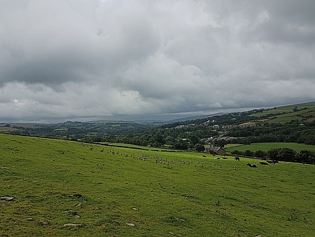 |
|
Looking south as we climbed the hillside to
Brownhill Farm |
| |
|
|
|
|
|
|
| |
|
| |
|
|
| |
|
|
|
|
Walk
16108 - 22/08/16 - Nessit Hill and Macclesfield Forest |
| Area |
Cheshire |
Walking time |
1 hour |
Average speed |
|
| Walk |
Nessit Hill and Macclesfield Forest |
Minimum altitude |
|
Maximum altitude |
|
| Start
from |
Trentabank |
Altitude loss |
|
Altitude gain |
|
| Weather |
Clear night |
Distance |
2.25 miles |
|
|
| Map |
Explorer 268 |
Information from
Viewranger app on my Samsung S4 phone |
|
Route - Trentabank
Visitor Centre - Forest paths - Nessit Hill - Forest paths
- Trentabank Visitor Centre |
|
| Four
of us set off on our regular evening walk in Macclesfield
Forest. Our route takes us from Trentabank Visitor Centre
up through the forest and then onto the summit of Nessit
Hill. We then follow the track down to lane and back along
the forest path the the Visitor Centre |
|
|
| |
|
|
|
|
| |
|
|
| |
|
|
|
|
|
|
Map
of our route |
| |
|
| |
|
|
| |
|
|
|
|
Walk 16109 - 24/08/16 - Piggford Moor and Macclesfield Forest |
| Area |
Cheshire |
Walking time |
1 hour |
Average speed |
|
| Walk |
Piggford
Moor and Macclesfield Forest |
Minimum altitude |
|
Maximum altitude |
|
| Start
from |
Trentabank Visitor Centre |
Altitude loss |
|
Altitude gain |
|
| Weather |
Clear night |
Distance |
2.5 miles |
|
|
| Map |
Explorer 268 |
Information from
Viewranger app on my Samsung S4 phone |
|
Route - Trentabank
Visitor Centre - Forest paths - Piggford Moor - Forest
paths - Trentabank Visitor Centre |
|
|
Richard and I set off from the Visitor Centre and walked
up through the forest and onto Piggford Moor and then
returned back though the forest to the Visitor Centre |
|
|
|
The nights are closing
in and we will be needing our head torches soon. |
|
|
|
|
| |
|
|
| |
|
|
 |
|
Heading back down over Piggford Moor |
| |
|
| |
|
|
| |
|
|
|
|
Walk
16110 - 28/08/16 - Langley and Higher Pethills with
Broken Cross Walkers |
| Area |
Cheshire |
Walking time |
3½
hours |
Average speed |
|
| Walk |
Langley
and Higher Pethills with Broken Cross Walkers |
Minimum altitude |
611ft |
Maximum altitude |
1125
ft |
| Start
from |
Langley |
Altitude loss |
|
Altitude gain |
1106
ft |
| Weather |
Sunny |
Distance |
7
miles |
|
|
| Map |
Explorer 268 |
Information from
Viewranger app on my Samsung S4 phone |
|
Route Langley -
Gritstone Traile - Hanging Gate Inn - High Lee - Higher
Pethills Farm - Lowerhouse - Ridge Hill - Langley |
|
|
Fifteen of us set off from the car park by Teggs Nose
Reservoir along the Gritstone Trail, it was overcast and
misty and we followed the Gritstone Trail across the
fields past Greenbarn and up to the Hanging Gate Inn. We
paused for a coffee break and then set off along the
field path with some rather muddy sections and eventually
passed the High Lee Farm and onto Withenshaw Lane. We
walked down the lane and crossed the main road onto the
farm lane which took us down towards Lower Pethills Farm.
We stopped for lunch on the hillside and were pleasantly
surprised as the cloud cleared and the blue skies appeared
giving us some great views over Croker Hill and the
surrounding countryside. After lunch we followed the track
through Higher Pethills Farm and down to Lowerhouse. After
crossing the road we walked up to Ridge Hill and down into
Langley and back to the start. A great walk which started
out a bit misty and ended with glorious sunshine. |
|
Thanks to Christine,
Kati, Doreen, Carol, Ruth, Ray, Maureen, Derek, Pat G,
Rob, Wendy, Hans, Alex and Chris for joining me on this
walk. |
| |
 |
|
Looking up at Croker
Hill |
| |
|
|
| |
|
 |
|
Lunch stop near Higher
Pethills Farm |
|
|
 |
|
Heading up from Lower House towards Langley |
|
|
|
|
| |
|
| |
|
|
| |
|
|
|
|
Walk
16111 30/08/16 - Nessit Hill and Macclesfield Forest |
| Area |
Cheshire |
Walking time |
1 hour |
Average speed |
|
| Walk |
Nessit Hill and Macclesfield Forest |
Minimum altitude |
|
Maximum altitude |
|
| Start
from |
Trentabank |
Altitude loss |
|
Altitude gain |
|
| Weather |
Sunny
evening |
Distance |
2.25 miles |
|
|
| Map |
Explorer 268 |
Information from
Viewranger app on my Samsung S4 phone |
|
Route - Trentabank
Visitor Centre - Forest paths - Nessit Hill - Forest paths
- Trentabank Visitor Centre |
|
| Four
of us set off on our regular evening walk in Macclesfield
Forest. Our route takes us from Trentabank Visitor Centre
up through the forest and then onto the summit of Nessit
Hill. We then follow the track down to lane and back along
the forest path the the Visitor Centre |
|
|
| |
|
|
|
|
| |
|
|
| |
|
|
|
|
|
|
Map
of our route |
| |
|
| |
|
|
| |
|
|
|
|
Walk
16112 - 31/08/16 Whaley Bridge and Taxal |
| Area |
Peak
District |
Walking time |
3½
hours |
Average speed |
|
| Walk |
Whaley
Bridge and Taxal |
Minimum altitude |
|
Maximum altitude |
|
| Start
from |
Whaley
Bridge |
Altitude loss |
|
Altitude gain |
1195ft |
| Weather |
Sunny
periods |
Distance |
7
miles |
|
|
| Map |
Ordnance Survey OL1 |
Information from
Viewranger app on my Samsung S4 phone |
|
Route - Whaley Bridge
- Slatersbank Wood - Cornhill Farm - Kishfield Bridge -
Gap House - Taxal - Hillbridge Nature Reserve - Whaley
bridge |
|
| I set
off from Whaley Bridge on a reconnaissance for
Broken Cross Walkers, I headed alongside Toddbrook
Reservoir and along the hillside past New House Farm
and down to Kishfield Bridge, A woodland path took me up
to Gap House and then across the road and down to Taxal.
The track southwards took me to Hillbridge Nature Reserve
and then over the footbridge and back through Shallcross
Wood and into Whaley Bridge. A great walk and I just hope
the weather on the day of the club walk is as good as it
was today. |
|
|
 |
|
Heading towards Taxal
which is just over the brow |
|
|
| |
|
|
| |
|
 |
|
Looking back towards
Cornhill Farm |
|
|
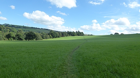 |
|
Heading south towards Hillbridge nature Reserve |
|
|
|
|
| |
|
| |
|
|
|
|
|
|
|
Walk 16113 - 06/09/16 Nessit Hill and
Macclesfield Forest |
| Area |
Cheshire |
Walking time |
1 hour |
Average speed |
|
| Walk |
Nessit Hill and
Macclesfield Forest |
Minimum altitude |
|
Maximum altitude |
|
| Start
from |
Trentabank Visitor Centre |
Altitude loss |
|
Altitude gain |
|
| Weather |
Clear
evening |
Distance |
2.4
miles |
|
|
| Map |
Explorer 268 |
Information from
Viewranger app on my Samsung S4 phone |
|
Route Trentabank
Visitor Centre - Nessit Hill - Forest paths - Trentabank
Visitor Centre |
|
| Three
of us set off on our regular evening walk in Macclesfield
Forest. Our route takes us from Trentabank Visitor Centre
up through the forest and then onto the summit of Nessit
Hill. We then follow the track down to lane and back along
the forest path the the Visitor Centre |
|
|
| |
|
|
|
|
| |
|
|
| |
|
|
|
|
|
|
Map
of our route |
| |
|
| |
|
|
| |
|
|
|
|
Walk
16114 - 07/09/16 Nessit Hill and Macclesfield Forest |
| Area |
Cheshire |
Walking time |
1 hour |
Average speed |
|
| Walk |
Nessit Hill and Macclesfield Forest |
Minimum altitude |
|
Maximum altitude |
|
| Start
from |
Trentabank Visitor Centre |
Altitude loss |
|
Altitude gain |
|
| Weather |
Clear
evening |
Distance |
2.40
miles |
|
|
| Map |
Explorer 268 |
Information from
Viewranger app on my Samsung S4 phone |
|
Route - Trentabank
Visitor Centre - Nessit Hill - Forest paths - Trentabank
Visitor Centre |
|
| Three
of us set off on our regular evening walk in Macclesfield
Forest. Our route takes us from Trentabank Visitor Centre
up through the forest and then onto the summit of Nessit
Hill. We then follow the track down to lane and back along
the forest path the the Visitor Centre |
|
|
| |
|
|
|
|
| |
|
|
| |
|
|
|
|
|
|
Map
of our route |
| |
|
| |
|
|
| |
|
|
|
|
Walk 16115 - 11/09/16 Whaley
Bridge and Taxal with Broken Cross Walkers |
| Area |
High
peak |
Walking time |
3
hours |
Average speed |
|
| Walk |
Whaley
Bridge and Taxal with Broken Cross Walkers |
Minimum altitude |
|
Maximum altitude |
|
| Start
from |
Whaley
bridge |
Altitude loss |
|
Altitude gain |
|
| Weather |
Sunny |
Distance |
7
miles |
|
|
| Map |
OS
Dark peak Area OL1 |
Information from
Viewranger app on my Samsung S4 phone |
|
Route Whaley Bridge - Slatersbank Wood - Cornhill Farm - Kishfield Bridge -
Gap House - Taxal - Hillbridge Nature Reserve - Whaley
bridge |
|
| Ten
off us set
off from Whaley Bridge and headed alongside Toddbrook
Reservoir and up along the hillside past New House Farm
and down to Kishfield Bridge, A woodland path took us up
to Gap House and then across the road and up onto the
ridge above Taxal where we stopped for lunch with some
great views across the valley. After passing through Taxal
we took the track southwards and down through Hillbridge Nature Reserve
and over the footbridge across the River Goyt, we then
followed the path back through Shallcross
Wood and into Whaley Bridge. After the walk some of us
enjoyed refreshments in the Goyt Inn in Whaley Bridge. A
great walk in good weather. Thanks to Christine, Pat G,
Dave G, Wendy, Chris R, Alec, Chris J, Maureen and Derek
for joining me on this walk. |
|
|
 |
|
Zooming in on two
walkers croosing the field near Hillbridge Nature Reserve |
|
|
| |
|
|
| |
|
|
|
|
 |
|
Looking across towards Taxal Moor |
| |
 |
|
Looking across towards Hillbridge Nature Reserve from
above Taxal |
|
|
| |
|
| |
|
|
| |
|
|
|
|
Walk
16116 - 12/09/16 Nessit Hill and Macclesfield Forest |
| Area |
Cheshire |
Walking time |
1 hour
|
Average speed |
|
| Walk |
Nessit Hill and Macclesfield Forest |
Minimum altitude |
|
Maximum altitude |
|
| Start
from |
Trentabank Visitor Centre |
Altitude loss |
|
Altitude gain |
|
| Weather |
Clear
evening |
Distance |
2 .40
miles |
|
|
| Map |
Explorer 268 |
Information from
Viewranger app on my Samsung S4 phone |
|
Route Trentabank
Visitor Centre - Nessit Hill - Forest paths - Trentabank
Visitor Centre |
|
| Five
of us set off on our regular evening walk in Macclesfield
Forest. Our route takes us from Trentabank Visitor Centre
up through the forest and then onto the summit of Nessit
Hill. We then follow the track down to lane and back along
the forest path the the Visitor Centre |
|
|
| |
|
|
|
|
| |
|
|
| |
|
|
|
|
|
|
Map
of our route |
| |
|
| |
|
|
| |
|
|
|
|
Walk
16117 - 13/09/16 Circuit of Kinder Scout - Day 1 Edale to Fairbrook Naze backpacking |
| Area |
Peak
District |
Walking time |
5
hours |
Average speed |
|
| Walk |
Circuit of Kinder Scout - Day 1 Edale to Fairbrook Naze |
Minimum altitude |
|
Maximum altitude |
|
| Start
from |
Edale |
Altitude loss |
|
Altitude gain |
|
| Weather |
Sunny
then stormy night |
Distance |
8
miles |
|
|
| Map |
OS
Dark Peak area OL1 |
Information from
Viewranger app on my Samsung S4 phone |
|
Route Edale - Ringing
Roger - Madwoman's Stones - Blackden Edge - Seal Stones -
Fairbrook Naze |
|
| I set
off from Edale and headed up the path by Ringing Roger
Roger, once up on the plateau rim I headed eastwards as my
intention was to follow the path anticlockwise and wild
camp halfway round. The weather was excellent and I had
some great views from the high level path. I passed Druids
Stone and then Madwoman's Stones and then west along
Blackden Edge to Seal Stones. I crossed the top of Fair
Brook and as it was around 6.00pm I started looking for a
place to camp. I eventually found a nice spot near to
Fairbrook Naze which gave me some great views down into
the Woodlands Valley. The weather was calm and sunny but
that was soon changed. I had planned to cook my meal sat
on the rocks looking over the valley but quite suddenly a
strong wind arrived and the sky darkened. I retreated into
my tent as thunder and lightening brought some spectacular
scenes. I cooked my meal watching with some apprehension
as the storm raged all around me. Heavy rain arrived and I
settled down snug in my sleeping bag and watched a film on
my tablet. Even with my earphones in I could still hear
the rain hammering down on my tent. It eventually eased
off and I soon fell asleep. My Wild Country Zephros 2 tent
stood the test and I remained dry throughout. |
|
|
 |
|
Thats a weight of my
back for a few minutes |
|
|
 |
|
Quite calm before the
storm, airing my sleeping bag |
| |
|
 |
|
Heading up towards
Ringing Roger |
|
|
 |
|
Some
strange rock formations on Kinder Scout |
|
|
 |
|
Storm clouds before the thunder and lightning |
|
| |
|
|
| |
|
|
|
|
Walk
16118 - 14/09/16 Fairbrook Naze to Edale backpacking |
| Area |
Peak
District |
Walking time |
6
hours |
Average speed |
|
| Walk |
Circuit
of Kinder Scout - Day 2 Fairbrook Naze to Edale |
Minimum altitude |
|
Maximum altitude |
|
| Start
from |
Fairbrook Naze |
Altitude loss |
|
Altitude gain |
|
| Weather |
Misty
the sunny all day |
Distance |
10
miles |
|
|
| Map |
OS
Dark Peak area OL1 |
Information from
Viewranger app on my Samsung S4 phone |
|
Route Fairbrook Naze -
Sandy Heys - Kinder Downfall - Kinder Low - Pym Chair -
Ringing Roger Edale |
|
| I
awoke to a misty start but this cleared after a few hours
to give a glorious sunny day, I followed the path along
the rim westwards and then south past Sandy Heys and
Kinder Downfall to Kinder Low. A lunch break by Noe Stool
gave me some great views over the Vale of Edale and then
it was along the path over Crowden Brook and Grindsbrook
Clough and back to Ringing Roger where I started my
descent down to Edale. Once down to the station I stopped
for a pot of welcome pot of tea at the Penny Pot Cafe. A
great couple of days walking with an exciting wild camp in
the storm. Total distance about 18.4 miles with an
altitude gain of 3981 ft. |
|
|
| I
weighed my rucksack before setting off and it weighed over
14 kg which is rather a lot for a one night camp but I was
carrying my Tablet 467g for evening entertainment and
almost 3 litres of water. I calculated it had been quite
dry recently and water would not be abundant. I guessed
right as streams coming off the plateau were a mere
trickle and very peaty. The water I carried was very
welcome particulaly due to the hot weather. The storm at
night merely provided a lot of very brown peaty water. |
|
|
|
 |
|
The tents still up and
dry after all the rain |
|
|
 |
|
Turned out to be a
beautiful day |
|
|
 |
|
Looking back to the
Kinder Plateau from Ringing Roger |
|
|
|
 |
|
A misty dawn from my
campsite |
|
|
 |
|
All
packed and ready to set off |
|
|
 |
|
Kinder Downfall |
|
|
|
|
|
|
|
|
|
|
|
|
|
|
|
|
|
|
| |
|
| |
|
|
| |
|
|
|
|
Walk
16119 - 18/09/16 Biddulph Grange and Gritstone Trail with
Macclesfield Ramblers |
| Area |
Staffordshire |
Walking time |
3½
hours |
Average speed |
|
| Walk |
Biddulph Grange and Gritstone Trail with
Macclesfield Ramblers |
Minimum altitude |
|
Maximum altitude |
|
| Start
from |
Biddulph Grange Country Park |
Altitude loss |
|
Altitude gain |
1034ft |
| Weather |
Sunny
periods |
Distance |
7.80
miles |
|
|
| Map |
Explorer 268 |
Information from
Viewranger app on my Samsung S4 phone |
|
Route Biddulph Grange
Country Park - Congleton Edge - Nick i'th Hill - Biddulph
Valley Way - Biddulph Country Park |
|
| Ten
of us set off from Biddulph Grange Country Park and after
passing through Biddulph Park we descended across the
fields and up to Congleton Edge and Nick i'th Hill, a
stretch of the Biddulph Valley Way took us to Marsh Green
and back to the Country Park. Refreshments at the Cafe
finished the day off nicely. |
|
|
 |
|
A Mill Pond |
|
|
| |
|
|
| |
|
 |
|
Looking across from
near Biddulph Park |
|
|
 |
|
Looking across to Biddulph Grange |
|
|
|
|
| |
|
| |
|
|
| |
|
|
|
|
Walk 16120 - 18/09/16 Nessit Hill and Macclesfield Forest |
| Area |
Cheshire |
Walking time |
1 hour
|
Average speed |
|
| Walk |
Nessit Hill and Macclesfield Forest |
Minimum altitude |
|
Maximum altitude |
|
| Start
from |
Trentabank Visitor Centre |
Altitude loss |
|
Altitude gain |
|
| Weather |
Clear
evening |
Distance |
2 .40
miles |
|
|
| Map |
Explorer 268 |
Information from
Viewranger app on my Samsung S4 phone |
|
Route Trentabank
Visitor Centre - Nessit Hill - Forest paths - Trentabank
Visitor Centre |
|
| Four
of us set off on our regular evening walk in Macclesfield
Forest. Our route takes us from Trentabank Visitor Centre
up through the forest and then onto the summit of Nessit
Hill. We then follow the track down to lane and back along
the forest path the the Visitor Centre |
|
|
| |
|
|
|
|
| |
|
|
| |
|
|
|
|
|
|
Map
of our route |
| |
|
| |
|
|
| |
|
|
|
|
|
|
|
|
Walk
16121 - 24/09/16 Bridges to Church Stretton with
Macclesfield Ramblers |
| Area |
Shropshire |
Walking time |
4
hours |
Average speed |
|
| Walk |
Bridges
to Church Stretton Macclesfield Ramblers |
Minimum altitude |
|
Maximum altitude |
|
| Start
from |
Carding Mill Valley |
Altitude loss |
|
Altitude gain |
|
| Weather |
Sunny
periods, windy |
Distance |
7
miles |
|
|
| Map |
Explorer 217 |
Information from
Viewranger app on my Samsung S4 phone |
|
Route Bridges -
Ratlinghope - Lower Darnford - Shropshire Way - Carding
Mill Valley |
|
Ten of us have just enjoyed a really splendid weekend at
the Longmynd Hotel in Church Stretton. Great food and
fabulous views from the Hotel.
On our first day we arrived at the Carding Mill Valley and
caught the Minibus which took us up onto the Longmynd and
then to Bridges. A 7 mile walk brought us back to the
start with some great views from the Longmynd. Sunny most
of the day but quite windy.
|
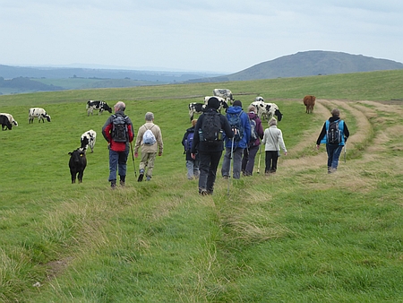 |
|
Heading across the
Long Mynd |
|
|
|
|
| |
|
|
| |
|
 |
|
Heading towards
Ratlinghope |
|
|
 |
|
On
the Long Mynd |
|
| |
|
|
| |
|
|
|
|
Walk
16122- 25/09/16 Church Stretton and Acton Scott with
Macclesfield Ramblers |
| Area |
Shropshire |
Walking time |
6
hours |
Average speed |
|
| Walk |
Church Stretton and Acton Scott Macclesfield
Ramblers |
Minimum altitude |
|
Maximum altitude |
|
| Start
from |
Church
Stretton |
Altitude loss |
|
Altitude gain |
|
| Weather |
Sunny |
Distance |
9
miles |
|
|
| Map |
Explorer 217 |
Information from
Viewranger app on my Samsung S4 phone |
|
Route Church Stretton
- Ragleth - Acton Scott - Little Stretton - Church
Stretton |
|
| On
Sunday we set off from the Hotel and
...after
a steep climb up from the town we eventually arrived on
the summit of Ragleth, wonderful views from the summit. We
then descended at the end of the ridge and eventually
arrived at the small village of Acton Scott. We had lunch
in the Churchyard and then set off back through some
rather tricky woodland footpaths and eventually arrived at
Little Stretton where we stopped for refreshments at a
charming Village Pub. Then it was along the hillside track
and back to the Hotel. About 9 miles on another great
sunny day. |
|
|
 |
|
Looking across from
Ragleth Hill to Long Mynd, our Hotel is the white
building in the centre of the forest |
|
|
| |
|
|
| |
|
 |
|
On the ridge of
Ragleth Hill |
|
|
 |
|
Looking towards Helmerth Hill from Ragleth Hill |
|
|
|
|
| |
|
| |
|
|
| |
|
|
|
|
Walk
16123 - 26/09/16 Church Stretton and Helmerth Hill with
Macclesfield Ramblers |
| Area |
Shropshire |
Walking time |
3
hours |
Average speed |
|
| Walk |
Church Stretton and Helmerth Hill Macclesfield
Ramblers |
Minimum altitude |
|
Maximum altitude |
|
| Start
from |
Church
Stretton |
Altitude loss |
|
Altitude gain |
|
| Weather |
Drizzle |
Distance |
5
miles |
|
|
| Map |
Explorer 217 |
Information from
Viewranger app on my Samsung S4 phone |
|
Route Church Stretton
- Gaerstones Farm - Helmerth Hill - Church Stretton |
|
Our final
day saw us not quite so lucky with the weather with
drizzle and restricted views, however we managed a 5 mile
walk around Helmeth Hill and then back into Church
Stretton for refreshments before setting off for home.
On the weekend trip were Janet, Bill, Peter, John, Wendy,
Hans, Doreen, Pat, David and Christine.
Special thanks to Janet for organising the trip and
planning the walks. |
|
|
 |
|
Hope Bowdler Hill in
the distance |
|
|
| |
|
|
| |
|
 |
|
Walking towards
Helmerth Hill |
|
|
 |
|
Heading back towards Church Stretton |
| |
|
| |
|
|
| |
|
|
|
|
Walk
16124 -26/09/16 Nessit Hill and Macclesfield Forest |
| Area |
Cheshire |
Walking time |
1 hour |
Average speed |
|
| Walk |
Nessit
Hill and Macclesfield Forest |
Minimum altitude |
|
Maximum altitude |
|
| Start
from |
Trentabank Visitor Centre |
Altitude loss |
|
Altitude gain |
|
| Weather |
Clear
night |
Distance |
2
miles |
|
|
| Map |
Explorer 268 |
Information from
Viewranger app on my Samsung S4 phone |
|
Route Trentabank
Visitor Centre - Nessit Hill - Forest paths - Trentabank
Visitor Centre |
|
| Five
of us set off on our regular evening walk in Macclesfield
Forest. Our route takes us from Trentabank Visitor Centre
up through the forest and then onto the summit of Nessit
Hill. We then follow the track down to lane and back along
the forest path the the Visitor Centre |
|
|
| |
|
|
|
|
| |
|
|
| |
|
|
|
|
Map of our route |
|
|
|
| |
|
|
| |
|
|
|
|
Walk 16125 - 28/09/16 Higher Hurdsfield and Langley
with Broken Cross Walkers |
| Area |
Cheshire |
Walking time |
4
hours |
Average speed |
|
| Walk |
Higher
Hurdsfield and Langley with Broken Cross
Walkers |
Minimum altitude |
|
Maximum altitude |
|
| Start
from |
Higher
Hurdsfield |
Altitude loss |
|
Altitude gain |
|
| Weather |
Sunny
periods |
Distance |
7
miles |
|
|
| Map |
Explorer 268 |
Information from
Viewranger app on my Samsung S4 phone |
|
Route - Higher
Hurdsfield - Gritstone Trail - Teggs Nose - Langley -
Gurnet - Macclesfield Canal - Higher Hurdsfield |
|
| Five
of us set off from Higher Hurdsfield and headed up Cliff
Lane and after crossing Buxton Road we followed the
Gritstone Trail across to Teggs Nose. We stopped here for
an early lunch and then followed the Saddlers Way down
into Langley and on to Gurnet where we stopped for a cup
of tea at the Bullocks Lane Garden Centre. Afterwards we
walked along the canal towpath back to Higher
Hurdsfield. Although the walk was supposed to be less the
7 miles it certainly felt longer. Thanks to Christine,
Pat, Dave and Sue for joining me on this walk |
|
|
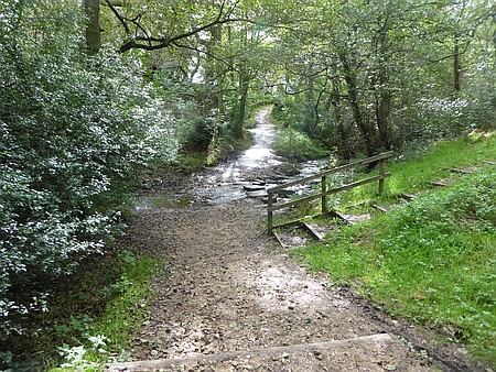 |
|
Crossing the stream
beneath Teggs Nose |
|
|
| |
|
|
| |
|
 |
|
Heading down the
Sadlers Way to Langley |
|
|
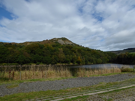 |
|
Looking back towards Teggs Nose |
|
|
|
|
| |
|
| |
|
|
| |
|
|
|
|
Walk
16126 - 28/09 16 - Nessit Hill and
Macclesfield Forest |
| Area |
Cheshire |
Walking time |
1 hour |
Average speed |
|
| Walk |
Nessit
Hill and Macclesfield Forest |
Minimum altitude |
|
Maximum altitude |
|
| Start
from |
Trentabank Visitor Centre |
Altitude loss |
|
Altitude gain |
|
| Weather |
Clear
night |
Distance |
2
miles |
|
|
| Map |
Explorer 268 |
Information from
Viewranger app on my Samsung S4 phone |
|
Route Trentabank
Visitor Centre - Nessit Hill - Forest paths - Trentabank
Visitor Centre |
|
| Two
of us set off on our regular evening walk in Macclesfield
Forest. Our route takes us from Trentabank Visitor Centre
up through the forest and then onto the summit of Nessit
Hill. We then follow the track down to lane and back along
the forest path the the Visitor Centre |
|
|
| |
|
|
|
|
| |
|
|
| |
|
|
|
|
Map of our usual route
for the evening walk |
|
|
|
| |
|
|
| |
|
|
|
|
Walk
16127 - 03/10/16 Benidorm to Sierra Helada |
| Area |
Spain |
Walking time |
2
hours |
Average speed |
|
| Walk |
Benidorm to Sierra Helada |
Minimum altitude |
|
Maximum altitude |
|
| Start
from |
Benidorm centre |
Altitude loss |
|
Altitude gain |
|
| Weather |
Sunny
and 28c |
Distance |
3
miles |
|
|
| Map |
|
Information from
Viewranger app on my Samsung S4 phone |
|
Route Benidorm -
Sierra Helada - Benidorm |
|
|
Whenever I stay in Benidorm I always make the climb to the
cross on the hill, the ridge is called the Sierra Helada
and has magnificent views to the distant mountain and
along the coast. The route takes you from the beach and
winds it way through apartments and hotels. It climbs
steeply, soon leaving the bustle of the town and passes
various properties in the process of construction. Once at
the Cross which is illuminated at night the path continues
along the ridge eventually descending to the town of
Albir. A great ridge walk which I did a few years ago. The
Bernia Ridge in the distance is I believe a challenging
walk and one I mean to tackle some time in the future.
In the west on the other side of the town stands the
mighty Puig Campania which I climbed a few years ago.
After admiring the scenery I descended back down the lane
and back to my Hotel. There is plenty of walking to be
done in this area. |
|
|
 |
|
Looking across
Benidorm from the Cross towards Puig Campana. climbed that
a few years ago. Great fun. |
|
|
| |
|
|
| |
|
 |
|
The cross above
Benidorm |
|
|
 |
|
At
the Cross looking towards Sierra Helada |
|
|
|
|
| |
|
| |
|
|
| |
|
|
|
|
Walk
16128 - 06/10/16 Benidorm to Sierra Helada |
| Area |
Spain |
Walking time |
2
hours |
Average speed |
|
| Walk |
Benidorm to Sierra Helada |
Minimum altitude |
|
Maximum altitude |
|
| Start
from |
Benidorm |
Altitude loss |
|
Altitude gain |
|
| Weather |
Sunny
and 28c |
Distance |
3
miles |
|
|
| Map |
|
Information from
Viewranger app on my Samsung S4 phone |
|
Route Benidorm -
Sierra Helada - Benidorm |
|
|
Another walk up to the Cross on Sierra Helada, still great
views from the Cross no matter how many times you do it.
Quite a few British folk up there admiring the views |
|
|
 |
|
The Sierra Helada
ridge. There is a footpath along it to the next town of
Albir. Takes about 4 hours if my memory is correct. Then
bus back to Benidorm |
|
|
| |
|
|
| |
|
 |
|
Another view of the
cross |
|
|
 |
|
Looking from the Cross towards Puig Campana |
|
|
|
|
| |
|
| |
|
|
| |
|
|
|
|
Walk 16129 - 06/10/16 - Altea to
Albir |
| Area |
Spain |
Walking time |
2½
hours |
Average speed |
|
| Walk |
Altea to
Albir |
Minimum altitude |
|
Maximum altitude |
|
| Start
from |
Altea |
Altitude loss |
|
Altitude gain |
|
| Weather |
Sunny
and 26c |
Distance |
5
miles |
|
|
| Map |
|
Information from
Viewranger app on my Samsung S4 phone |
|
Route - Altea - Albir |
|
| Four
of us caught the bus from Benidorm to Altea and walked up
through the narrow alleyways to the Church Square on the
hill in Altea. A really beautiful place with some great
views down the coast. We then followed the alleyways down
to the coast and walked along the promenade to Albir for
coffee in one of the many seaside Cafe's. We then caught
the bus back to our Hotel. |
|
|
 |
|
Altea |
|
|
| |
|
|
| |
|
 |
|
Altea just a bus ride
from Bendirorm. Totally different |
|
|
 |
|
Looking from Altea
towards Benidorm, you can just see the tall buildings on
the horizon. The mountain in the centre is the the Sierra
Helada and Albir is at the foot of the ridge |
| |
|
| |
|
|
| |
|
|
|
|
Walk
16130 - 12/10/16 - Circuit of Rudyard Lake with
Broken Cross Walkers |
| Area |
Staffordshire |
Walking time |
3
hours |
Average speed |
|
| Walk |
Circuit of Rudyard Lake with Broken Cross Walkers |
Minimum altitude |
|
Maximum altitude |
|
| Start
from |
Staffordshire Way Car Park, Rushton Spencer |
Altitude loss |
|
Altitude gain |
|
| Weather |
Sunny
periods |
Distance |
7
miles |
|
|
| Map |
Explorer 268 |
Information from
Viewranger app on my Samsung S4 phone |
|
Route Rushton Spencer
- Rycroft Gate - Cliff Park - Rea Cliff Wood - Rudyard -
Dismantled railway - Rushton Spencer |
|
| Six
of us set off from the Car Park at Rushton Spencer on a
Wednesday walk. We followed the old disused railway track
then took the Staffordshire Way which follows the west
shore of Rudyard Lake and then into Rudyard where we
stopped for lunch at the Rudyard Hotel, nice carvery and
good value. Afterwards we headed north up the east side of
Rudyard Lake and back to the start at Rushton Spencer.
Thanks to Christine, Pat G, Dave G, Hans and Chris R for
joining me on this Wednesday walk. |
|
|
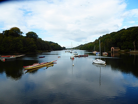 |
|
Rudyard Lake |
|
|
| |
|
|
| |
|
 |
|
Rudyard Lake |
|
|
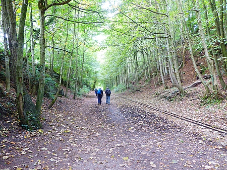 |
|
Walking back along the disused railway track to Rushton
Spencer |
|
|
|
| |
|
|
| |
|
|
|
|
Walk 16131 - 13/10/16 Nessit
Hill and Macclesfield Forest |
| Area |
Cheshire |
Walking time |
1 hour |
Average speed |
|
| Walk |
Nessit
Hill and Macclesfield Forest |
Minimum altitude |
|
Maximum altitude |
|
| Start
from |
Trentabank Visitor Centre |
Altitude loss |
|
Altitude gain |
|
| Weather |
Clear
night |
Distance |
2
miles |
|
|
| Map |
Explorer 268 |
Information from
Viewranger app on my Samsung S4 phone |
|
Route Trentabank
Visitor Centre - Nessit Hill - Forest paths - Trentabank
Visitor Centre |
|
| Three
of us set off on our regular evening walk in Macclesfield
Forest. Our route takes us from Trentabank Visitor Centre
up through the forest and then onto the summit of Nessit
Hill. We then follow the track down to lane and back along
the forest path the the Visitor Centre |
|
|
| |
|
|
|
|
| |
|
|
| |
|
|
|
|
Map of our usual route
for the evening walk, we usually walk clockwise. |
|
|
|
| |
|
|
| |
|
|
|
|
Walk
16132- 16/10/16 Bollin Valley, Prestbury and
Bollington with Macclesfield Ramblers |
| Area |
Cheshire |
Walking time |
3
hours |
Average speed |
|
| Walk |
Prestbury and Bollington Macclesfield Ramblers |
Minimum altitude |
|
Maximum altitude |
|
| Start
from |
Riverside Park, Macclesfield |
Altitude loss |
|
Altitude gain |
|
| Weather |
Sunny
periods |
Distance |
8
miles |
|
|
| Map |
Explorer 268 |
Information from
Viewranger app on my Samsung S4 phone |
|
Route - Macclesfield
Riverside Park - Prestbury - Butley Town - Lowerhouse -
Clarence Mill - Canal - Middlewood Way - Riverside Park |
|
| Ten
of us set off from The Riverside Park in Macclesfield and
followed the path along the River Bollin to Prestbury, a
field path then took us across to Butley Town then after
passing Lowerhouse we joined the Canal and walked to
Clarence Mill where we stopped for Lunch. Afterwards we
headed south along the towpath and then joined the
Middlewood Way which took us back to our start at the
Riverside Park. A great walk led by Wendy with Christine,
Pat g, Doreen, John, Rob, Roy, Grant, Jack and myself. |
|
|
 |
|
Heading towards
Clarence Mill |
|
|
| |
|
|
| |
|
 |
|
Macclesfield Canal
near Bollington |
|
|
 |
|
Looking across to Kerridge |
|
|
|
| |
|
|
| |
|
|
|
|
Walk
16133 - 17/10/16 Nessit Hill and Macclesfield Forest |
| Area |
Cheshire |
Walking time |
1 hour |
Average speed |
|
| Walk |
Nessit
Hill and Macclesfield Forest |
Minimum altitude |
|
Maximum altitude |
|
| Start
from |
Trentabank Visitor Centre |
Altitude loss |
|
Altitude gain |
|
| Weather |
Clear
night |
Distance |
3
miles |
|
|
| Map |
Explorer 268 |
Information from
Viewranger app on my Samsung S4 phone |
|
Route Trentabank
Visitor Centre - Nessit Hill - Forest paths - Trentabank
Visitor Centre |
|
| Four
of us set off on our regular evening walk in Macclesfield
Forest. Our route takes us from Trentabank Visitor Centre
up through the forest and then onto the summit of Nessit
Hill. We then follow the track down to lane and back along
the forest path the the Visitor Centre |
|
|
| |
|
|
|
|
| |
|
|
| |
|
|
|
|
Map of our usual route
for the evening walk, we usually walk clockwise. |
|
|
|
| |
|
|
| |
|
|
|
|
Walk
16134 - 18/10/16 Leek to Cat and Fiddle backpack. Day 1
Leek to Roaches |
| Area |
Shropshire |
Walking time |
4½
hours |
Average speed |
|
| Walk |
Leek to
Cat & Fiddle backpack. Day 1 Leek - Roaches |
Minimum altitude |
|
Maximum altitude |
|
| Start
from |
Leek |
Altitude loss |
|
Altitude gain |
|
| Weather |
Dry at
first then rain and windy |
Distance |
9
miles |
|
|
| Map |
Explorer OL24 |
Information from
Viewranger app on my Samsung S4 phone |
|
Route - Leek
Ball Hay Green - Churnet Valley Way - Tittesworth Visitor
Centre - Roach House - Doxey Pool - Roach End |
|
|
The forecast looked reasonable as I caught
the bus to Leek and set off with my gear with the
intention of a wild camp on the Roaches. The plan was to
spend the night near Doxey Pool but things did not go
quite as planned. I left Leek after lunchtime in dry
weather and followed the Churnet Way which took me
alongside the Tittesworth Reservoir. The rain started as I
reached the visitor centre and I soon had all my
waterproofs on. After a cup of tea in the Cafe about
4.00pm I pressed on through the showers and climbed up the
path taking me towards the ridge. Once on the ridge the
rain was quite heavy and the mist was down, all the paths
were awash with water as I thought to myself this was not
what I was expecting. To late now to change my mind and I
could see that darkness was approaching. The area around
Doxey Pool was very wet and I could find no suitable place
for camping. Poor visibility, heavy rain and glasses
steamed up, I was not a happy chappy. I was carrying all
the correct gear it was just a case of finding a suitable
spot to put my tent up. It was decision time, I knew that
once the path descended past Bearstone Rock towards the
lane there were some areas to camp. I passed the Trig
point and after a while descended down to the lane. Time
was of the essence as darkness was approaching, I selected
a place to camp and battled with the wind and the rain to
get the tent up. Once the tent was up it was waterproofs
off and quickly inside, I sat there for a while and rested
while the rain hammered down. Once I had recovered I
cooked my meal which was a tin of Chicken Masala with some
couscous with tea and biscuits afterwards. I watched an
episode of Dads Army on my phone and fell asleep.
|
| |
 |
|
Tittesworth Reservoir |
|
|
|
|
 |
|
Heading towards Tittesworth Reservoir |
| |
|
|
|
|
|
|
| |
|
| |
|
|
| |
|
|
|
|
Walk 16135 - 19/10/16 Leek to
Cat and Fiddle backpack. Day 2 Roaches to Cat and Fiddle |
| Area |
Staffordshire |
Walking time |
4 hours |
Average speed |
|
| Walk |
Leek to
Cat &Fiddle backpack. Day 2 Roaches to Cat & Fiddle |
Minimum altitude |
|
Maximum altitude |
|
| Start
from |
Roaches |
Altitude loss |
|
Altitude gain |
|
| Weather |
Rain,
windy |
Distance |
9 miles |
|
|
| Map |
OL24 |
Information from
Viewranger app on my Samsung S4 phone |
|
Route Roach End -
Gradbach - Three Shires Head - Danebower Hollow - Cat and
Fiddle |
|
|
The rain woke me several times during the
night and I eventually woke at six. I cooked my porridge
and packed everything away as I wanted to be away early as
I might have been on private land. My original plan had
been to walk as far as Macclesfield but after the rigours
of yesterday I decided to amend my plan and walk as far as
the Cat and Fiddle where I knew there was an hourly bus
service to Macclesfield. Today the weather was excellent
and I enjoyed a great walk down through the woods to
Gradbach and then onto the Dane Valley Way which I
followed up to Three Shires Head. After a brief coffee
break I continued along the DVW. A slightly muddy path in
places due to the previous nights rain but some great
views across the valley to Reeves End Quarries, now
deserted but once the scene of intense activity with the
stone and coal that was extracted in the area. After
crossing the A54 I followed the path along Danebower
Hollow and eventually arrived at the Cat and Fiddle Inn,
the next bus took me back to Macclesfield and a walk
across town to me to my home. An enjoyable couple of days
despite the poor weather on the previous day. |
|
|
 |
|
My camp site for the
night |
|
|
 |
|
Looking back towards
the Roaches |
| |
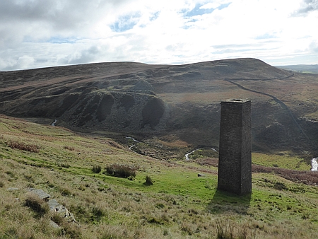 |
|
Looking towards Danebower and Reeve Edge Quarries,
once the scene much coal mining and quarrying |
| |
| |
|
 |
|
Early morning, looking
back towards Tittesworth Reservoir |
|
|
 |
|
In
the woods heading towards Gradbach |
|
|
 |
|
Three Shires Head |
|
|
|
|
|
|
|
|
|
|
| |
|
| |
|
|
| |
|
|
|
|
Walk
16136 - 23/10/16 Nelson Pit and Lyme Park with
Broken Cross Walkers |
| Area |
Cheshire |
Walking time |
3
hours |
Average speed |
|
| Walk |
Nelson Pit and Lyme Park with Broken Cross Walkers |
Minimum altitude |
|
Maximum altitude |
|
| Start
from |
Nelson
Pit |
Altitude loss |
|
Altitude gain |
|
| Weather |
Sunny
periods |
Distance |
7
miles |
|
|
| Map |
Explorer 268 |
Information from
Viewranger app on my Samsung S4 phone |
|
Route Nelson - Pit -
Platt Wood Farm - Elmerhurst Wood - Crow Wood - Lyme Park
Visitor Centre - Darcy's Pool - West Parkgate - Nelson Pit |
|
| Five
of us set off from Nelson Pit Visitor Centre and headed
north along the canal towpath, we then crossed the canal
and headed through Platt Wood Farm and after passing
Elmerhurst Cottage we entered Elmerhurst Wood and then
Crow Wood and ate our lunch by the Visitor Centre.
Afterwards we headed across the Moor past Darcy's Pool.
Unfortunately he was not bathing at the time much to the
dismay of the ladies in our group. We then walked
down to West Parkgate and then back along the canal
towpath to Nelson Pit. After the walk we enjoyed tea and
coffee at the Trading Post on the Canal. |
|
|
 |
|
Looking towards the
Cage in Lyme Park |
|
|
|
|
|
|
|
|
|
|
|
|
|
|
| |
|
 |
|
Heading towards
Elmerhurst Cottage |
|
|
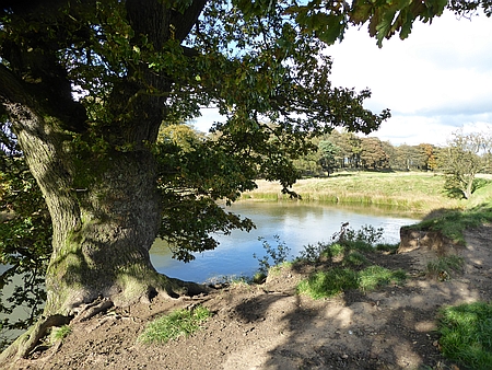 |
|
Darcy's Pool in Lyme Park |
| |
|
| |
|
|
| |
|
|
|
|
Walk
16137 - 24/10/16 Nessit Hill and Macclesfield Forest |
| Area |
Cheshire |
Walking time |
1 hour |
Average speed |
|
| Walk |
Nessit
Hill and Macclesfield Forest |
Minimum altitude |
|
Maximum altitude |
|
| Start
from |
Trentabank Visitor Centre |
Altitude loss |
|
Altitude gain |
|
| Weather |
Clear
night |
Distance |
2
miles |
|
|
| Map |
Explorer 268 |
Information from
Viewranger app on my Samsung S4 phone |
|
Route Trentabank
Visitor Centre - Nessit Hill - Forest paths - Trentabank
Visitor Centre |
|
| Four
of us set off on our regular evening walk in Macclesfield
Forest. Our route takes us from Trentabank Visitor Centre
up through the forest and then onto the summit of Nessit
Hill. We then follow the track down to lane and back along
the forest path the the Visitor Centre |
|
|
| |
|
|
|
|
| |
|
|
| |
|
|
|
|
Map of our usual route
for the evening walk, we usually walk clockwise. |
|
|
| |
|
| |
|
|
| |
|
|
|
|
Walk
16138 - 30/10/16 Circuit of Tittesworth with Macclesfield
Ramblers |
| Area |
Staffordshire |
Walking time |
3 hours |
Average speed |
|
| Walk |
Circuit of Tittesworth with Macclesfield Ramblers |
Minimum altitude |
|
Maximum altitude |
|
| Start
from |
Meerbrook |
Altitude loss |
|
Altitude gain |
|
| Weather |
Overcast |
Distance |
7 miles |
|
|
| Map |
Explorer OL24 |
Information from
Viewranger app on my Samsung S4 phone |
|
Route Meerbrook -
South Hillswood Farm - Ball Haye Green - Churnet Valley
Way - Visitor Centre - Meerbrook |
|
|
Eleven of us set off from Meerbrook heading south along
the lane alongside Tittesworth Reservoir, we passed
through North Hillswood Farm and then South Hillswood Farm
eventually reaching Ball Haye Green on the outskirts of
Leek. Here we joined the Churnet Valley Way which heads
north alongside the Reservoir. Although the weather
was overcast we had some splendid views alongside the
water and woods the Autumn colours were magnificent. At
the Visitor Centre we stopped for tea and cakes and then
back along the lane to the start. Thanks to Roy for
leading the walk and Christine, David, Pat G,
Doreen, Janet D, Janet B, John, Cathy, Hans and Wendy for
coming on the walk |
|
|
 |
|
Tittesworth Reservoir |
|
|
|
 |
|
In the woods alongside
Tittesworth Reservoir |
|
|
| |
|
|
|
|
|
|
| |
|
| |
|
|
| |
|
|
|
|
Walk 16139 - 31/10/16 Nessit Hill and Macclesfield Forest |
| Area |
Cheshire |
Walking time |
1 hour |
Average speed |
|
| Walk |
Nessit
Hill and Macclesfield Forest |
Minimum altitude |
|
Maximum altitude |
|
| Start
from |
Trentabank Visitor Centre |
Altitude loss |
|
Altitude gain |
|
| Weather |
Clear
evening |
Distance |
2.37
miles |
|
|
| Map |
Explorer 268 |
Information from
Viewranger app on my Samsung S4 phone |
|
Route - Trentabank
Visitor Centre - Nessit Hill - Forest paths - Trentabank
Visitor Centre |
|
| Four
of us set off on our regular evening walk in Macclesfield
Forest. Our route takes us from Trentabank Visitor Centre
up through the forest and then onto the summit of Nessit
Hill. We then follow the track down to lane and back along
the forest path the the Visitor Centre. |
|
|
| |
|
|
|
|
| |
|
|
| |
|
|
|
|
|
|
Map
of our usual route for the evening walk, we usually walk
clockwise. |
| |
|
| |
|
|
| |
|
|
|
|
Walk 16140 - 04/11/16 Harrop Pike from Swindale with the
MaccPackers |
| Area |
Lake
District |
Walking time |
5½
hours |
Average speed |
|
| Walk |
Harrop
Pike from Swindale with the MaccPackers |
Minimum altitude |
907 ft |
Maximum altitude |
2071
ft |
| Start
from |
Truss
Gap, Swindale |
Altitude loss |
2035
ft |
Altitude gain |
2024
ft |
| Weather |
Showery |
Distance |
10.2
miles |
|
|
| Map |
Ordnance Survey OL5 |
Information from
Viewranger app on my Samsung S4 phone |
|
Route Truss Gap
- Swindale Head - Mosedale Cottage Seavy Side -
Swindale Head - Truss Gap |
|
|
|
| Four
of us set off from Truss Gap along the lane to Swindale
Head and then along the path above Mosedale Beck, we
arrived at Mosedale Cottage, a Bothy belonging to the
Mountain Bothy Association. We sheltered inside from the
showers as we ate our lunch and then set off across the
boggy valley bottom and then climbed up to the summit of
Harrop Pike. A slightly different route down eventually
took us past Mosedale Cottage and back to Swindale Head
and Truss Gap. Parking in this area is extremely limited.
a 45 minute drive took us to the White Horse Inn where we
had booked one of the Bunkhouse 8 person rooms as we were
to be joined later by 3 other members of our group |
|
|
|
The White Horse
Inn, Scales, highly recommended
The White Horse Inn |
|
|
|
 |
|
Deer on the hill
behind Mosedale Cottage |
|
|
 |
|
Harrop Pike |
|
|
|
|
|
|
|
|
|
|
|
|
|
|
|
|
| |
|
|
| |
|
 |
|
Heading towards
Mosedale Cottage |
|
|
 |
|
Mosedale Cottage |
|
|
 |
|
Descending from Harrop Pike and looking across to
the disused Mosedale Quarry |
|
| |
|
|
| |
|
|
|
|
Walk
16141 - 05/11/16 - Clough Head and Great Dodd from
Scales with the MaccPackers |
| Area |
Lake
District |
Walking time |
7½
hours |
Average speed |
|
| Walk |
Clough
Head & Great Dodd from Scales with MaccPackers |
Minimum altitude |
459 ft |
Maximum altitude |
2799 ft |
| Start
from |
Scales |
Altitude loss |
3260
ft |
Altitude gain |
3350 ft |
| Weather |
Windy,
cold |
Distance |
13.9
miles |
|
|
| Map |
Ordnance Survey OL5 |
Information from
Viewranger app on my Samsung S4 phone |
|
Route Scales -
Hausewell Brow - Clough Head - Calfhow Pike - Little Dodd
- Great Dodd Matterdale Common - Sandbeds Moss - Highgate
- Scales |
|
| Seven
of us set off from the White Horse Inn and followed the
River Glenderamackin as far as Mill Bridge near Threlkeld,
we then headed south across the moor to Hausewell Brow and
then up the steep hillside to the summit of Clough Head,
we then descended and walked across the Calfhow Pike where
we ate our lunch in the shelter of the rocks. Afterwards
we returned to the path and climbed steadily over Little
Dodd and onto the summit of Great Dodd. It was quite icy
with a thin layer of snow on the summit and we quickly
descended to Matterdale Common and eventually to
Groovebeck Fold where we joined the Old Coach Road. After
heading westwards we turned north across Sandbeds Moss, a
very boggy walk for almost a mile until we reached Lobbs
and firmer ground. We passed Highgate Close and
Wallthwaite and arrived back at Scales. A hot shower and
another excellent meal at the Inn finished the day off
nicely. Our group were Kevin, John, Chris, Paul. Alan,
Richard, Poppy the dog and myself. |
|
|
 |
|
Looking across to
Derwentwater with Skiddaw on the right |
|
|
 |
|
Setting off for Great
Dodd |
|
 |
|
Looking back towards
Great Dodd after we had descended |
|
|
 |
|
Group photo as we set
off for Clough Head which is in the distance |
|
|
 |
|
Having a breather before we set off from Clough Head |
|
|
 |
|
Shelter on Great Dodd |
| |
| |
| |
| |
| |
| |
| |
| |
| |
| |
|
| |
|
|
| |
|
|
|
|
Walk
16142 - 06/11/16 - Scales Tarn from Scales |
| Area |
Lake
District |
Walking time |
4
hours |
Average speed |
|
| Walk |
Scales
Tarn from Scales |
Minimum altitude |
745 ft |
Maximum altitude |
1956
ft |
| Start
from |
Scales |
Altitude loss |
1514
ft |
Altitude gain |
1510
ft |
| Weather |
Sleet
and snow |
Distance |
4
miles |
|
|
| Map |
Ordnance Survey OL5 |
Information from
Viewranger app on my Samsung S4 phone |
|
Route Scales - Scales
Tarn - Mousthwaite Combe - Scales |
|
| Seven
of us set off from Scales on a wintry day with the
intention of climbing Blencathra, almost immediately the
rain and sleet started and we plodded uphill and along the
valley above the infant River Glenderamackin. We climbed
up alongside Scales Beck and reached Scales Tarn where we
stopped to assess the conditions. Snow and sleet were
falling and four of the group Richard and Poppy, Paul,
Chris and John were keen to carry on to the summit and
they continued up the steep track above Scales Tarn to the
summit. Myself, Kevin and Alan returned back along
the track and across to Mousthwaite Coombe and back to
Scales. We ate our lunch by the Inn and then it was inside
to the log fire and hot coffee. A short while later the
rest of the group arrived back having completed the climb
and descending quickly back to the Inn. An excellent
weekend with great walks in varied weather
conditions and staying at the excellent White Horse Inn.
|
|
|
 |
|
Pause for a breather
as we head towards Scales Beck |
|
|
| |
|
|
| |
|
 |
|
Looking back towards
Souther Fell |
|
|
 |
|
By
Scales Tarn |
|
|
|
|
| |
|
| |
|
|
| |
|
|
|
|
Walk
16143 - Nessit Hill and Macclesfield Forest |
| Area |
Cheshire |
Walking time |
1 hour |
Average speed |
|
| Walk |
Nessit Hill and Macclesfield Forest |
Minimum altitude |
|
Maximum altitude |
|
| Start
from |
Trentabank Visitor Centre |
Altitude loss |
|
Altitude gain |
|
| Weather |
Clear
evening |
Distance |
2
miles |
|
|
| Map |
Explorer 268 |
Information from
Viewranger app on my Samsung S4 phone |
|
Route - Trentabank
Visitor Centre - Nessit Hill - Forest paths - Trentabank
Visitor Centre |
|
| Four
of us set off on our regular evening walk in Macclesfield
Forest. Our route takes us from Trentabank Visitor Centre
up through the forest and then onto the summit of Nessit
Hill. We then follow the track down to lane and back along
the forest path the the Visitor Centre. |
|
|
| |
|
|
|
|
| |
|
|
| |
|
|
|
|
Map of our usual route
for the evening walk, we usually walk clockwise. |
|
|
|
| |
|
|
| |
|
|
|
|
Walk
16144 - 08/11/16 Plumley and Holford Hall |
| Area |
Cheshire |
Walking time |
3
hours |
Average speed |
|
| Walk |
Plumley
and Holford Hal |
Minimum altitude |
|
Maximum altitude |
|
| Start
from |
Plumley |
Altitude loss |
214 ft |
Altitude gain |
214 ft |
| Weather |
Overcast |
Distance |
7.50
miles |
|
|
| Map |
|
Information from
Viewranger app on my Samsung S4 phone |
|
Route - Plumley
Holford Moss - Hame Farm - Holford Hall - Royd Wood -
Plumley |
|
| I set
off from Plumley Station on a reccy walk for January with
the Macclesfield Ramblers. It was an overcast day and I
walked along the field path to Holford Moss and across to
Langford Farm. Then it was north past Plumley Lime Beds
Nature Reserve to Holford Hall which was built in 1601. A
short way along the A556 a field path took me across the
fields to Royd Wood by Tabley Mere and then back into
Plumley. |
|
|
 |
|
Holford Hall |
|
|
|
 |
|
Autumn has arrived |
|
|
| |
|
|
|
|
|
|
| |
|
| |
|
|
| |
|
|
|
|
Walk
16145 - 12/11/16 Alderley Edge and the Wizard |
| Area |
Cheshire |
Walking time |
3
hours |
Average speed |
|
| Walk |
Alderley Edge ands the Wizard |
Minimum altitude |
|
Maximum altitude |
|
| Start
from |
NT Car
park, The Wizard |
Altitude loss |
|
Altitude gain |
|
| Weather |
Overcast, damp. |
Distance |
6.37
miles |
|
|
| Map |
Explorer 268 |
Information from
Viewranger app on my Samsung S4 phone |
|
Route - Wizard car
park - Adders Moss - Clinton Hill - Hocker Lane - Nether
Alderley Edge - Wizard car park |
|
| I set
off from the Wizard Car Park to check out a future walk
for Broken Cross Ramblers. The weather was overcast and
there was dampness in the air. I followed the path through
the woods and over past Adders Moss, then after crossing
the main road I went through Finlow Hill Wood and past
Clinton Hill and onto Hocker Lane. A steady walk along
this delightful bridleway took me to Nether Alderley where
I stopped for lunch. Afterwards I followed the path
through the outskirts of Alderley Edge and then up through
the woods and back to the Wizard car park. |
|
|
 |
|
The woods near the
Wizard |
|
|
| |
|
|
| |
|
 |
|
Autumn scene in the
woods near the Wizard |
|
|
| |
|
|
|
|
|
|
| |
|
| |
|
|
| |
|
|
|
|
Walk
16146 - 13/11/16 Whaley Bridge and Coombs Reservoir with
Macclesfield Ramblers |
| Area |
High Peak |
Walking time |
3
hours |
Average speed |
|
| Walk |
Whaley
Bridge and Coombs Reservoir ith Macclesfield Ramblers |
Minimum altitude |
|
Maximum altitude |
|
| Start
from |
Whaley
Bridge Canal Basin |
Altitude loss |
|
Altitude gain |
|
| Weather |
Sunny
periods |
Distance |
7
miles |
|
|
| Map |
|
Information from
Viewranger app on my Samsung S4 phone |
|
Route - Whaley bridge
- New Horwich - Buxsworth - Lydgate - Bradshaw Hall -
Tunstead Milton - Cadster House - Horwich End - Whaley
Bridge. |
|
| Ten
of us set off from Whaley Bridge to New Horwich and then
along the hillside path to Buxworth another hillside path
took us to Lydgate and then to the magnificent Bradshaw
Hall. We passed through Tunstead Milton and alongside
Coombs Reservoir on onto the hillside path which took us
past Cadster House and then through Horwich End and back
to Whaley Bridge. |
|
|
 |
|
Another view from our
path above Buxsworth |
|
|
| |
|
|
| |
|
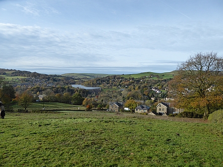 |
|
Looking across to
Toddbrook Reservoir |
|
|
 |
|
Heading along the path beneath Eccles Pike |
|
|
|
|
| |
|
| |
|
|
| |
|
|
|
|
Walk
16147 - 14/11/16 - Macclesfield Forrest and Nessit Hill |
| Area |
Cheshire |
Walking time |
1 hour |
Average speed |
|
| Walk |
Macclesfield
Forrest and Nessit Hill |
Minimum altitude |
|
Maximum altitude |
|
| Start
from |
Trentabank Visitor Centre |
Altitude loss |
|
Altitude gain |
|
| Weather |
Clear
evening |
Distance |
2.40
miles |
|
|
| Map |
Explorer 268 |
Information from
Viewranger app on my Samsung S4 phone |
|
Route - Trentabank
Visitor Centre - Nessit Hill - Forest paths - Trentabank
Visitor Centre |
|
| Three
of us set off on our regular evening walk in Macclesfield
Forest. Our route takes us from Trentabank Visitor Centre
up through the forest and then onto the summit of Nessit
Hill. We then follow the track down to lane and back along
the forest path the the Visitor Centre. |
|
|
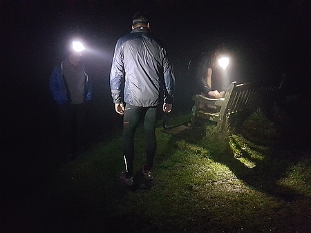 |
|
Time for a breather on
Nessit Hill |
|
|
| |
|
|
| |
|
|
|
|
Map of our route |
|
|
|
| |
|
|
| |
|
|
|
|
Walk
16148 - 16/11/16 Macclesfield Forrest and Nessit Hill |
| Area |
Cheshire |
Walking time |
1 hour |
Average speed |
|
| Walk |
Macclesfield Forrest and Nessit Hill |
Minimum altitude |
|
Maximum altitude |
|
| Start
from |
Trentabank Visitor Centre |
Altitude loss |
|
Altitude gain |
|
| Weather |
Clear
evening |
Distance |
2.40
miles |
|
|
| Map |
Explorer 268 |
Information from
Viewranger app on my Samsung S4 phone |
|
Route - Trentabank
Visitor Centre - Nessit Hill - Forest paths - Trentabank
Visitor Centre |
|
|
Richard and I set off on our regular evening walk in Macclesfield
Forest. Our route takes us from Trentabank Visitor Centre
up through the forest and then onto the summit of Nessit
Hill. We then follow the track down to lane and back along
the forest path the the Visitor Centre. |
|
|
 |
|
Looking out over
Macclesfield from Nessit Hill |
|
|
| |
|
|
| |
|
|
|
|
Map of our usual route |
|
|
 |
|
Mountain bikers in the forest, they really do have very
powerful lights |
|
|
|
| |
|
|
| |
|
|
|
|
Walk
16149 - 20/11/16 Alderley Edge and the Wizard with
Broken Cross Walkers |
| Area |
Cheshire |
Walking time |
3
hours |
Average speed |
|
| Walk |
Alderley
Edge and the Wizard with Broken Cross Walkers |
Minimum altitude |
|
Maximum altitude |
|
| Start
from |
NT Car
park, The Wizard |
Altitude loss |
|
Altitude gain |
|
| Weather |
Drizzle then dry |
Distance |
6.83
miles |
|
|
| Map |
Explorer 268 |
Information from
Viewranger app on my Samsung S4 phone |
|
Route - Wizard car
park - Adders Moss - Clinton Hill - Hocker Lane - Nether
Alderley Edge - Wizard car park |
|
| Seven
of us set
off from the Wizard Car Park on a damp day which later
turned out quite nice. We followed the path through
the woods and over past Adders Moss, then after crossing
the main road we went through Finlow Hill Wood and past
Clinton Hill and onto Hocker Lane. A steady walk along
this delightful bridleway took us to Nether Alderley where
we stopped for lunch. Afterwards we followed the path
through the outskirts of Alderley Edge and then up through
the woods and back to the Wizard car park. Tea in the
Wizard Cafe finished the day off nicely. |
|
|
 |
|
Handy bus shelter for
lunch at Nether Alderley |
|
|
| |
|
|
| |
|
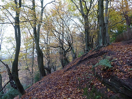 |
|
Alderley woods |
|
|
 |
|
Path
through the woods at Alderley Edge |
|
|
|
|
| |
|
| |
|
|
| |
|
|
|
|
Walk
16150 - 21/11/16 Nessit Hill and Macclesfield Forest evening
walk |
| Area |
Cheshire |
Walking time |
1 hour |
Average speed |
|
| Walk |
Nessit
Hill and Macclesfield Forest evening walk |
Minimum altitude |
|
Maximum altitude |
|
| Start
from |
Trentabank Visitor Centre |
Altitude loss |
|
Altitude gain |
|
| Weather |
Clear
evening |
Distance |
2.40
miles |
|
|
| Map |
Explorer 268 |
Information from
Viewranger app on my Samsung S4 phone |
|
Route - Trentabank
Visitor Centre - Nessit Hill - Forest paths - Trentabank
Visitor Centre |
|
| Three
of us set off on our regular evening walk in Macclesfield
Forest. Our route takes us from Trentabank Visitor Centre
up through the forest and then onto the summit of Nessit
Hill. We then follow the track down to lane and back along
the forest path the the Visitor Centre. |
|
|
| |
|
|
|
|
| |
|
|
| |
|
|
|
|
Map of our night time
route |
|
|
|
| |
|
|
| |
|
|
|
|
Walk
16151 - 25/11/16 Tatton Park circular |
| Area |
Cheshire |
Walking time |
2
hours |
Average speed |
|
| Walk |
Tatton
Park circular |
Minimum altitude |
|
Maximum altitude |
|
| Start
from |
Tatton
Park |
Altitude loss |
|
Altitude gain |
|
| Weather |
Sunny
periods |
Distance |
4
miles |
|
|
| Map |
Explorer 268 |
Information from
Viewranger app on my Samsung S4 phone |
|
Route - Tatton Park
circular walk |
|
| Chris
and I parked in Tatton Park and did a circular walk around
the park visiting the Christmas Fair in the Courtyard. |
|
|
|
|
|
|
|
|
|
|
 |
|
Tatton Park |
|
|
| |
|
|
| |
|
 |
|
Melchett Mere in
Tatton Park |
|
|
 |
|
Tatton Park |
|
| |
|
|
| |
|
|
|
|
Walk
16152 - 27/11/16 Tatton Park from Knutsford with
Macclesfield Ramblers |
| Area |
Cheshire |
Walking time |
3
hours |
Average speed |
|
| Walk |
Tatton
Park from Knutsford with Macclesfield Ramblers |
Minimum altitude |
|
Maximum altitude |
|
| Start
from |
Knutsford |
Altitude loss |
|
Altitude gain |
|
| Weather |
Sunny
periods |
Distance |
6.38
miles |
|
|
| Map |
Explorer 268 |
Information from
Viewranger app on my Samsung S4 phone |
|
Route - Knutsford -
Dog Wood - Old Hall - Tatton Hall - Knutsford |
|
| Ten
of us set off from Knutsford through Dog Wood and
alongside Tatton Mere and then across to the Old Hall,
once past the Hall we followed the perimeter fence and
then back across the Park to Tatton Hall where we stopped
for lunch in the Courtyard. Afterwards we passed the
Temple and then back along the track and into Knutsford.
|
|
|
 |
|
Heading along the
track in Tatton Park |
|
|
| |
|
|
| |
|
 |
|
Walking through Dog
Wood |
|
|
 |
|
Magnificent Stag in Tatton Park |
|
|
|
| |
|
|
| |
|
|
|
|
Walk
16153 - 28/11/16 Shutlingsloe from Trentabank evening walk |
| Area |
Cheshire |
Walking time |
1½
hours |
Average speed |
|
| Walk |
Shutlingsloe
from Trentabank evening walk |
Minimum altitude |
|
Maximum altitude |
|
| Start
from |
Trentabank Visitor Centre |
Altitude loss |
|
Altitude gain |
|
| Weather |
Clear
evening |
Distance |
3.35
miles |
|
|
| Map |
Explorer 268 |
Information from
Viewranger app on my Samsung S4 phone |
|
Route - Trentabank -
Forest paths - Piggford Moor - Shutlingsloe - return by
same route |
|
| Five
of us set off from Trentabank for an evening walk up
Shutlingsloe, we followed the path up through the forest
and out over Piggford Moor and up onto the summit of
Shutlingsloe. Great nightime views for the summit.
Afterwards we returned by the same route. |
|
|
 |
|
Time for a breather on
Shutlingsloe |
|
|
| |
|
|
| |
|
 |
|
Heading across
Piggford Moor |
|
|
 |
|
On
the summit of Shutlingsloe |
|
|
|
|
| |
|
| |
|
|
| |
|
|
|
|
Walk
16154 - 03/12/16 Timbersbrook and Congleton |
| Area |
Cheshire |
Walking time |
3
hours |
Average speed |
|
| Walk |
Timbersbrook
and Congleton |
Minimum altitude |
|
Maximum altitude |
|
| Start
from |
Timbersbrook |
Altitude loss |
|
Altitude gain |
|
| Weather |
Overcast |
Distance |
6.64
miles |
|
|
| Map |
Explorer 268 |
Information from
Viewranger app on my Samsung S4 phone |
|
Route - Timbersbrook -
Buglawton - Havannah - Congleton - Dane in Shaw - Overedge
- Timbersbrook |
|
| I set
off from Timbersbrook to check the route for the
following days walk that I was leading. After leaving
Timbersbrook I walked across the fields to join the
Canal towpath and then headed north to Buglawton, then it
was through the outskirts of Congleton to join the
footpath alongside the River Dane which I followed into
Congleton. I then joined the Biddulph Valley Way which I
followed out of town to Dane-in-Shaw and then the
Gritstone Trail back to Timbersbrook. Not quite as
interesting walk as I had anticipated so a rethink was
planned for the next day. |
|
|
| |
|
|
|
|
| |
|
|
| |
|
|
| |
|
|
| |
|
|
|
|
Walk
16155 - 04/12/16 Timbersbrook and the Biddulph Valley
Way with Broken Cross Walkers |
| Area |
Cheshire /Staffs |
Walking time |
3
hours |
Average speed |
|
| Walk |
Timbersbrook
& Biddulph Valley Way Broken Cross Walkers |
Minimum altitude |
|
Maximum altitude |
|
| Start
from |
Timbersbrook |
Altitude loss |
|
Altitude gain |
|
| Weather |
Sunny |
Distance |
7
miles |
|
|
| Map |
Explorer 268 |
Information from
Viewranger app on my Samsung S4 phone |
|
Route - Timbersbrook -
Dane in Shaw - Higher Whitemoor Farm - Staffordshire
Moorlands Walk - Newton - Biddulph Park - Timbersbrook |
|
| Eight
of us set off from Timbersbrook on a lovely sunny but cool
day, field paths took us across to Dane in Shaw and the
along the Biddulph Valley Way and then across the shoulder
of Congleton Edge. We then descended past Higher Whitemoor
farm and along the Staffordshire Moorlands Walk, then it
was up to Newtown and back past Biddulph Park and back to
Timbersbrook. Thanks to Kati, Carol, Wendy, Chris R, Janet
H, Chris and Alec for joining me on this walk. |
|
|
 |
|
Zooming in on
Congleton with Jodrell Bank in the distance |
|
|
| |
|
|
| |
|
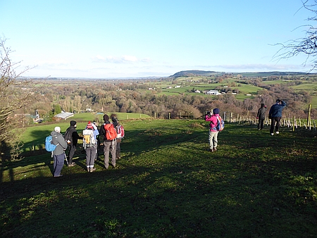 |
|
Looking across to
Bosley Cloud |
|
|
 |
|
Mow
Cop in the distance |
|
|
|
|
| |
|
| |
|
|
| |
|
|
|
|
Walk
16156 - 05/12/16 Nessit Hill Macclesfield Forest |
| Area |
Cheshire |
Walking time |
1 hour |
Average speed |
|
| Walk |
Nessit
Hill Macclesfield Forest |
Minimum altitude |
|
Maximum altitude |
|
| Start
from |
Trentabank Visitor Centre |
Altitude loss |
|
Altitude gain |
|
| Weather |
Clear
evening |
Distance |
2 .40
miles |
|
|
| Map |
Explorer 268 |
Information from
Viewranger app on my Samsung S4 phone |
|
Route - Trentabank
Visitor Centre - Nessit Hill - Forest paths - Trentabank
Visitor Centre |
|
| Five
of us set off on our regular evening walk in Macclesfield
Forest. Our route takes us from Trentabank Visitor Centre
up through the forest and then onto the summit of Nessit
Hill. We then follow the track down to lane and back along
the forest path the the Visitor Centre. |
|
|
| |
|
|
|
|
| |
|
|
| |
|
|
|
|
Map of our usual
evening route in Macclesfield Forest |
|
|
|
| |
|
|
| |
|
|
|
|
Walk
16157 - 09/12/16 Rainow and Harrop Fold Farm |
| Area |
Cheshire |
Walking time |
1 hour |
Average speed |
|
| Walk |
Rainow
and Harrop Fold Farm |
Minimum altitude |
|
Maximum altitude |
|
| Start
from |
Roadside parking B5470 near Rainow |
Altitude loss |
|
Altitude gain |
|
| Weather |
Overcast |
Distance |
2
miles |
|
|
| Map |
Explorer 268 |
Information from
Viewranger app on my Samsung S4 phone |
|
Route - Harrop Fold
Farm - Hedge Row - Harrop Fold Farm |
|
| Chris
and I did a circular walk passing through Harrop Fold Farm
and along Hedge Row and back to the car. |
|
|
| |
|
|
|
|
| |
|
|
| |
|
 |
|
Hedge Row |
|
|
|
| |
|
|
| |
|
|
|
|
Walk
16158 - Bowfell and Angle Tarn with the MaccPackers |
| Area |
Lake District |
Walking time |
6
hours |
Average speed |
|
| Walk |
Bowfell and Angle Tarn with the MaccPackers |
Minimum altitude |
318ft |
Maximum altitude |
2944ft |
| Start
from |
Old
Gungeon Ghyll, Great Langdale |
Altitude loss |
|
Altitude gain |
3121ft |
| Weather |
Overcast |
Distance |
8.11
miles |
|
|
| Map |
Ordnance Survey OL6 |
Information from
Viewranger app on my Samsung S4 phone |
|
Route - Old Dungeon
Ghyll Hotel - Stool End - The Band - Bowfell - Ore Gap -
Angle Tarn Rossett Gill - Mickleden - Old Dungeon Ghyll
Hotel |
|
| Three
of us, myself, Richard and Kevin set off from the Old
Dungeon Ghyll Hotel and headed along the track to Stool
End, we then climbed the path leading up The Band and
eventually arrived on the summit of Bowfell which had a
light covering of snow, we had lunch in the lee of some
rocks and then headed along the ridge to Ore Gap and then
descended to Angle Tarn. Once oast the tarn we followed
the path down Rossett Gill to Mickleden and back to the
start at the Old Dungeon Ghyll Hotel where we enjoyed
refreshments before setting off for home. Thanks to
Richard for driving. |
|
|
 |
|
Descending towards
Angle Tarn from Ore Gap |
|
|
 |
|
Langdale Pikes in the
distance |
| |
|
 |
|
Looking down from The
Band into the Langdale Valley |
|
|
 |
|
At
the top of Rossett Gill |
|
|
 |
|
Path
junction in Mickleden |
|
| |
|
|
| |
|
|
|
|
Walk
16159 - 11/12/16 Gawsworth and North Rode with
Macclesfield Ramblers |
| Area |
Cheshire |
Walking time |
3
hours |
Average speed |
|
| Walk |
Gawsworth
and North Rode with Macclesfield Ramblers |
Minimum altitude |
|
Maximum altitude |
|
| Start
from |
Gawsworth |
Altitude loss |
|
Altitude gain |
|
| Weather |
Overcast |
Distance |
7
miles |
|
|
| Map |
Explorer 268 |
Information from
Viewranger app on my Samsung S4 phone |
|
Route - Gawsworth -
Manor Farm - North Rode - Macclesfield Canal - Oakgrove -
Gawsworth |
|
| Ten
of us set off from Gawsworth and followed the field path
southwards to through Manor Farm to North Rode, then east
along the track and the the lane to the Macclesfield Canal
where we stopped lunch at the start of the Bosley Locks.
Our route then took us north along the towpath as far as
Oakgrove where we took the fieldpath westwards and back to
our start at Gawsworth. We then called in at Gawsworth
Church to see the Christmas Tree Festival. A magnificent
display and definitely on our list for next year. |
|
|
 |
|
Heading across the
fields towards North Rode |
|
|
 |
|
The magnificent
Christmas Tree Festival in Gawsworth Church |
| |
|
 |
|
Gawsworth Church |
|
|
 |
|
The
new Gawsworth Hall |
|
|
 |
|
Another view of the Christmas Tree Festival in Gawsworth
Church |
|
| |
|
|
| |
|
|
|
|
Walk
16160 - 14/12/16 Lyme Park from West Parkgate |
| Area |
Cheshire |
Walking time |
2
hours |
Average speed |
|
| Walk |
Lyme
Park from West Parkgate |
Minimum altitude |
|
Maximum altitude |
|
| Start
from |
West
Parkgate |
Altitude loss |
|
Altitude gain |
|
| Weather |
Sunny
periods |
Distance |
3.23
miles |
|
|
| Map |
Explorer 268 |
Information from
Viewranger app on my Samsung S4 phone |
|
Route - West Parkgate
- Hase Bank Wood - Lyme Park - Cluse Hay - West Parkgate |
|
| After
parking near West Parkgate I followed the track through
Hase Bank Wood and across Lyme Park to the Visitor Centre
where I stopped for lunch. Afterwards I followed the path
over the moor towards Cluse Hay and then down to West
Parkgate and my start point. |
|
|
 |
|
Looking across the
Cage |
|
|
| |
|
|
| |
|
 |
|
Hase Bank Wood |
|
|
 |
|
Paddock Cottage |
|
|
|
|
| |
|
| |
|
|
| |
|
|
|
|
Walk
16161 - 14/12/16 Macclesfield Forest and Nessit Hill evening
walk |
| Area |
Cheshire |
Walking time |
1 hour |
Average speed |
|
| Walk |
Macclesfield
Forest and Nessit Hill evening walk |
Minimum altitude |
|
Maximum altitude |
|
| Start
from |
Trentabank Visitor Centre |
Altitude loss |
|
Altitude gain |
|
| Weather |
Clear
evening |
Distance |
2.40
miles |
|
|
| Map |
Explorer 268 |
Information from
Viewranger app on my Samsung S4 phone |
|
Route - Trentabank
Visitor Centre - Nessit Hill - Forest paths - Trentabank
Visitor Centre |
|
|
Richard and I set off on our regular evening walk in Macclesfield
Forest. Our route takes us from Trentabank Visitor Centre
up through the forest and then onto the summit of Nessit
Hill. We then follow the track down to lane and back along
the forest path the the Visitor Centre. |
|
|
| |
|
|
|
|
| |
|
|
| |
|
|
|
|
Our usual route
through the forest at night |
|
|
|
| |
|
|
| |
|
|
|
|
Walk
16162 -16/12/16 Xmas Meal at Langley and walk back to
Macclesfield |
| Area |
Cheshire |
Walking time |
A long
time |
Average speed |
|
| Walk |
MaccPackers Xmas
Meal at Langley & walk to Macclesfield |
Minimum altitude |
|
Maximum altitude |
|
| Start
from |
Langle |
Altitude loss |
|
Altitude gain |
|
| Weather |
Overcast evening |
Distance |
5.08
miles |
|
|
| Map |
Explorer 268 |
Information from
Viewranger app on my Samsung S4 phone |
|
Route - Langley to
Macclesfield. |
|
| Nine
of us from our group the MaccPackers enjoyed
an excellent Xmas meal at the Leathers Smithy near Langley
and then walked back to Macclesfield calling in at the St
Dunstans Inn in Langley, the Church House Inn at Sutton
and the Red Willow in Macclesfield. A really great night.
The group consisted of Richard, Kevin, Bary, John, Paul,
Alan, Chris, Rob and myself. |
|
|
| |
|
|
|
|
| |
|
|
| |
|
|
| |
|
|
| |
|
|
|
|
Walk
16163 - 18/12/16 Rainow and Kerridge with Broken Cross
Walkers |
| Area |
Cheshire |
Walking time |
3
hours |
Average speed |
|
| Walk |
Rainow
and Kerridge with Broken Cross Walkers |
Minimum altitude |
|
Maximum altitude |
|
| Start
from |
Rainow |
Altitude loss |
|
Altitude gain |
|
| Weather |
Sunny
periods |
Distance |
6
miles |
|
|
| Map |
Explorer 268 |
Information from
Viewranger app on my Samsung S4 phone |
|
Route - Rainow -
Rainowlow - Billinge Head farm - Hedge Row - Oakenbank -
Kerridge - Endon Hall - Kerridge Hill - Rainow |
|
| Eight
of us set off from Rainow and followed field paths and
tracks through Rainowlow and past Billinge Head Farm to
Hedge Row, then it was along the track and across to
Oakenbank and through Kerridge where we stopped for lunch.
Afterwards we followed the path up and over Kerridge Hill
and back down into Rainow. Refreshments were enjoyed in
the Robin Hood Inn at the end of the walk. Thanks to
Christine, Kati, Doreen, Wendy, Rob, Ruth and Ray for
joining me on this last Broken Cross Walkers walk before
Christmas. |
|
|
 |
|
Zooming in on White
Nancy |
|
|
| |
|
|
| |
|
|
|
 |
|
Looking across to
Alderley Edge in the distance |
|
|
 |
|
Heading down to Rainow from Kerridge Hill |
|
|
|
|
| |
|
| |
|
|
| |
|
|
|
|
Walk
16164 - 19/12/16 - Nessit Hill and Macclesfield Forest |
| Area |
Cheshire |
Walking time |
1 hour |
Average speed |
|
| Walk |
Nessit
Hill and Macclesfield Forest |
Minimum altitude |
|
Maximum altitude |
|
| Start
from |
Trentabank Visitor
Centre |
Altitude loss |
|
Altitude gain |
|
| Weather |
Clear
evening |
Distance |
2.40
miles |
|
|
| Map |
Explorer 268 |
Information from
Viewranger app on my Samsung S4 phone |
|
Route - Trentabank
Visitor Centre - forest paths - Nessit Hill - forest paths
- Trentabank Visitor Centre |
|
| Six
of us set off on our regular evening walk in Macclesfield
Forest. Our route takes us from Trentabank Visitor Centre
up through the forest and then onto the summit of Nessit
Hill. We then follow the track down to lane and back along
the forest path the the Visitor Centre. |
|
|
| |
|
|
|
|
| |
|
|
| |
|
|
|
|
Our usual route
through the forest at night |
|
|
|
| |
|
|
| |
|
|
|
|
Walk
16165 - 26/12/16 A walk around Ridgegate Reservoir |
| Area |
Cheshire |
Walking time |
1 hour |
Average speed |
|
| Walk |
A walk
around Ridgegate Reservoir |
Minimum altitude |
|
Maximum altitude |
|
| Start
from |
Leathers Smithy, Langley |
Altitude loss |
|
Altitude gain |
|
| Weather |
Overcast |
Distance |
2
miles |
|
|
| Map |
Explorer 268 |
Information from
Viewranger app on my Samsung S4 phone |
|
Route - Leathers
Smithy - Circuit of Ridgegate Reservoir |
|
| Chris
and I set off from the Leathers Smithy and walked around
Ridgegate Reservoir and through the Forest and then back
to the car. A nice walk to blow the cobwebs away
after all the Christmas Festivities. |
|
|
| |
|
|
|
|
| |
|
|
| |
|
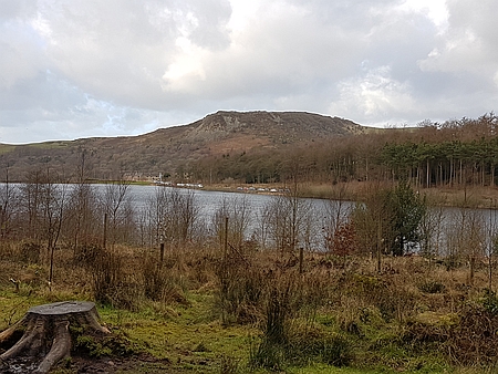 |
|
Looking across
Ridgegate Reservoir towards Teggs Nose |
|
|
|
| |
|
|
| |
|
|
|
|
Walk
16166 - 27/12/16 A walk around Bakewell |
| Area |
Peak
District |
Walking time |
|
Average speed |
|
| Walk |
A
walk around Bakewell |
Minimum altitude |
|
Maximum altitude |
|
| Start
from |
Bakewell |
Altitude loss |
|
Altitude gain |
|
| Weather |
Sunny
periods |
Distance |
3
miles |
|
|
| Map |
|
Information from
Viewranger app on my Samsung S4 phone |
|
Route - A trip into
Bakewell and back |
|
| Chris
and I parked outside Bakewell and walked across the fields
into Bakewell for a leisurely visit. A bit of shopping and
a look round some of the Walking Shops followed by a spot
of lunch on the river bank. We then returned back using
the same route. |
|
|
| |
|
|
|
|
| |
|
|
| |
|
|
 |
|
River Wye near Bakewell |
|
| |
|
|
| |
|
|
|
|
Walk
16167 - 30/12/16 Bakestall, Skiddaw, Carl Side &
Ullock Pike with the MaccPackers |
| Area |
Lake
District |
Walking time |
6
hours |
Average speed |
|
| Walk |
Bakestall, Skiddaw, Carl Side &
Ullock Pike with the MaccPackers |
Minimum altitude |
486ft |
Maximum altitude |
3023ft |
| Start
from |
Peter
House Farm near Bassenthwaite. |
Altitude loss |
3023ft |
Altitude gain |
3267ft |
| Weather |
Low
cloud, windy |
Distance |
9.09
miles |
|
|
| Map |
OL4 |
Information from
Viewranger app on my Samsung S4 phone |
|
Route - Peter House
Farm - Cumbria Way - Birkett Edge - Bakestall - Skiddaw -
Carl Side - Longside Edge - Ullock Pike - Peter
House Farm |
|
| Seven
of us set off from the parking area at Peter House Farm
and followed the Cumbria Way to the falls at White Water
Dash. It was then a steep climb up Birkett Edge to the
summit of Bakestall. the weather was overcast with very
strong winds. After a brief stop we continued south to the
summit of Skiddaw, it was difficult walking with winds
gusting to 45 mph and we were glad to leave the summit and
head south towards our next summit which was Carl Side.
Once down at the Col we were sheltered from the wind and
enjoyed our lunch with some good views down into the
Valley. Afterwards we set off from Carl Side along
Longside Edge and onto Ullock Pike and descended along The
Edge and down onto the lane. A steady walk then brought us
back to Peter House Farm. A great days walk in very windy
conditions. Our group consisted of myself, Richard, Kevin,
Barry, Paul, John and Alan. |
|
|
 |
|
John and Kevin on the
Cumbria Way |
|
|
 |
| A
very very windy summit of Skiddaw, I recorded wind speeds
of around 45mph on the summit and it was difficult
to walk. |
| |
 |
|
Ullock Pike in the
distance |
| |
| |
| |
| |
| |
|
|
| |
|
 |
|
Ready to set off up
the Cumbria Way |
|
|
 |
|
Setting off on the steep climb up Birkett Edge |
|
|
 |
|
Heading down towards Carl Side |
|
|
 |
|
Looking back from Ullock Pike towards Skiddaw |
|
|
|
|
|
|
|
|
|
|
| |
|
| |
|
|
| |
|
|
|
|
|
|
|
|
Back to the top |
|
|
|
|